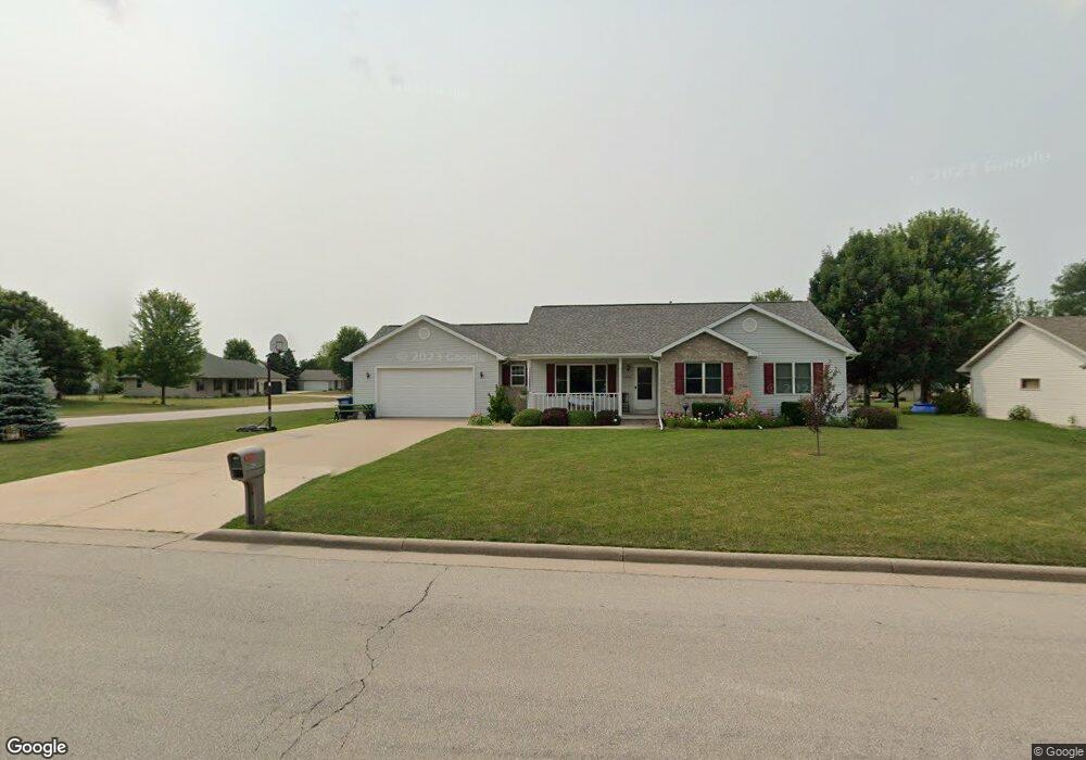
420 Longwood Ln Wrightstown, WI 54180
Estimated Value: $368,706 - $402,000
3
Beds
3
Baths
2,200
Sq Ft
$177/Sq Ft
Est. Value
About This Home
This home is located at 420 Longwood Ln, Wrightstown, WI 54180 and is currently estimated at $388,677, approximately $176 per square foot. 420 Longwood Ln is a home located in Brown County with nearby schools including Wrightstown Elementary School, Wrightstown Middle School, and Wrightstown High School.
Ownership History
Date
Name
Owned For
Owner Type
Purchase Details
Closed on
Oct 13, 2011
Sold by
Hoekman James M and Hoekman Pamela J
Bought by
Klister Paul F and Klister Mary Jane
Current Estimated Value
Home Financials for this Owner
Home Financials are based on the most recent Mortgage that was taken out on this home.
Original Mortgage
$80,000
Outstanding Balance
$54,616
Interest Rate
4.12%
Mortgage Type
New Conventional
Estimated Equity
$334,061
Create a Home Valuation Report for This Property
The Home Valuation Report is an in-depth analysis detailing your home's value as well as a comparison with similar homes in the area
Home Values in the Area
Average Home Value in this Area
Purchase History
| Date | Buyer | Sale Price | Title Company |
|---|---|---|---|
| Klister Paul F | $150,000 | None Available |
Source: Public Records
Mortgage History
| Date | Status | Borrower | Loan Amount |
|---|---|---|---|
| Open | Klister Paul F | $80,000 |
Source: Public Records
Tax History Compared to Growth
Tax History
| Year | Tax Paid | Tax Assessment Tax Assessment Total Assessment is a certain percentage of the fair market value that is determined by local assessors to be the total taxable value of land and additions on the property. | Land | Improvement |
|---|---|---|---|---|
| 2024 | $4,085 | $292,900 | $45,000 | $247,900 |
| 2023 | $4,419 | $292,900 | $45,000 | $247,900 |
| 2022 | $4,323 | $187,200 | $33,700 | $153,500 |
| 2021 | $4,179 | $187,200 | $33,700 | $153,500 |
| 2020 | $4,101 | $187,200 | $33,700 | $153,500 |
| 2019 | $3,861 | $187,200 | $33,700 | $153,500 |
| 2018 | $3,616 | $187,200 | $33,700 | $153,500 |
| 2017 | $3,317 | $163,700 | $26,200 | $137,500 |
| 2016 | $3,452 | $163,700 | $26,200 | $137,500 |
| 2015 | $3,587 | $163,700 | $26,200 | $137,500 |
| 2014 | $3,261 | $163,700 | $26,200 | $137,500 |
| 2013 | $3,261 | $163,700 | $26,200 | $137,500 |
Source: Public Records
Map
Nearby Homes
- 544 Nicole Ln
- 552 Songbird Ave
- 217 Patricia Ln
- 75 Washington St
- 0 Plum Rd
- 27 Golden Wheat Ln
- 4275 Lost Dauphin Rd
- 4351 Lost Dauphin Rd
- 4251 Lost Dauphin Rd
- 4225 Lost Dauphin Rd
- 814 Main St
- 167 Fox Shores Dr
- 4406 Rosin Rd
- 4079 Lost Dauphin Rd
- 0 Legacy Ln
- 3979 Lost Dauphin Rd
- 3829 Lost Dauphin Rd
- 107 Beckerae Ct
- 110 Beckerae Ct
- 278 Kerrigan Dr
- 416 Longwood Ln
- 115 Nicole Ln Unit 117
- 321 Patricia Ln
- 543 Nicole Ln
- 412 Longwood Ln
- 116 Nicole Ln
- 540 Fieldcrest Ave
- 317 Patricia Ln
- 540 Nicole Ln
- 428 Longwood Ln
- 547 Nicole Ln
- 408 Longwood Ln
- 318 Patricia Ln
- 411 Patricia Ln Unit 413
- 544 Fieldcrest Ave
- 313 Patricia Ln
- 314 Patricia Ln
- 404 Patricia Ln
- 551 Nicole Ln
- 109 Nicole Ln