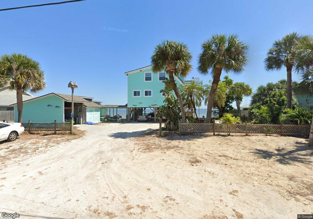
420 Milford Point Rd Merritt Island, FL 32952
Estimated Value: $1,078,573 - $1,156,000
3
Beds
2
Baths
1,608
Sq Ft
$691/Sq Ft
Est. Value
About This Home
This home is located at 420 Milford Point Rd, Merritt Island, FL 32952 and is currently estimated at $1,111,143, approximately $691 per square foot. 420 Milford Point Rd is a home located in Brevard County with nearby schools including Audubon Elementary School, Thomas Jefferson Middle School, and Merritt Island High School.
Ownership History
Date
Name
Owned For
Owner Type
Purchase Details
Closed on
Sep 20, 2024
Sold by
Mercurio John A and Holland Laura L
Bought by
Mathis Jeffrey
Current Estimated Value
Purchase Details
Closed on
Feb 22, 2022
Sold by
Strickland Thomas D and Strickland Cheryl R
Bought by
Mercurio John A and Holland Laura L
Purchase Details
Closed on
Oct 29, 2018
Sold by
Strickland Thomas D
Bought by
Strickland Thomas D and Strickland Cheryl R
Purchase Details
Closed on
Mar 19, 2004
Sold by
Strickland D M
Bought by
Strickland D M and Strickland Thomas D
Create a Home Valuation Report for This Property
The Home Valuation Report is an in-depth analysis detailing your home's value as well as a comparison with similar homes in the area
Home Values in the Area
Average Home Value in this Area
Purchase History
| Date | Buyer | Sale Price | Title Company |
|---|---|---|---|
| Mathis Jeffrey | $1,150,000 | Aurora Title | |
| Mathis Jeffrey | $1,150,000 | Aurora Title | |
| Mercurio John A | $875,000 | On Point Title Services | |
| Strickland Thomas D | -- | None Available | |
| Strickland D M | -- | -- |
Source: Public Records
Tax History Compared to Growth
Tax History
| Year | Tax Paid | Tax Assessment Tax Assessment Total Assessment is a certain percentage of the fair market value that is determined by local assessors to be the total taxable value of land and additions on the property. | Land | Improvement |
|---|---|---|---|---|
| 2025 | $9,374 | $948,760 | -- | -- |
| 2024 | $10,139 | $773,610 | -- | -- |
| 2023 | $10,139 | $779,550 | $530,000 | $249,550 |
| 2022 | $8,369 | $777,190 | $0 | $0 |
| 2021 | $7,155 | $505,810 | $325,000 | $180,810 |
| 2020 | $7,041 | $488,530 | $305,000 | $183,530 |
| 2019 | $6,980 | $472,760 | $305,000 | $167,760 |
| 2018 | $6,407 | $419,520 | $268,400 | $151,120 |
| 2017 | $6,433 | $406,710 | $257,400 | $149,310 |
| 2016 | $6,117 | $365,690 | $220,000 | $145,690 |
| 2015 | $6,320 | $362,620 | $220,000 | $142,620 |
| 2014 | $3,514 | $225,730 | $220,000 | $5,730 |
Source: Public Records
Map
Nearby Homes
- 397 Milford Point Dr
- 1646 Fisherman's St
- 1685 Savannah Dr
- 300 Waterfront Ave
- 1675 Oceana Dr Unit 8
- 1668 Oceana Dr
- 1613 Dock St
- 306 Mullet Ave
- 325 Simpson Cir
- 1585 Anchor Ln
- 250 N Banana River Dr
- 250 N Banana River Dr Unit G6
- 700 Milford Point Dr
- 1545 Cunningham Ave
- 195 Treasure St Unit A4105
- 215 Buccaneer Ave Unit B3201
- 205 Buccaneer Ave Unit C1104
- 120 Mutiny Ln Unit C3208
- 1515 Quince Ave
- 365 Hula Cir
- 420 Milford Point Dr
- 450 Milford Point Dr
- 450 Milford Point Rd
- 410 Milford Point Rd
- 441 Milford Point Rd
- 425 Milford Point Rd
- 455 Milford Point Rd
- 417 Milford Point Rd
- 400 Milford Point Rd
- 417 Milford Point Dr
- 401 Milford Point Rd
- 465 Milford Point Rd
- 401 Milford Point Dr
- 390 Milford Point Rd
- 0 Vac Lot Milford Point Dr
- 490 Milford Point Dr
- 397 Milford Point Rd
- 390 Milford Point Dr
- 490 Milford Point Rd
- 485 Milford Point Dr