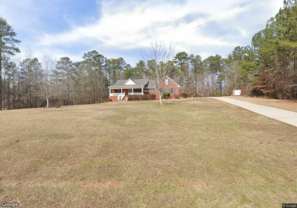
420 Pine Ln Covington, GA 30016
Estimated Value: $351,000 - $402,000
Studio
2
Baths
2,286
Sq Ft
$163/Sq Ft
Est. Value
About This Home
This home is located at 420 Pine Ln, Covington, GA 30016 and is currently estimated at $373,029, approximately $163 per square foot. 420 Pine Ln is a home located in Newton County with nearby schools including Heard-Mixon Elementary School, Indian Creek Middle School, and Alcovy High School.
Ownership History
Date
Name
Owned For
Owner Type
Purchase Details
Closed on
Jan 18, 2022
Sold by
Head Thomas Eugene
Bought by
Head Margaret
Current Estimated Value
Purchase Details
Closed on
May 12, 2003
Sold by
Callaway Ronald E
Bought by
Head Thomas E and Head Margaret
Purchase Details
Closed on
Jun 13, 2002
Sold by
Stewart Beau
Bought by
Hudson Clayanne
Purchase Details
Closed on
Jul 23, 2001
Sold by
Rasmussen Alaric W and Rasmussen Tiffany S
Bought by
Hudson Clayanne
Create a Home Valuation Report for This Property
The Home Valuation Report is an in-depth analysis detailing your home's value as well as a comparison with similar homes in the area
Home Values in the Area
Average Home Value in this Area
Purchase History
| Date | Buyer | Sale Price | Title Company |
|---|---|---|---|
| Head Margaret | -- | -- | |
| Head Thomas E | $32,000 | -- | |
| Hudson Clayanne | -- | -- | |
| Hudson Clayanne | $42,000 | -- |
Source: Public Records
Tax History
| Year | Tax Paid | Tax Assessment Tax Assessment Total Assessment is a certain percentage of the fair market value that is determined by local assessors to be the total taxable value of land and additions on the property. | Land | Improvement |
|---|---|---|---|---|
| 2025 | $3,214 | $173,320 | $14,000 | $159,320 |
| 2024 | $3,140 | $165,520 | $14,000 | $151,520 |
| 2023 | $3,499 | $157,960 | $8,800 | $149,160 |
| 2022 | $3,936 | $129,800 | $8,800 | $121,000 |
| 2021 | $2,583 | $114,280 | $8,800 | $105,480 |
| 2020 | $2,397 | $100,560 | $7,680 | $92,880 |
| 2019 | $2,184 | $93,240 | $7,680 | $85,560 |
| 2018 | $1,061 | $91,000 | $7,680 | $83,320 |
| 2017 | $1,618 | $76,360 | $7,680 | $68,680 |
| 2016 | $1,510 | $73,200 | $7,680 | $65,520 |
| 2015 | $1,409 | $70,360 | $7,680 | $62,680 |
| 2014 | $1,401 | $70,360 | $0 | $0 |
Source: Public Records
Map
Nearby Homes
- 219 Channing Cope Rd
- 12510 Highway 36
- 12895 Highway 36
- 0 Highway 36 Unit 10671092
- 0 Highway 36 Unit 10632443
- 0 White Laurel Ln Unit 16
- 440 Varner St
- 550 Anderson Creek Rd
- 0 Rocky Plains Rd Unit 18248418
- 0 River Shoals Ct Unit 10620666
- 60 Laurie Ln
- 30 Laurie Ln
- 230 Alcovy Reserve Way
- 90 Alcovy Reserve Way
- 674 Lower River Rd
- 70 Alcovy Reserve Way
- 1599 Lower River Rd
- 645 5th Ave
- 185 Mountain View Cir
- 185 Mountain Ridge
- 430 Pine Ln
- 305 High Point Forest Dr
- 275 High Point Forest Dr
- 495 Cedar Dr
- 435 Pine Ln
- 505 Cedar Dr
- 440 Pine Ln
- 515 Cedar Dr
- 445 Pine Ln
- 585 Cedar Dr
- 270 High Point Forest Dr
- 265 High Point Forest Dr
- 450 Pine Ln
- 455 Pine Ln
- 375 High Point Forest Dr
- 375 High Point Forest Dr Unit 14
- 570 Cedar Dr
- 480 Pine Ln
- 525 Cedar Dr
- 320 High Point Forest Dr
Your Personal Tour Guide
Ask me questions while you tour the home.