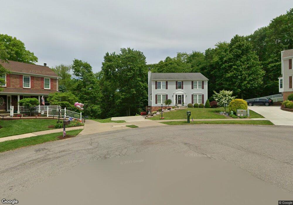
420 Poplar Ct Coraopolis, PA 15108
Estimated Value: $397,477 - $440,000
3
Beds
3
Baths
1,882
Sq Ft
$220/Sq Ft
Est. Value
About This Home
This home is located at 420 Poplar Ct, Coraopolis, PA 15108 and is currently estimated at $414,119, approximately $220 per square foot. 420 Poplar Ct is a home located in Allegheny County with nearby schools including Moon Area High School.
Ownership History
Date
Name
Owned For
Owner Type
Purchase Details
Closed on
Jun 20, 2005
Sold by
Prudential Resid'L Svcs
Bought by
Walsh Timothy
Current Estimated Value
Home Financials for this Owner
Home Financials are based on the most recent Mortgage that was taken out on this home.
Original Mortgage
$107,000
Outstanding Balance
$55,932
Interest Rate
5.78%
Mortgage Type
New Conventional
Estimated Equity
$358,187
Purchase Details
Closed on
May 28, 2004
Sold by
Farmer William L
Bought by
Pelletier Anthony M
Home Financials for this Owner
Home Financials are based on the most recent Mortgage that was taken out on this home.
Original Mortgage
$155,000
Interest Rate
5.88%
Mortgage Type
New Conventional
Purchase Details
Closed on
Nov 7, 1997
Sold by
Hilliard Danny D and Hilliard Michelle
Bought by
Farmer William L and Farmer Laura G
Purchase Details
Closed on
Mar 4, 1994
Sold by
Nvr Homes Inc
Bought by
Hilliard Danny D
Create a Home Valuation Report for This Property
The Home Valuation Report is an in-depth analysis detailing your home's value as well as a comparison with similar homes in the area
Home Values in the Area
Average Home Value in this Area
Purchase History
| Date | Buyer | Sale Price | Title Company |
|---|---|---|---|
| Walsh Timothy | $210,000 | -- | |
| Pelletier Anthony M | $194,000 | -- | |
| Farmer William L | $177,000 | -- | |
| Hilliard Danny D | $155,953 | -- |
Source: Public Records
Mortgage History
| Date | Status | Borrower | Loan Amount |
|---|---|---|---|
| Open | Pelletier Anthony M | $107,000 | |
| Previous Owner | Pelletier Anthony M | $155,000 |
Source: Public Records
Tax History Compared to Growth
Tax History
| Year | Tax Paid | Tax Assessment Tax Assessment Total Assessment is a certain percentage of the fair market value that is determined by local assessors to be the total taxable value of land and additions on the property. | Land | Improvement |
|---|---|---|---|---|
| 2025 | $5,582 | $178,600 | $45,100 | $133,500 |
| 2024 | $5,582 | $178,600 | $45,100 | $133,500 |
| 2023 | $5,384 | $178,600 | $45,100 | $133,500 |
| 2022 | $5,384 | $178,600 | $45,100 | $133,500 |
| 2021 | $5,681 | $178,600 | $45,100 | $133,500 |
| 2020 | $5,249 | $178,600 | $45,100 | $133,500 |
| 2019 | $5,106 | $178,600 | $45,100 | $133,500 |
| 2018 | $845 | $178,600 | $45,100 | $133,500 |
| 2017 | $4,827 | $178,600 | $45,100 | $133,500 |
| 2016 | $845 | $178,600 | $45,100 | $133,500 |
| 2015 | $845 | $178,600 | $45,100 | $133,500 |
| 2014 | $4,701 | $178,600 | $45,100 | $133,500 |
Source: Public Records
Map
Nearby Homes
- 105 Springwater Ct
- 116 Mesa Dr
- 001 Spring Run Road Extension
- 121 Shelbourne Dr
- 0 Spring Run Road Extension Unit 1684623
- 120 Scottsdale Dr
- Somerset Plan at Victoria Ridge
- Rockford Plan at Victoria Ridge
- Birmingham Plan at Victoria Ridge
- Eisenhower Plan at Victoria Ridge
- Carlisle Plan at Victoria Ridge
- Truman Plan at Victoria Ridge
- Chattanooga Plan at Victoria Ridge
- Cleveland Plan at Victoria Ridge
- 121 Victoria Dr
- 108 Economy Grade Rd
- 110 Victoria Dr
- 106 Victoria Dr
- Bristol Plan at Victoria Ridge
- Galen Plan at Victoria Ridge
- 418 Poplar Ct
- 419 Poplar Ct
- 416 Poplar Ct
- 417 Poplar Ct
- 414 Poplar Ct
- 415 Poplar Ct
- 413 Poplar Ct
- 412 Poplar Ct
- 411 Poplar Ct
- 410 Poplar Ct
- 1052 Whispering Woods Dr
- 1054 Whispering Woods Dr
- 407 Poplar Ct
- 1050 Whispering Woods Dr
- 1048 Whispering Woods Dr
- 1056 Whispering Woods Dr
- 3004 Linden Ct
- 3002 Linden Ct
- 403 Poplar Ct
- 3000 Linden Ct