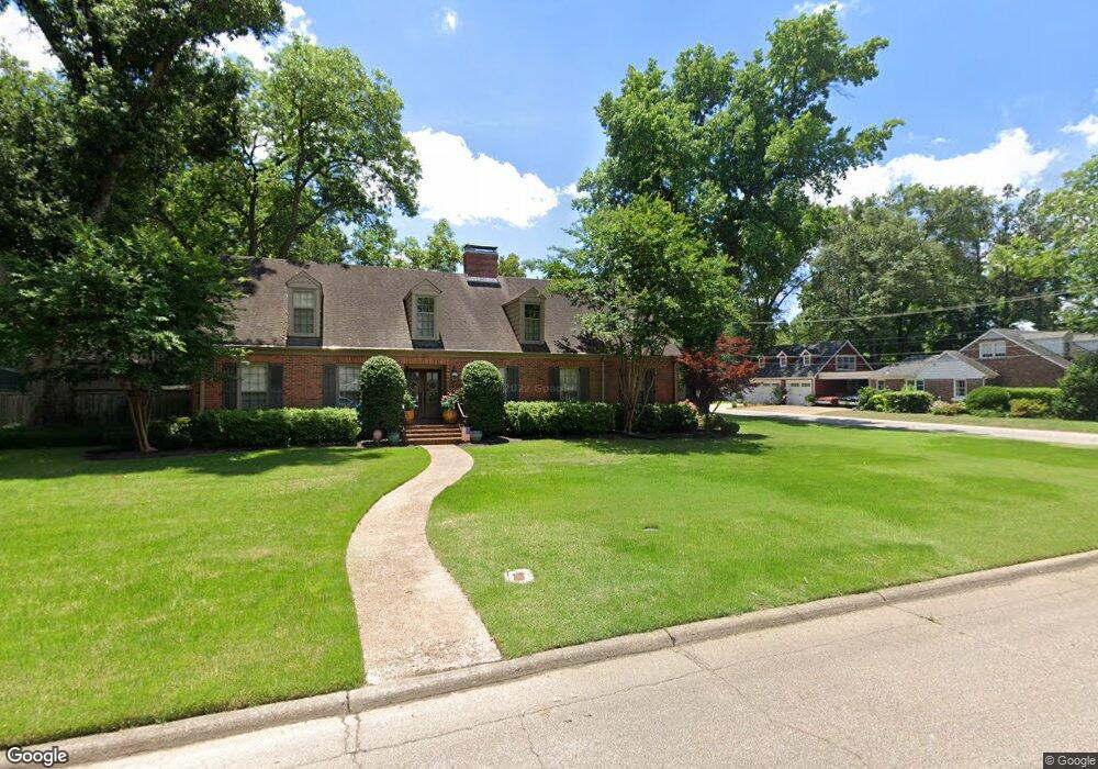
420 Roosevelt Ave West Memphis, AR 72301
Estimated Value: $407,000 - $528,000
5
Beds
5
Baths
4,282
Sq Ft
$109/Sq Ft
Est. Value
About This Home
This home is located at 420 Roosevelt Ave, West Memphis, AR 72301 and is currently estimated at $464,755, approximately $108 per square foot. 420 Roosevelt Ave is a home located in Crittenden County with nearby schools including Bragg Elementary School, West Junior High School, and The Academies of West Memphis Charter School.
Ownership History
Date
Name
Owned For
Owner Type
Purchase Details
Closed on
Nov 29, 2018
Sold by
Tyrone Taz C and Tyrone Meredith M
Bought by
Montgomery Micah J and Montgomery Reaghan D
Current Estimated Value
Home Financials for this Owner
Home Financials are based on the most recent Mortgage that was taken out on this home.
Original Mortgage
$328,500
Outstanding Balance
$289,415
Interest Rate
4.8%
Mortgage Type
New Conventional
Estimated Equity
$175,340
Purchase Details
Closed on
Aug 29, 2007
Sold by
Not Provided
Bought by
Tyrone Taz and Tyrone Meredith
Purchase Details
Closed on
Jan 1, 1910
Bought by
To
Create a Home Valuation Report for This Property
The Home Valuation Report is an in-depth analysis detailing your home's value as well as a comparison with similar homes in the area
Home Values in the Area
Average Home Value in this Area
Purchase History
| Date | Buyer | Sale Price | Title Company |
|---|---|---|---|
| Montgomery Micah J | $365,000 | Stewart Title | |
| Tyrone Taz | $283,000 | -- | |
| Tyrone Taz | $283,000 | -- | |
| To | -- | -- |
Source: Public Records
Mortgage History
| Date | Status | Borrower | Loan Amount |
|---|---|---|---|
| Open | Montgomery Micah J | $328,500 |
Source: Public Records
Tax History Compared to Growth
Tax History
| Year | Tax Paid | Tax Assessment Tax Assessment Total Assessment is a certain percentage of the fair market value that is determined by local assessors to be the total taxable value of land and additions on the property. | Land | Improvement |
|---|---|---|---|---|
| 2024 | $2,184 | $71,110 | $10,500 | $60,610 |
| 2023 | $2,152 | $71,110 | $10,500 | $60,610 |
| 2022 | $2,095 | $71,110 | $10,500 | $60,610 |
| 2021 | $1,988 | $71,110 | $10,500 | $60,610 |
| 2020 | $2,130 | $71,110 | $10,500 | $60,610 |
| 2019 | $1,693 | $44,790 | $12,000 | $32,790 |
| 2018 | $1,463 | $44,790 | $12,000 | $32,790 |
| 2017 | $1,463 | $44,790 | $12,000 | $32,790 |
| 2016 | $1,711 | $44,790 | $12,000 | $32,790 |
| 2015 | $1,481 | $44,790 | $12,000 | $32,790 |
| 2014 | $1,608 | $47,500 | $12,000 | $35,500 |
Source: Public Records
Map
Nearby Homes
- 501 W Cooper Ave
- 413 Gibson Ave
- 307 W Cooper Ave
- 503 W Oliver Ave
- 323 W Oliver Ave
- 607 W Barton Ave
- 235 W Barton Ave
- 221 W Barton Ave
- 216 Roosevelt Ave
- 223 W Oliver Ave
- 232 Ross Ave
- 215 W Oliver Ave
- 451 S Roselawn Dr
- 1009 Spears St
- 321 S Worthington Dr
- 123 W Danner Ave
- 303 N Rhodes St
- 112 Ross Ave
- 104 Ross Ave
- 807 W Barton Ave
- 414 Roosevelt Ave
- 500 Roosevelt Ave
- 423 Roosevelt Ave
- 421 W Cooper Ave
- 412 Roosevelt Ave
- 417 Roosevelt Ave
- 503 Roosevelt Ave
- 417 W Cooper Ave
- 415 W Cooper Ave
- 415 Roosevelt Ave
- 506 Roosevelt Ave
- 502 N Avalon St
- 505 W Cooper Ave
- 505 Roosevelt Ave
- 510 Roosevelt Ave
- 422 W Barton Ave
- 414 W Barton Ave
- 416 W Barton Ave
- 612 Pearce St
- 420 W Cooper Ave