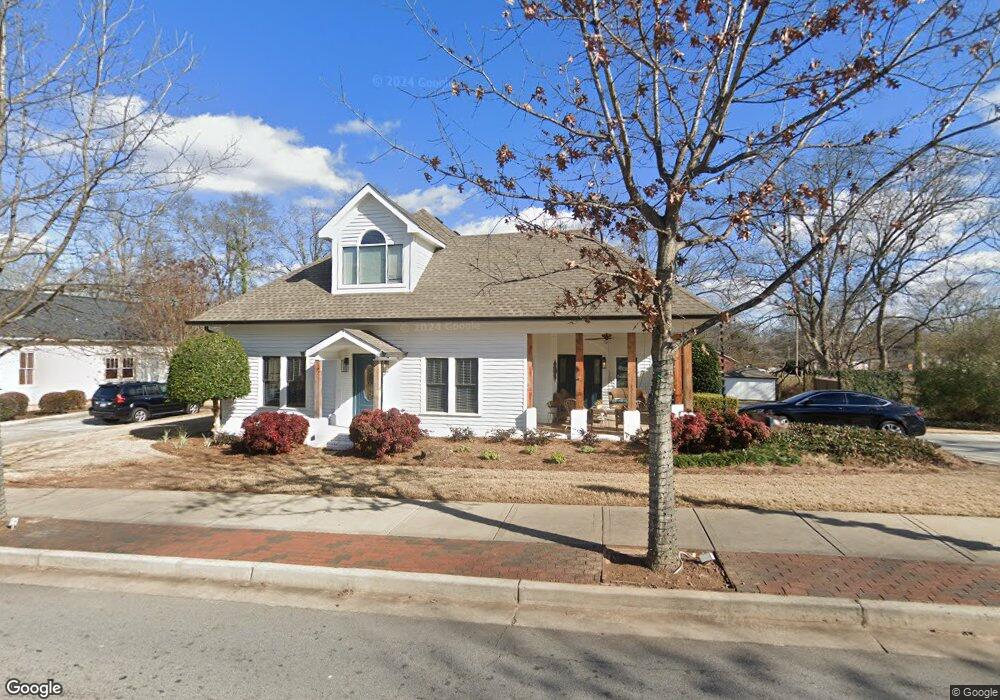
420 S Hill St Unit A Buford, GA 30518
Estimated Value: $1,030,000 - $1,250,296
2
Beds
1
Bath
3,627
Sq Ft
$314/Sq Ft
Est. Value
About This Home
This home is located at 420 S Hill St Unit A, Buford, GA 30518 and is currently estimated at $1,140,148, approximately $314 per square foot. 420 S Hill St Unit A is a home located in Gwinnett County with nearby schools including Buford Elementary School, Buford Senior Academy, and Buford Academy.
Ownership History
Date
Name
Owned For
Owner Type
Purchase Details
Closed on
Feb 10, 2006
Sold by
Norton Scott B and Norton Stephanie R
Bought by
Hudgens Russell M and Hudgens Heather A
Current Estimated Value
Home Financials for this Owner
Home Financials are based on the most recent Mortgage that was taken out on this home.
Original Mortgage
$456,000
Interest Rate
6.05%
Mortgage Type
New Conventional
Purchase Details
Closed on
Jul 8, 1998
Sold by
Cohran Terry
Bought by
Norton Scott B and Norton Stephanie R
Home Financials for this Owner
Home Financials are based on the most recent Mortgage that was taken out on this home.
Original Mortgage
$194,400
Interest Rate
7.04%
Mortgage Type
New Conventional
Create a Home Valuation Report for This Property
The Home Valuation Report is an in-depth analysis detailing your home's value as well as a comparison with similar homes in the area
Home Values in the Area
Average Home Value in this Area
Purchase History
| Date | Buyer | Sale Price | Title Company |
|---|---|---|---|
| Hudgens Russell M | $570,000 | -- | |
| Norton Scott B | $243,000 | -- |
Source: Public Records
Mortgage History
| Date | Status | Borrower | Loan Amount |
|---|---|---|---|
| Closed | Hudgens Russell M | $456,000 | |
| Previous Owner | Norton Scott B | $194,400 |
Source: Public Records
Tax History Compared to Growth
Tax History
| Year | Tax Paid | Tax Assessment Tax Assessment Total Assessment is a certain percentage of the fair market value that is determined by local assessors to be the total taxable value of land and additions on the property. | Land | Improvement |
|---|---|---|---|---|
| 2025 | $2,970 | $207,000 | $54,880 | $152,120 |
| 2024 | $3,410 | $237,600 | $74,040 | $163,560 |
| 2023 | $3,410 | $237,600 | $74,040 | $163,560 |
| 2022 | $3,410 | $237,600 | $74,040 | $163,560 |
| 2021 | $2,010 | $140,080 | $43,560 | $96,520 |
| 2020 | $1,815 | $140,080 | $43,560 | $96,520 |
| 2019 | $1,815 | $140,080 | $43,560 | $96,520 |
| 2018 | $1,860 | $143,520 | $43,560 | $99,960 |
| 2016 | $1,839 | $143,520 | $43,560 | $99,960 |
| 2015 | $1,904 | $143,520 | $43,560 | $99,960 |
| 2014 | $1,936 | $143,520 | $43,560 | $99,960 |
Source: Public Records
Map
Nearby Homes
- 449 S Hill St
- 480 S Hill St
- 5065 Cooper Farm Dr
- 2051 Harvester Ln
- 401 Pirkle Ave
- 4817 Cooper Farm Dr
- 489 Williams St
- 4942 Greenard Watson Ln
- 4933 Greenard Watson Ln
- 460 Espy St
- 2255 Buford Hwy
- 2255 Buford Hwy
- 185 Scott St
- 25 Morgan St
- 27 Morgan St
- 21 Buford Village Walk
- 4831 Miller Hill Rd
- 3 Buford Village Walk
- 408 Bona Rd
- 420 S Hill St
- 1655 Hillcrest Dr
- 1645 Hillcrest Dr
- 4908 Mountain Rose Walk
- 4909 Mountain Rose Walk
- 450 S Hill St
- 479 S Hill St
- 429 S Hill St
- 415 Williams St Unit 415
- 415 Williams St
- 415 Williams St
- 501 Clover Dr
- 0 S Hill St
- S S Hill St Unit B
- S S Hill St
- 435 Clover Dr
- 425 Power Ave
- 470 S Hill St
- 490 S Hill St
- 340 Williams St