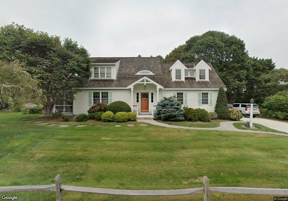
420 S Sunken Meadow Rd Eastham, MA 02642
Estimated Value: $1,128,000 - $2,840,000
4
Beds
3
Baths
2,934
Sq Ft
$797/Sq Ft
Est. Value
About This Home
This home is located at 420 S Sunken Meadow Rd, Eastham, MA 02642 and is currently estimated at $2,337,635, approximately $796 per square foot. 420 S Sunken Meadow Rd is a home located in Barnstable County with nearby schools including Eastham Elementary School, Nauset Regional Middle School, and Nauset Regional High School.
Ownership History
Date
Name
Owned For
Owner Type
Purchase Details
Closed on
Apr 14, 1999
Sold by
Mason Mary A
Bought by
Price Jason J and Price Gretchen E
Current Estimated Value
Create a Home Valuation Report for This Property
The Home Valuation Report is an in-depth analysis detailing your home's value as well as a comparison with similar homes in the area
Home Values in the Area
Average Home Value in this Area
Purchase History
| Date | Buyer | Sale Price | Title Company |
|---|---|---|---|
| Price Jason J | $179,500 | -- |
Source: Public Records
Mortgage History
| Date | Status | Borrower | Loan Amount |
|---|---|---|---|
| Open | Price Jason J | $1,000,000 | |
| Closed | Price Jason J | $1,200,000 | |
| Closed | Price Jason J | $283,000 |
Source: Public Records
Tax History Compared to Growth
Tax History
| Year | Tax Paid | Tax Assessment Tax Assessment Total Assessment is a certain percentage of the fair market value that is determined by local assessors to be the total taxable value of land and additions on the property. | Land | Improvement |
|---|---|---|---|---|
| 2025 | $18,765 | $2,433,900 | $562,900 | $1,871,000 |
| 2024 | $16,677 | $2,379,000 | $546,500 | $1,832,500 |
| 2023 | $15,207 | $2,100,400 | $506,100 | $1,594,300 |
| 2022 | $13,777 | $1,605,700 | $451,900 | $1,153,800 |
| 2021 | $10,417 | $1,134,700 | $410,700 | $724,000 |
| 2020 | $9,559 | $1,096,200 | $419,200 | $677,000 |
| 2019 | $8,653 | $1,048,800 | $407,000 | $641,800 |
| 2018 | $8,562 | $1,025,400 | $395,200 | $630,200 |
| 2017 | $7,995 | $1,012,000 | $387,500 | $624,500 |
| 2016 | $7,129 | $958,200 | $367,300 | $590,900 |
| 2015 | $6,675 | $940,100 | $360,100 | $580,000 |
Source: Public Records
Map
Nearby Homes
- 480 S Sunken Meadow Rd
- 440 S Sunken Meadow Rd
- 490 S Sunken Meadow Rd
- 380 S Sunken Meadow Rd
- 435 S Sunken Meadow Rd
- 495 S Sunken Meadow Rd
- 475 S Sunken Meadow Rd
- 360 S Sunken Meadow Rd
- 415 S Sunken Meadow Rd
- 175 Spring Rd
- 520 S Sunken Meadow Rd
- 375 S Sunken Meadow Rd
- 535 S Sunken Meadow Rd
- 7 Salt Works Ct
- 5 Salt Works Ct
- 340 S Sunken Meadow Rd
- 9 Salt Works Ct
- 555 S Sunken Meadow Rd
- 150 Salt Works Rd
- 320 S Sunken Meadow Rd