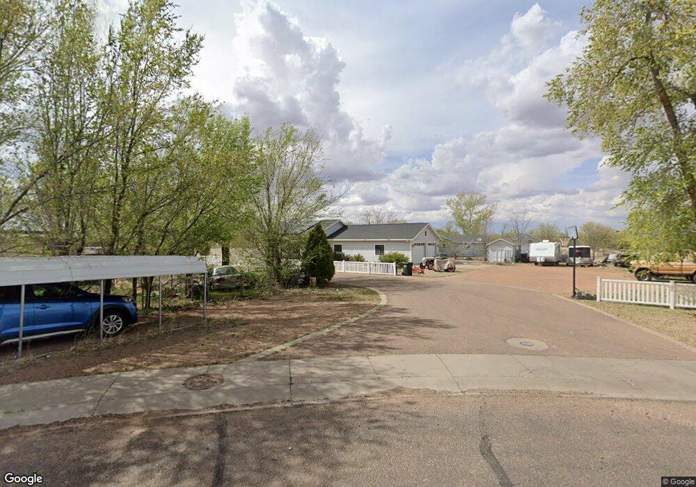
420 W 1st St N Snowflake, AZ 85937
Estimated Value: $260,000 - $362,000
--
Bed
--
Bath
1,185
Sq Ft
$267/Sq Ft
Est. Value
About This Home
This home is located at 420 W 1st St N, Snowflake, AZ 85937 and is currently estimated at $316,477, approximately $267 per square foot. 420 W 1st St N is a home located in Navajo County with nearby schools including Snowflake Intermediate School, Highland Primary School, and Snowflake Junior High School.
Ownership History
Date
Name
Owned For
Owner Type
Purchase Details
Closed on
Jun 3, 2015
Sold by
Crawford Bill R
Bought by
Burk Russell T and Burk Chantal K
Current Estimated Value
Home Financials for this Owner
Home Financials are based on the most recent Mortgage that was taken out on this home.
Original Mortgage
$169,387
Outstanding Balance
$130,583
Interest Rate
3.62%
Mortgage Type
New Conventional
Estimated Equity
$185,894
Purchase Details
Closed on
Apr 21, 2008
Sold by
Morgan Roger L and Morgan Judy J
Bought by
Crawford Bill R and Crawford Marilyn K
Create a Home Valuation Report for This Property
The Home Valuation Report is an in-depth analysis detailing your home's value as well as a comparison with similar homes in the area
Home Values in the Area
Average Home Value in this Area
Purchase History
| Date | Buyer | Sale Price | Title Company |
|---|---|---|---|
| Burk Russell T | $166,000 | Lawyers Title Of Arizona Inc | |
| Crawford Bill R | $188,470 | Landamerica Transnation Titl |
Source: Public Records
Mortgage History
| Date | Status | Borrower | Loan Amount |
|---|---|---|---|
| Open | Burk Russell T | $169,387 |
Source: Public Records
Tax History Compared to Growth
Tax History
| Year | Tax Paid | Tax Assessment Tax Assessment Total Assessment is a certain percentage of the fair market value that is determined by local assessors to be the total taxable value of land and additions on the property. | Land | Improvement |
|---|---|---|---|---|
| 2026 | $622 | -- | -- | -- |
| 2025 | $605 | $27,743 | $4,465 | $23,278 |
| 2024 | $645 | $27,224 | $3,883 | $23,341 |
| 2023 | $605 | $20,224 | $894 | $19,330 |
| 2022 | $645 | $0 | $0 | $0 |
| 2021 | $700 | $0 | $0 | $0 |
| 2020 | $704 | $0 | $0 | $0 |
| 2019 | $690 | $0 | $0 | $0 |
| 2018 | $669 | $0 | $0 | $0 |
| 2017 | $653 | $0 | $0 | $0 |
| 2016 | $669 | $0 | $0 | $0 |
| 2015 | $587 | $7,226 | $886 | $6,339 |
Source: Public Records
Map
Nearby Homes
- 461 W Center St
- 44 S 3rd St W Unit W
- 44 S 3rd St W
- 177 W 1st St N
- 276 N 2nd St W
- 276 N 2nd St W Unit West
- 221 N Main St
- 177 N 1st East St
- 416 S 2nd St W
- 0 S 1st St W
- 420 S Astante Dr
- 381 W 7th St S
- 940 S 2nd St W
- 1052 W 8th St S
- 864 S 1st St E
- 960 S Highland Dr
- Parcel C Arizona 77
- Parcel A Arizona 77
- Parcel B Arizona 77
- 662 E 1 2 St
- 384 W 1/2 St N Unit 4th west and 1st nor
- 92 N 4th St W
- 447 W 1st St N
- 379 W 1 1/2 St N
- 453 W 1st St N
- 89 N 4th St W
- 367 N 1 2 St
- 415 W Bushman Ct
- 347 N 1 2 St
- 345 W 1 1/2 St N
- 347 W 1 1/2 St N
- 69 N 4th St W
- 360 W 1/2 St N Unit /2
- 2 S Country Club Dr
- 344 W 1 1/2 St N
- 0 W 1st St N Unit 243708
- 0 W 1st St N Unit 241667
- 460 W 1/2 St N
- 332 W 1 1/2 St N
- 49 N 4th St W