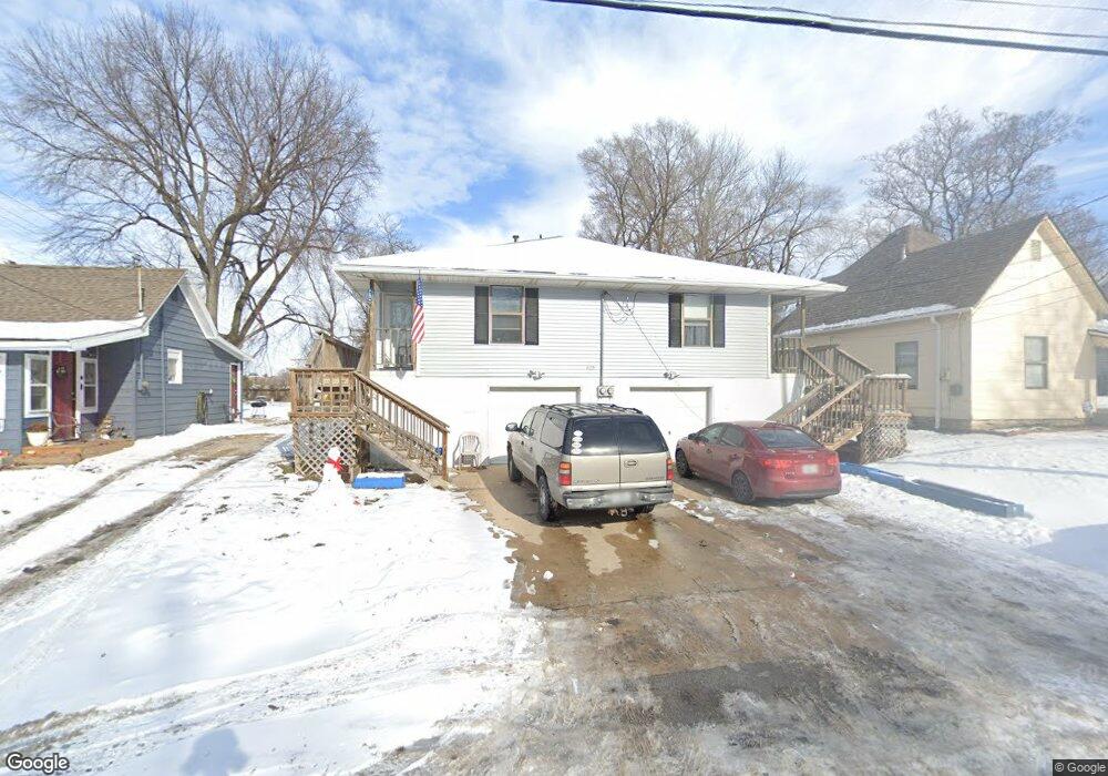
420 W Sea Ave Unit A Independence, MO 64050
Heart of Independence NeighborhoodEstimated Value: $136,000 - $224,528
4
Beds
2
Baths
1,872
Sq Ft
$103/Sq Ft
Est. Value
About This Home
This home is located at 420 W Sea Ave Unit A, Independence, MO 64050 and is currently estimated at $192,882, approximately $103 per square foot. 420 W Sea Ave Unit A is a home located in Jackson County with nearby schools including Santa Fe Trail Elementary School, Bridger Middle School, and Bingham Middle School.
Ownership History
Date
Name
Owned For
Owner Type
Purchase Details
Closed on
Mar 13, 2023
Sold by
Nk Missouri Investments Llc
Bought by
Ejc Rentals Llc
Current Estimated Value
Purchase Details
Closed on
Jul 6, 2000
Sold by
Fairfield Larry E and Fairfield Carol S
Bought by
Howen Mary Parna
Home Financials for this Owner
Home Financials are based on the most recent Mortgage that was taken out on this home.
Original Mortgage
$60,000
Interest Rate
8.66%
Mortgage Type
Purchase Money Mortgage
Create a Home Valuation Report for This Property
The Home Valuation Report is an in-depth analysis detailing your home's value as well as a comparison with similar homes in the area
Home Values in the Area
Average Home Value in this Area
Purchase History
| Date | Buyer | Sale Price | Title Company |
|---|---|---|---|
| Ejc Rentals Llc | -- | First American Title | |
| Howen Mary Parna | -- | Chicago Title Co |
Source: Public Records
Mortgage History
| Date | Status | Borrower | Loan Amount |
|---|---|---|---|
| Previous Owner | Howen Mary Parna | $60,000 |
Source: Public Records
Tax History Compared to Growth
Tax History
| Year | Tax Paid | Tax Assessment Tax Assessment Total Assessment is a certain percentage of the fair market value that is determined by local assessors to be the total taxable value of land and additions on the property. | Land | Improvement |
|---|---|---|---|---|
| 2025 | $1,785 | $29,399 | $3,872 | $25,527 |
| 2024 | $1,745 | $25,768 | $2,728 | $23,040 |
| 2023 | $1,745 | $25,768 | $2,088 | $23,680 |
| 2022 | $1,642 | $22,230 | $1,899 | $20,331 |
| 2021 | $1,641 | $22,230 | $1,899 | $20,331 |
| 2020 | $1,480 | $19,480 | $1,899 | $17,581 |
| 2019 | $1,457 | $19,480 | $1,899 | $17,581 |
| 2018 | $1,328 | $16,954 | $1,653 | $15,301 |
| 2017 | $1,308 | $16,954 | $1,653 | $15,301 |
| 2016 | $1,308 | $16,530 | $1,900 | $14,630 |
| 2014 | $1,279 | $16,530 | $1,900 | $14,630 |
Source: Public Records
Map
Nearby Homes
- 421 W Sea Ave
- 427 W Linden Ave
- 334 W Sea Ave
- 501 W South Ave
- 900 S Osage St
- 908 S Delaware St
- 1106 S Osage St
- 1215 S Delaware Ave
- 1215 S Osage St
- 1511 W 23rd St S
- 712 W 23rd St S
- 1223 S Osage St
- 701 W 24th St
- 511 S Pleasant St
- 1122 S Main St
- 1100 S Noland Rd
- 1224 Windsor St
- 709 S Willis Ave
- 315 S Spring St
- 514 W Walnut St
- 414 W Sea Ave
- 426 W Sea Ave
- 412 W Sea Ave
- 423 W Linden Ave
- 423 W Linden Ave Unit B
- 427 W Sea Ave
- 408 W Sea Ave
- 421 W Linden Ave
- 409 W Linden Ave
- 415 W Sea Ave
- 413 W Sea Ave
- 405 W Sea Ave
- 404 W Sea Ave
- 407 W Linden Ave
- 401 W Sea Ave
- 503 W Sea Ave
- 338 W Sea Ave
- 401 W Linden Ave
- 917 S Pleasant St
- 511 W Sea Ave