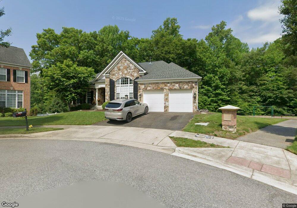
4200 Coakley Ln Upper Marlboro, MD 20772
Estimated Value: $646,712 - $759,000
--
Bed
--
Bath
2,834
Sq Ft
$248/Sq Ft
Est. Value
About This Home
This home is located at 4200 Coakley Ln, Upper Marlboro, MD 20772 and is currently estimated at $703,928, approximately $248 per square foot. 4200 Coakley Ln is a home located in Prince George's County with nearby schools including Patuxent Elementary School, James Madison Middle School, and Dr. Henry A. Wise Jr. High School.
Ownership History
Date
Name
Owned For
Owner Type
Purchase Details
Closed on
May 26, 2016
Sold by
Winston Debbi Morgan
Bought by
Winston Debbi Morgan and Winston Jeffrey C
Current Estimated Value
Purchase Details
Closed on
Nov 17, 2009
Sold by
M I Homes Of D C Llc
Bought by
Morgan Debbi A
Home Financials for this Owner
Home Financials are based on the most recent Mortgage that was taken out on this home.
Original Mortgage
$536,338
Interest Rate
4.98%
Mortgage Type
FHA
Create a Home Valuation Report for This Property
The Home Valuation Report is an in-depth analysis detailing your home's value as well as a comparison with similar homes in the area
Home Values in the Area
Average Home Value in this Area
Purchase History
| Date | Buyer | Sale Price | Title Company |
|---|---|---|---|
| Winston Debbi Morgan | -- | None Available | |
| Morgan Debbi A | $546,233 | -- |
Source: Public Records
Mortgage History
| Date | Status | Borrower | Loan Amount |
|---|---|---|---|
| Previous Owner | Morgan Debbi A | $536,338 |
Source: Public Records
Tax History Compared to Growth
Tax History
| Year | Tax Paid | Tax Assessment Tax Assessment Total Assessment is a certain percentage of the fair market value that is determined by local assessors to be the total taxable value of land and additions on the property. | Land | Improvement |
|---|---|---|---|---|
| 2025 | $8,103 | $626,500 | $186,300 | $440,200 |
| 2024 | $8,103 | $593,400 | $0 | $0 |
| 2023 | $7,808 | $560,300 | $0 | $0 |
| 2022 | $7,426 | $527,200 | $156,300 | $370,900 |
| 2021 | $7,117 | $507,767 | $0 | $0 |
| 2020 | $6,986 | $488,333 | $0 | $0 |
| 2019 | $6,813 | $468,900 | $100,600 | $368,300 |
| 2018 | $6,598 | $448,733 | $0 | $0 |
| 2017 | $6,425 | $428,567 | $0 | $0 |
| 2016 | -- | $408,400 | $0 | $0 |
| 2015 | $6,156 | $408,400 | $0 | $0 |
| 2014 | $6,156 | $408,400 | $0 | $0 |
Source: Public Records
Map
Nearby Homes
- 15312 Sir Edwards Dr
- 15411 Governors Park Ln
- 15407 Governors Park Ln
- 15318 Governors Park Ln
- 15200 Peerless Ave
- 3823 Effie Fox Way
- 3807 Pentland Hills Dr
- 4661 Crain Hwy
- 15700 Grand St
- 15701 Norus St
- 15109 Marlboro Pike
- 4411 Largo Rd
- 3902 Presidential Golf Dr
- 14511 Colonels Choice
- 14508 Brock Hall Dr
- 4516 Governor Pratt Ct
- 4001 Largo Rd
- 4720 Colonel Ashton Place
- 4603 Governor Kent Ct
- 4808 Colonel Brooke Ct
- 4201 Coakley Ln
- 4202 Coakley Ln
- 15308 Doralshire Ct
- 4204 Coakley Ln
- 15306 Doralshire Ct
- 4206 Coakley Ln
- 15304 Doralshire Ct
- 4208 Coakley Ln
- 15307 Doralshire Ct
- 15309 Doralshire Ct
- 15302 Doralshire Ct
- 15305 Doralshire Ct
- 4210 Coakley Ln
- 15303 Doralshire Ct
- 4212 Coakley Ln
- 15300 Doralshire Ct
- 15301 Doralshire Ct
- 15310 Sir Edwards Dr
- 4203 Captain Perry Ct
- 15308 Sir Edwards Dr