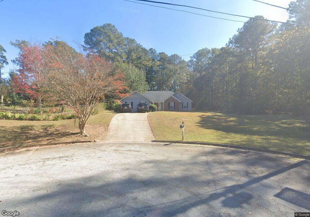
4200 Stephanie Cir SE Unit 4 Conyers, GA 30013
Estimated Value: $256,023 - $291,000
3
Beds
2
Baths
1,892
Sq Ft
$143/Sq Ft
Est. Value
About This Home
This home is located at 4200 Stephanie Cir SE Unit 4, Conyers, GA 30013 and is currently estimated at $271,256, approximately $143 per square foot. 4200 Stephanie Cir SE Unit 4 is a home located in Rockdale County with nearby schools including Barksdale Elementary School, Memorial Middle School, and Salem High School.
Ownership History
Date
Name
Owned For
Owner Type
Purchase Details
Closed on
Jan 5, 2023
Sold by
Clark Alvin Joseph
Bought by
Clark Alvin Joseph and Clark Enochia V
Current Estimated Value
Purchase Details
Closed on
Dec 9, 2010
Sold by
Clark Alvin J
Bought by
Clark Alvin J and Clark Chase Q
Purchase Details
Closed on
Sep 23, 2005
Sold by
Clark Alvin J
Bought by
Jean-Pierre Patrick and Jean-Pierre Regine
Purchase Details
Closed on
Dec 12, 2003
Sold by
Prussack George and Prussack Jane
Bought by
Clark Alvin J
Home Financials for this Owner
Home Financials are based on the most recent Mortgage that was taken out on this home.
Original Mortgage
$122,281
Interest Rate
5.85%
Mortgage Type
FHA
Create a Home Valuation Report for This Property
The Home Valuation Report is an in-depth analysis detailing your home's value as well as a comparison with similar homes in the area
Home Values in the Area
Average Home Value in this Area
Purchase History
| Date | Buyer | Sale Price | Title Company |
|---|---|---|---|
| Clark Alvin Joseph | -- | -- | |
| Clark Alvin J | -- | -- | |
| Jean-Pierre Patrick | $16,000 | -- | |
| Clark Alvin J | $124,200 | -- | |
| Prussack George | -- | -- |
Source: Public Records
Mortgage History
| Date | Status | Borrower | Loan Amount |
|---|---|---|---|
| Previous Owner | Prussack George | $122,281 |
Source: Public Records
Tax History Compared to Growth
Tax History
| Year | Tax Paid | Tax Assessment Tax Assessment Total Assessment is a certain percentage of the fair market value that is determined by local assessors to be the total taxable value of land and additions on the property. | Land | Improvement |
|---|---|---|---|---|
| 2024 | $2,232 | $94,040 | $17,800 | $76,240 |
| 2023 | $1,780 | $79,240 | $18,600 | $60,640 |
| 2022 | $1,401 | $64,440 | $12,960 | $51,480 |
| 2021 | $1,192 | $53,680 | $11,600 | $42,080 |
| 2020 | $904 | $44,560 | $9,600 | $34,960 |
| 2019 | $790 | $40,120 | $6,000 | $34,120 |
| 2018 | $685 | $36,560 | $6,000 | $30,560 |
| 2017 | $568 | $32,560 | $6,000 | $26,560 |
| 2016 | $464 | $30,440 | $7,200 | $23,240 |
| 2015 | $403 | $28,280 | $5,040 | $23,240 |
| 2014 | $326 | $26,720 | $4,560 | $22,160 |
| 2013 | -- | $37,520 | $8,320 | $29,200 |
Source: Public Records
Map
Nearby Homes
- 4195 Stephanie Cir SE
- 4260 Brandy Ln SE
- 1828 Brandy Woods Dr SE
- 1296 Carman Ct SE
- 1789 Brandy Dr SE
- 1790 Brandy Woods Trail SE
- 4217 SE Lindsey Way
- 1388 Caritas Ct SE
- 1580 Christian Cir SE
- 1155 Christian Cir SE
- 1540 Christian Cir SE
- 1107 Brookfield Dr SE
- 3960 Highway 20 SE
- 1311 N Brandy Shoals SE
- 1104 Brookfield Dr SE
- 217 Limestone Cir
- 1927 Brandy Woods Dr SE
- 1907 Brandy Woods Dr SE
- 0 Stephanie Cir SE
- 1919 Brandy Woods Trail SE
- 1947 Brandy Woods Dr SE
- 1909 Brandy Woods Trail SE
- 1929 Brandy Woods Trail SE
- 4170 Stephanie Cir SE
- 1899 Brandy Woods Trail SE
- 1938 Brandy Woods Dr SE
- 1898 Brandy Woods Dr SE Unit 1
- 1967 Brandy Woods Dr SE
- 4160 Stephanie Cir SE Unit 4
- 1888 Brandy Woods Dr SE
- 1890 Brandy Woods Trail SE
- 1920 Brandy Woods Trail SE
- 4190 Lance Cir SE
- 1958 Brandy Woods Dr SE
- 1889 Brandy Woods Trail SE
- 1900 Brandy Dr SE