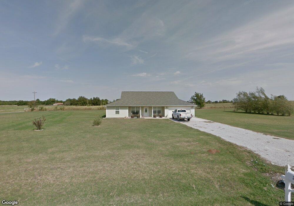
42004 M Laine St Shawnee, OK 74801
Estimated Value: $236,000 - $314,000
3
Beds
2
Baths
1,763
Sq Ft
$152/Sq Ft
Est. Value
About This Home
This home is located at 42004 M Laine St, Shawnee, OK 74801 and is currently estimated at $268,725, approximately $152 per square foot. 42004 M Laine St is a home with nearby schools including South Rock Creek Public School.
Ownership History
Date
Name
Owned For
Owner Type
Purchase Details
Closed on
Nov 10, 2006
Sold by
Mcphetridge Rodney L
Bought by
Effinger Artie and Effinger Amanda
Current Estimated Value
Home Financials for this Owner
Home Financials are based on the most recent Mortgage that was taken out on this home.
Original Mortgage
$90,000
Interest Rate
6.28%
Mortgage Type
Purchase Money Mortgage
Create a Home Valuation Report for This Property
The Home Valuation Report is an in-depth analysis detailing your home's value as well as a comparison with similar homes in the area
Home Values in the Area
Average Home Value in this Area
Purchase History
| Date | Buyer | Sale Price | Title Company |
|---|---|---|---|
| Effinger Artie | -- | None Available |
Source: Public Records
Mortgage History
| Date | Status | Borrower | Loan Amount |
|---|---|---|---|
| Closed | Effinger Artie | $90,000 |
Source: Public Records
Tax History Compared to Growth
Tax History
| Year | Tax Paid | Tax Assessment Tax Assessment Total Assessment is a certain percentage of the fair market value that is determined by local assessors to be the total taxable value of land and additions on the property. | Land | Improvement |
|---|---|---|---|---|
| 2024 | $1,512 | $17,888 | $1,740 | $16,148 |
| 2023 | $1,512 | $17,367 | $1,740 | $15,627 |
| 2022 | $1,498 | $17,367 | $1,740 | $15,627 |
| 2021 | $1,291 | $17,367 | $1,740 | $15,627 |
| 2020 | $1,564 | $17,031 | $1,740 | $15,291 |
| 2019 | $1,518 | $16,535 | $1,740 | $14,795 |
| 2018 | $1,506 | $16,053 | $1,740 | $14,313 |
| 2017 | $1,451 | $15,586 | $1,740 | $13,846 |
| 2016 | $1,320 | $15,132 | $1,740 | $13,392 |
| 2015 | $1,313 | $14,691 | $1,740 | $12,951 |
| 2014 | $1,272 | $14,264 | $1,740 | $12,524 |
Source: Public Records
Map
Nearby Homes
- 42601 Stout Dr
- 19705 Harrison Rd
- 00 Benson Park Rd
- 000 Gordon Cooper Dr
- 19402 Rangeline Rd
- 19708 Persimmon Ln
- 19901 Prairieview Rd
- 19903 Prairieview Rd
- 42608 Bob Crouch Rd
- 19910 Gordon Cooper Dr
- 00 Charleston Pointe
- 1100 Foggy Bottom Rd
- 0 Rd Unit 1180426
- 1011 N Rangeline St
- 00 Gordon Cooper 12 56 Acres Dr
- 803 N Sharon St
- 18509 Brangus Rd
- 803 S Bell Ave
- 714 Kimberly Rd
- 806 Myrtle Dr
- 42008 M Laine St
- 42003 M Laine St
- 42004 Benson Park Rd
- 42100 M Laine St
- 41906 Benson Park Rd
- 42104 Benson Park Rd
- 41905 Benson Park Rd
- 41808 Benson Park Rd
- 42108 Benson Park Rd
- 42110 Benson Park Rd
- 18740 S Harrison Ave
- 42073 Benson Park Rd
- 42424 Benson Park Rd
- 19141 Harrison Rd
- 42204 Benson Park Rd
- 18700 S Harrison Ave
- 42202 Benson Park Rd
- 19012 Harrison Rd
- 42203 Benson Park Rd
- 42274 Benson Park Rd