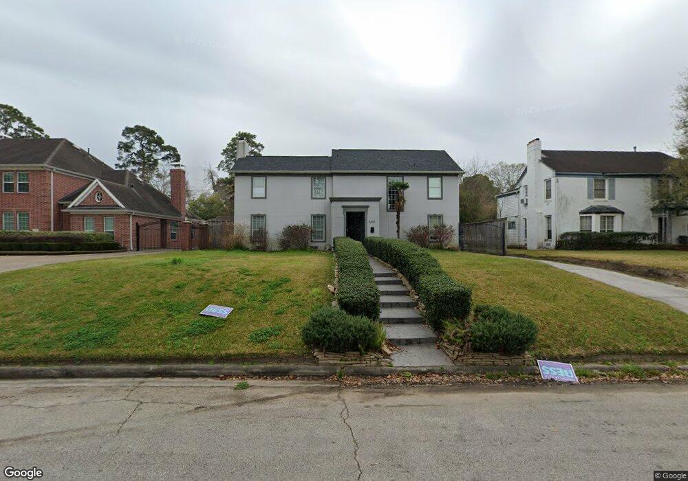
4202 Roseneath Dr Houston, TX 77021
MacGregor NeighborhoodEstimated Value: $515,000 - $657,000
4
Beds
4
Baths
4,098
Sq Ft
$145/Sq Ft
Est. Value
About This Home
This home is located at 4202 Roseneath Dr, Houston, TX 77021 and is currently estimated at $595,750, approximately $145 per square foot. 4202 Roseneath Dr is a home located in Harris County with nearby schools including Peck Elementary School, Cullen Middle School, and Yates High School.
Ownership History
Date
Name
Owned For
Owner Type
Purchase Details
Closed on
Mar 29, 2021
Sold by
Gifiespie Property Holdings Llc
Bought by
Steele Kenya
Current Estimated Value
Home Financials for this Owner
Home Financials are based on the most recent Mortgage that was taken out on this home.
Original Mortgage
$479,370
Outstanding Balance
$431,409
Interest Rate
2.8%
Mortgage Type
New Conventional
Estimated Equity
$164,341
Purchase Details
Closed on
Jul 11, 2016
Sold by
Gillespie Angela
Bought by
Gillespie Property Holdings Llc
Home Financials for this Owner
Home Financials are based on the most recent Mortgage that was taken out on this home.
Original Mortgage
$147,031
Interest Rate
3.58%
Mortgage Type
New Conventional
Purchase Details
Closed on
Jun 29, 2016
Sold by
Lavinghousez George Dwight
Bought by
Gillespie Angela
Home Financials for this Owner
Home Financials are based on the most recent Mortgage that was taken out on this home.
Original Mortgage
$147,031
Interest Rate
3.58%
Mortgage Type
New Conventional
Purchase Details
Closed on
May 7, 2013
Sold by
Carter Anthony and Carter Anne M
Bought by
Lavinghousez George Dwight
Purchase Details
Closed on
Aug 31, 2011
Sold by
Lavinghousez George Dwight
Bought by
Carter Anthony and Carter Anne M
Home Financials for this Owner
Home Financials are based on the most recent Mortgage that was taken out on this home.
Original Mortgage
$250,000
Interest Rate
4.53%
Mortgage Type
Seller Take Back
Purchase Details
Closed on
Dec 7, 2010
Sold by
Rubio Ruby
Bought by
Lavinghousez George Dwight
Purchase Details
Closed on
Jul 29, 2009
Sold by
Lavinghousez George Guy and Lavinghousez Verdell W
Bought by
Rubio Ruby
Home Financials for this Owner
Home Financials are based on the most recent Mortgage that was taken out on this home.
Original Mortgage
$285,000
Interest Rate
5.41%
Mortgage Type
Seller Take Back
Purchase Details
Closed on
Mar 28, 2006
Sold by
Swaim Mark Anthony and Swaim Mark A
Bought by
Lavinghousez George Guy and Lavinghousez Verdell W
Purchase Details
Closed on
Jul 12, 1999
Sold by
Lavinghousez George Guy and Lavinghousez Verdell W
Bought by
Swaim Mark A and Hodgson Ronald K
Create a Home Valuation Report for This Property
The Home Valuation Report is an in-depth analysis detailing your home's value as well as a comparison with similar homes in the area
Home Values in the Area
Average Home Value in this Area
Purchase History
| Date | Buyer | Sale Price | Title Company |
|---|---|---|---|
| Steele Kenya | -- | American Title Company | |
| Gillespie Property Holdings Llc | -- | None Available | |
| Gillespie Angela | -- | None Available | |
| Lavinghousez George Dwight | $250,000 | None Available | |
| Carter Anthony | -- | Stewart Title | |
| Lavinghousez George Dwight | $250,000 | None Available | |
| Rubio Ruby | -- | Stewart Title Houston Div | |
| Lavinghousez George Guy | -- | None Available | |
| Swaim Mark A | -- | -- |
Source: Public Records
Mortgage History
| Date | Status | Borrower | Loan Amount |
|---|---|---|---|
| Open | Steele Kenya | $479,370 | |
| Previous Owner | Gillespie Angela | $147,031 | |
| Previous Owner | Carter Anthony | $250,000 | |
| Previous Owner | Rubio Ruby | $285,000 |
Source: Public Records
Tax History
| Year | Tax Paid | Tax Assessment Tax Assessment Total Assessment is a certain percentage of the fair market value that is determined by local assessors to be the total taxable value of land and additions on the property. | Land | Improvement |
|---|---|---|---|---|
| 2025 | $5,962 | $417,438 | $245,575 | $171,863 |
| 2024 | $5,962 | $407,323 | $245,575 | $161,748 |
| 2023 | $5,962 | $425,268 | $245,575 | $179,693 |
| 2022 | $9,092 | $392,417 | $245,575 | $146,842 |
| 2021 | $7,384 | $316,831 | $178,600 | $138,231 |
| 2020 | $7,642 | $301,272 | $178,600 | $122,672 |
| 2019 | $8,043 | $304,021 | $178,600 | $125,421 |
| 2018 | $7,693 | $304,021 | $178,600 | $125,421 |
| 2017 | $8,037 | $304,021 | $178,600 | $125,421 |
| 2016 | $8,037 | $304,021 | $178,600 | $125,421 |
| 2015 | $6,001 | $307,192 | $178,600 | $128,592 |
| 2014 | $6,001 | $233,441 | $111,625 | $121,816 |
Source: Public Records
Map
Nearby Homes
- 0 S Macgregor Way Unit 68999068
- 4301 Charleston St
- 4310 Fernwood Dr
- 4315 Fernwood Dr
- 4031 Fernwood Dr
- 5730 Cullen Blvd
- 4102 Charleston St
- 4327 Alconbury Ln
- 4042 Glen Cove Dr
- 4415 Charleston St
- 4130 Glen Cove Ct
- 4030 Glen Cove Dr
- 4425 Laurel Dr
- 3922 Roseneath Dr
- 4015 England Ct E
- 4435 Old Spanish Trail
- 3942 Charleston St
- 4155 Griggs Rd
- 3878 Arbor St
- 3817 Palm St
- 4122 Roseneath Dr
- 4206 Roseneath Dr
- 4118 Roseneath Dr
- 4127 Fernwood Dr
- 4129 Fernwood Dr
- 4210 Roseneath Dr
- 4207 Roseneath Dr
- 4211 Roseneath Dr
- 4135 Fernwood Dr
- 4114 Roseneath Dr
- 4215 Roseneath Dr
- 4115 Fernwood Dr
- 4218 Roseneath Dr
- 4203 Roseneath Dr
- 4110 Roseneath Dr
- 4115 Roseneath Dr
- 4225 Fernwood Dr
- 4202 S Macgregor Way
- 4219 Roseneath Dr
- 4109 Fernwood Dr
Your Personal Tour Guide
Ask me questions while you tour the home.