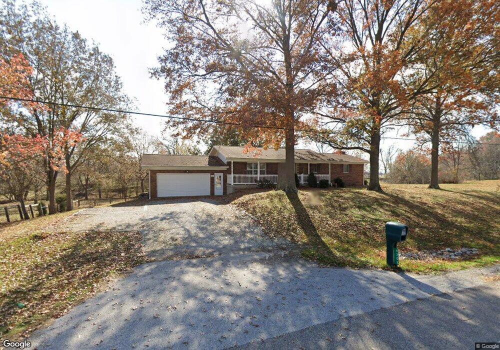
4202 State Route 161 New Baden, IL 62265
Estimated Value: $213,877 - $270,000
--
Bed
--
Bath
1,344
Sq Ft
$177/Sq Ft
Est. Value
About This Home
This home is located at 4202 State Route 161, New Baden, IL 62265 and is currently estimated at $237,469, approximately $176 per square foot. 4202 State Route 161 is a home with nearby schools including Albers Elementary School and Central Community High School.
Ownership History
Date
Name
Owned For
Owner Type
Purchase Details
Closed on
Aug 17, 2016
Sold by
Rolves Carol Sue
Bought by
Rolves Carol Sue and Carol Sue Rolves Trust
Current Estimated Value
Purchase Details
Closed on
May 31, 2015
Sold by
Rolves Carol Sue
Bought by
Rolves Leonard L and Rolves Linda M
Purchase Details
Closed on
Jun 30, 2009
Sold by
Rolves Robert B and Rolves Carol Sue
Bought by
Rolves Robert B and Rolves Carol Sue
Purchase Details
Closed on
Feb 6, 2009
Sold by
Rolves Robert R and Rolves Carol
Bought by
State Of Illinois
Create a Home Valuation Report for This Property
The Home Valuation Report is an in-depth analysis detailing your home's value as well as a comparison with similar homes in the area
Home Values in the Area
Average Home Value in this Area
Purchase History
| Date | Buyer | Sale Price | Title Company |
|---|---|---|---|
| Rolves Carol Sue | -- | Attorney | |
| Rolves Leonard L | -- | None Available | |
| Rolves Robert B | -- | None Available | |
| State Of Illinois | -- | None Available |
Source: Public Records
Tax History Compared to Growth
Tax History
| Year | Tax Paid | Tax Assessment Tax Assessment Total Assessment is a certain percentage of the fair market value that is determined by local assessors to be the total taxable value of land and additions on the property. | Land | Improvement |
|---|---|---|---|---|
| 2024 | $3,691 | $66,520 | $14,530 | $51,990 |
| 2023 | $3,691 | $62,190 | $13,840 | $48,350 |
| 2022 | $3,575 | $58,670 | $13,060 | $45,610 |
| 2021 | $3,234 | $56,960 | $12,680 | $44,280 |
| 2020 | $3,107 | $53,730 | $11,960 | $41,770 |
| 2019 | $3,063 | $53,730 | $11,960 | $41,770 |
| 2018 | $2,964 | $50,110 | $11,670 | $38,440 |
| 2017 | $2,933 | $48,650 | $11,330 | $37,320 |
| 2016 | $2,896 | $48,650 | $11,330 | $37,320 |
| 2015 | $3,273 | $48,650 | $11,330 | $37,320 |
| 2013 | $3,273 | $52,290 | $11,330 | $40,960 |
Source: Public Records
Map
Nearby Homes
- 244 Walnut
- 228 Walnut
- 4810 Airport Rd
- 111 E Poos Dr
- 204 W Poos Dr
- 308 W Indiana St
- 00 Illinois 161
- 12702 Crestview Ln
- 91 Weatherholt Dr
- 10 S Hull St
- 751 E 4th St
- 12746 Rolling Hills Dr
- 315 Briarwood Ln
- 1144 Emily Ln
- 437 Galen Dr
- 203 S Walnut St
- 501 Wedgewood Ln
- 304 S Washington St
- 525 Wedgewood Ln
- 630 Wedgewood Ln
- 4115 State Route 161
- 4109 State Route 161
- 4205 State Route 161
- 4103 State Route 161
- 4065 State Route 161
- 4209 State Route 161
- 8014 Thole Rd
- 8020 Thole Rd
- 8008 Thole Rd
- 8032 Thole Rd
- 4004 State Route 161
- 4004 State Route 161
- 3938 State Route 161
- 3928 State Route 161
- 8045 Thole Rd
- 3920 W State Rte 161 W
- 800 State Route 161 W
- 800 State Route 161 W
- 3 Oaktree St
- 4 Oak Tree St