Estimated Value: $313,501 - $358,000
3
Beds
3
Baths
2,112
Sq Ft
$161/Sq Ft
Est. Value
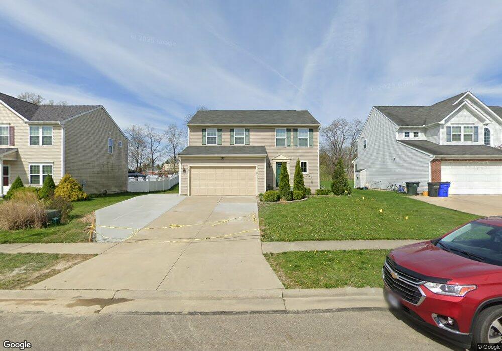
About This Home
This home is located at 4203 Whitestone Rd, Kent, OH 44240 and is currently estimated at $339,375, approximately $160 per square foot. 4203 Whitestone Rd is a home located in Portage County with nearby schools including Brimfield Elementary School, Field Middle School, and Field High School.
Ownership History
Date
Name
Owned For
Owner Type
Purchase Details
Closed on
Jun 20, 2012
Sold by
Nvr Inc
Bought by
Wilson Frederick D
Current Estimated Value
Home Financials for this Owner
Home Financials are based on the most recent Mortgage that was taken out on this home.
Original Mortgage
$170,850
Interest Rate
3.54%
Mortgage Type
Purchase Money Mortgage
Create a Home Valuation Report for This Property
The Home Valuation Report is an in-depth analysis detailing your home's value as well as a comparison with similar homes in the area
Home Values in the Area
Average Home Value in this Area
Purchase History
| Date | Buyer | Sale Price | Title Company |
|---|---|---|---|
| Wilson Frederick D | $170,900 | Nvr Title Agency Llc |
Source: Public Records
Mortgage History
| Date | Status | Borrower | Loan Amount |
|---|---|---|---|
| Previous Owner | Wilson Frederick D | $170,850 |
Source: Public Records
Tax History
| Year | Tax Paid | Tax Assessment Tax Assessment Total Assessment is a certain percentage of the fair market value that is determined by local assessors to be the total taxable value of land and additions on the property. | Land | Improvement |
|---|---|---|---|---|
| 2024 | $4,068 | $83,690 | $12,250 | $71,440 |
| 2023 | $4,016 | $66,540 | $12,250 | $54,290 |
| 2022 | $4,028 | $66,540 | $12,250 | $54,290 |
| 2021 | $3,933 | $66,540 | $12,250 | $54,290 |
| 2020 | $3,817 | $58,240 | $12,250 | $45,990 |
| 2019 | $4,420 | $58,240 | $12,250 | $45,990 |
| 2018 | $3,076 | $52,360 | $12,250 | $40,110 |
| 2017 | $3,076 | $52,360 | $12,250 | $40,110 |
| 2016 | $2,867 | $52,360 | $12,250 | $40,110 |
| 2015 | $2,778 | $52,360 | $12,250 | $40,110 |
| 2014 | $2,586 | $50,440 | $12,250 | $38,190 |
| 2013 | $2,528 | $50,440 | $12,250 | $38,190 |
Source: Public Records
Map
Nearby Homes
- 4360 Beal Dr
- 4545 State Route 43
- 4088 Lynwood Dr
- 3793 Ranfield Rd
- 1386 Brookdale Ln
- 3880 Selnik Rd
- 3910 Willow Way
- 3929 Lor Ron St
- 4808 Sherman Rd
- 3555 Jameson Dr
- 3532 Gary Dr
- 3517 Jameson Dr
- 3483 Lawndale Dr
- 1676 Countryview Dr
- 788 Cambridge Ct
- 4595 Creekside Dr
- 5088 Spruce Knoll Run
- 2092 Sugar Maple Dr
- 0 Meloy Rd Unit 5162435
- 1233 Cedar Ridge Rd
- 4209 Whitestone Rd
- 4195 Whitestone Rd
- 4215 Whitestone Rd
- 4189 Whitestone Rd
- TBD Whitestone Rd
- 4204 Whitestone Rd
- 4212 Whitestone Rd
- 4223 Whitestone Rd
- 4198 Whitestone Rd
- 4183 Whitestone Rd
- 4190 Whitestone Rd
- 4216 Whitestone Rd
- 4229 Whitestone Rd
- 4224 Whitestone Rd
- 4180 Whitestone Rd
- 4177 Whitestone Rd
- 4239 Pembroke Dr
- 4227 Pembroke Dr
- 4173 Whitestone Rd
- 4237 Whitestone Rd
Your Personal Tour Guide
Ask me questions while you tour the home.