Estimated Value: $299,000 - $348,000
4
Beds
3
Baths
1,752
Sq Ft
$181/Sq Ft
Est. Value
About This Home
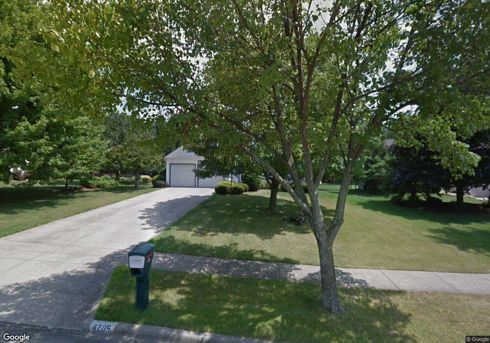
This home is located at 4205 Hampton Cir, Stow, OH 44224 and is currently estimated at $316,703, approximately $180 per square foot. 4205 Hampton Cir is a home located in Summit County with nearby schools including Stow-Munroe Falls High School, Holy Family Elementary School, and Walsh Jesuit High School.
Ownership History
Date
Name
Owned For
Owner Type
Purchase Details
Closed on
Jan 12, 2001
Sold by
Kelly Grasso Salvatore and Kelly Karen
Bought by
Buckbee Erica M and Bordonaro Thomas M
Current Estimated Value
Home Financials for this Owner
Home Financials are based on the most recent Mortgage that was taken out on this home.
Original Mortgage
$119,500
Outstanding Balance
$44,571
Interest Rate
7.69%
Estimated Equity
$272,132
Purchase Details
Closed on
May 26, 1995
Sold by
Ross Philip G
Bought by
Grasso Salvatore and Grasso Karen K
Create a Home Valuation Report for This Property
The Home Valuation Report is an in-depth analysis detailing your home's value as well as a comparison with similar homes in the area
Home Values in the Area
Average Home Value in this Area
Purchase History
| Date | Buyer | Sale Price | Title Company |
|---|---|---|---|
| Buckbee Erica M | $149,500 | Blvd Title | |
| Grasso Salvatore | $138,500 | -- |
Source: Public Records
Mortgage History
| Date | Status | Borrower | Loan Amount |
|---|---|---|---|
| Open | Buckbee Erica M | $119,500 |
Source: Public Records
Tax History Compared to Growth
Tax History
| Year | Tax Paid | Tax Assessment Tax Assessment Total Assessment is a certain percentage of the fair market value that is determined by local assessors to be the total taxable value of land and additions on the property. | Land | Improvement |
|---|---|---|---|---|
| 2025 | $5,284 | $93,787 | $18,680 | $75,107 |
| 2024 | $5,284 | $93,787 | $18,680 | $75,107 |
| 2023 | $5,284 | $93,787 | $18,680 | $75,107 |
| 2022 | $4,613 | $72,223 | $14,368 | $57,855 |
| 2021 | $4,130 | $72,223 | $14,368 | $57,855 |
| 2020 | $4,059 | $72,230 | $14,370 | $57,860 |
| 2019 | $3,761 | $62,500 | $14,220 | $48,280 |
| 2018 | $3,700 | $62,500 | $14,220 | $48,280 |
| 2017 | $3,409 | $62,500 | $14,220 | $48,280 |
| 2016 | $3,509 | $55,910 | $14,220 | $41,690 |
| 2015 | $3,409 | $55,910 | $14,220 | $41,690 |
| 2014 | $3,412 | $55,910 | $14,220 | $41,690 |
| 2013 | $3,483 | $57,460 | $14,220 | $43,240 |
Source: Public Records
Map
Nearby Homes
- 2831 Saybrooke Blvd
- 2908 Wexford Blvd
- 2714 Wexford Blvd
- 3788 Woodbury Oval Unit 60
- 4445 Kenneth Trail
- 4444 Hickory Trail
- 3860 Lake Run Blvd
- 4556 Fishcreek Rd
- 1302 Carol Dr
- 4638 Dresher Trail
- 4078 Pardee Rd
- 0 Vira Rd
- 3801 Baird Rd
- 4131 Burton Dr
- 76 Wanda Ct
- 4155 Burton Dr
- 4910 Independence Cir Unit D
- 4675 Kent Rd
- 4916 Friar Rd Unit B
- 3711 Vira Rd
- 4197 Hampton Cir
- 2982 Saybrooke Blvd
- 2990 Saybrooke Blvd
- 4191 Hampton Cir
- 2998 Saybrooke Blvd
- 2966 Saybrooke Blvd
- 4204 Hampton Cir
- 4183 Hampton Cir
- 3006 Saybrooke Blvd
- 4190 Hampton Cir
- 4198 Hampton Cir
- 2958 Saybrooke Blvd
- 2987 Saybrooke Blvd
- 2979 Saybrooke Blvd
- 2971 Saybrooke Blvd
- 2997 Saybrooke Blvd
- 3014 Saybrooke Blvd
- 2950 Saybrooke Blvd
- 2963 Saybrooke Blvd
- 3007 Saybrooke Blvd