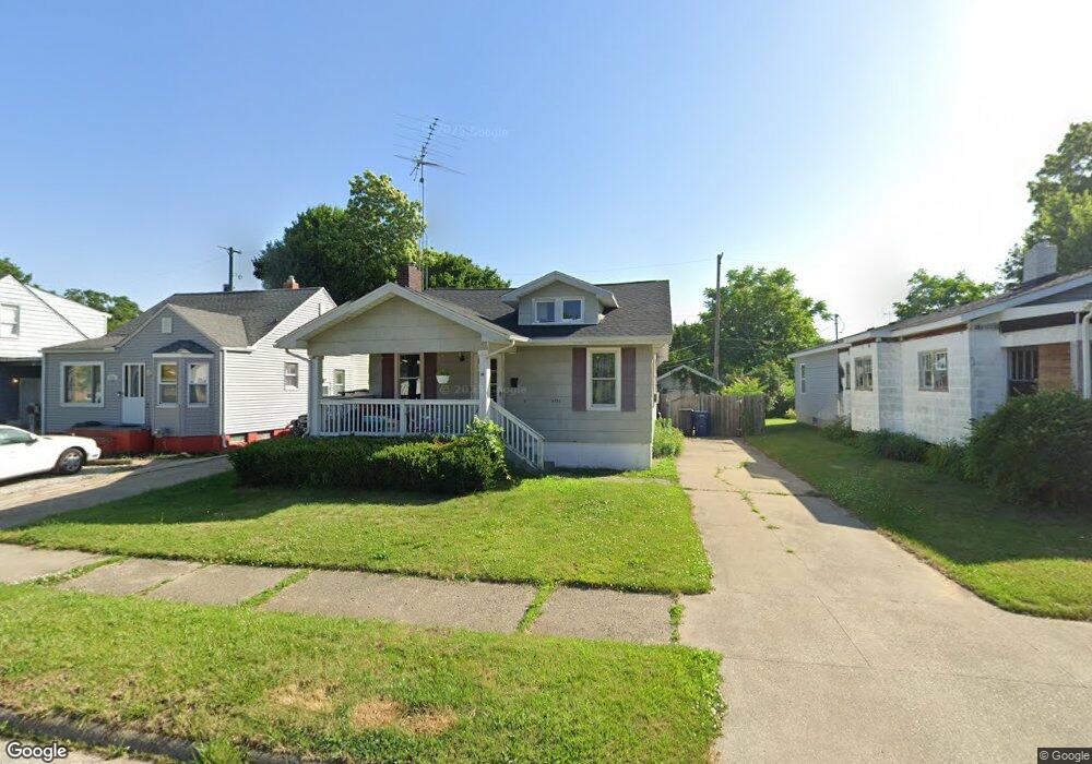
4205 Menton St Flint, MI 48507
Circle Drive NeighborhoodEstimated Value: $61,000 - $78,000
2
Beds
1
Bath
884
Sq Ft
$79/Sq Ft
Est. Value
About This Home
This home is located at 4205 Menton St, Flint, MI 48507 and is currently estimated at $70,049, approximately $79 per square foot. 4205 Menton St is a home located in Genesee County with nearby schools including Freeman Elementary School, Flint Southwestern Classical Academy, and International Academy of Flint (K-12).
Ownership History
Date
Name
Owned For
Owner Type
Purchase Details
Closed on
May 27, 2015
Sold by
Davis Heather and Citizens Bank
Bought by
Premier Investments Llc
Current Estimated Value
Purchase Details
Closed on
Dec 30, 2005
Sold by
Russell Curtis and Russell Kathleen
Bought by
Davis Heather
Home Financials for this Owner
Home Financials are based on the most recent Mortgage that was taken out on this home.
Original Mortgage
$45,050
Interest Rate
6.2%
Mortgage Type
FHA
Purchase Details
Closed on
Feb 3, 2000
Sold by
Rothley P Rothley J and Rothley Ward S
Bought by
Russell Curtis and Russell Kathleen
Create a Home Valuation Report for This Property
The Home Valuation Report is an in-depth analysis detailing your home's value as well as a comparison with similar homes in the area
Home Values in the Area
Average Home Value in this Area
Purchase History
| Date | Buyer | Sale Price | Title Company |
|---|---|---|---|
| Premier Investments Llc | $1,400 | None Available | |
| Davis Heather | $45,000 | Lawyers Title | |
| Russell Curtis | $31,429 | First American Title Ins Co |
Source: Public Records
Mortgage History
| Date | Status | Borrower | Loan Amount |
|---|---|---|---|
| Previous Owner | Davis Heather | $45,050 |
Source: Public Records
Tax History
| Year | Tax Paid | Tax Assessment Tax Assessment Total Assessment is a certain percentage of the fair market value that is determined by local assessors to be the total taxable value of land and additions on the property. | Land | Improvement |
|---|---|---|---|---|
| 2025 | $1,066 | $34,800 | $0 | $0 |
| 2024 | $989 | $31,000 | $0 | $0 |
| 2023 | $968 | $28,500 | $0 | $0 |
| 2022 | $0 | $23,400 | $0 | $0 |
| 2021 | $980 | $16,300 | $0 | $0 |
| 2020 | $903 | $11,500 | $0 | $0 |
| 2019 | $885 | $10,200 | $0 | $0 |
| 2018 | $870 | $9,300 | $0 | $0 |
| 2017 | $927 | $0 | $0 | $0 |
| 2016 | $881 | $0 | $0 | $0 |
| 2015 | -- | $0 | $0 | $0 |
| 2014 | -- | $0 | $0 | $0 |
| 2012 | -- | $12,900 | $12,900 | $0 |
Source: Public Records
Map
Nearby Homes
- 4127 Custer Ave
- 416 Burroughs Ave
- 621 Lochhead Ave
- 4205 Red Arrow Rd
- 530 McKeighan Ave
- 617 McKeighan Ave
- 621 Burroughs Ave
- 630 Buckingham Ave
- 326 Burroughs Ave
- 352 Buckingham Ave
- 361 Buckingham Ave
- 338 Browning Ave
- 802 McKeighan Ave
- 818 Dell Ave
- 4526 Milton Dr
- 4424 Cheyenne Ave
- 3505 Comanche Ave
- 3442 Griffith Ct
- 3115 Circle Dr
- 3209 Shawnee Ave
Your Personal Tour Guide
Ask me questions while you tour the home.