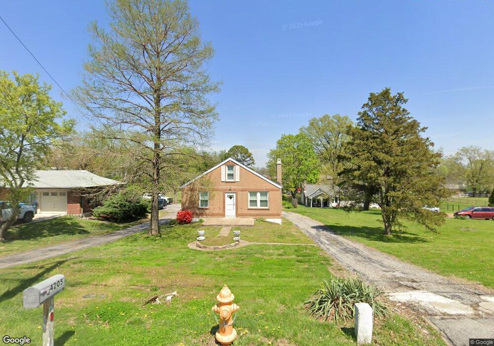
4205 Reavis Barracks Rd Saint Louis, MO 63125
Lemay NeighborhoodEstimated Value: $127,000 - $225,000
2
Beds
1
Bath
1,080
Sq Ft
$170/Sq Ft
Est. Value
About This Home
This home is located at 4205 Reavis Barracks Rd, Saint Louis, MO 63125 and is currently estimated at $183,595, approximately $169 per square foot. 4205 Reavis Barracks Rd is a home located in St. Louis County with nearby schools including Bierbaum Elementary School, Margaret Buerkle Middle School, and Mehlville High School.
Ownership History
Date
Name
Owned For
Owner Type
Purchase Details
Closed on
Jan 19, 2022
Sold by
Holdings By Mk Llc
Bought by
Holdings By Mk Llc
Current Estimated Value
Home Financials for this Owner
Home Financials are based on the most recent Mortgage that was taken out on this home.
Original Mortgage
$126,000
Interest Rate
3.92%
Mortgage Type
New Conventional
Purchase Details
Closed on
Nov 11, 2021
Sold by
Harris Laura J
Bought by
Holdings By Mk Llc
Purchase Details
Closed on
Sep 21, 2021
Sold by
Wiesehan Oliver G
Bought by
Harris Laura J
Create a Home Valuation Report for This Property
The Home Valuation Report is an in-depth analysis detailing your home's value as well as a comparison with similar homes in the area
Home Values in the Area
Average Home Value in this Area
Purchase History
| Date | Buyer | Sale Price | Title Company |
|---|---|---|---|
| Holdings By Mk Llc | -- | Title Partners | |
| Holdings By Mk Llc | -- | Title Partners | |
| Grega Denise L | -- | Title Partners | |
| Harris Laura J | -- | Title Partners | |
| Harris Laura J | -- | -- |
Source: Public Records
Mortgage History
| Date | Status | Borrower | Loan Amount |
|---|---|---|---|
| Previous Owner | Holdings By Mk Llc | $126,000 |
Source: Public Records
Tax History Compared to Growth
Tax History
| Year | Tax Paid | Tax Assessment Tax Assessment Total Assessment is a certain percentage of the fair market value that is determined by local assessors to be the total taxable value of land and additions on the property. | Land | Improvement |
|---|---|---|---|---|
| 2025 | $1,758 | $33,160 | $15,810 | $17,350 |
| 2024 | $1,758 | $23,750 | $9,840 | $13,910 |
| 2023 | $1,657 | $23,750 | $9,840 | $13,910 |
| 2022 | $1,224 | $16,160 | $10,550 | $5,610 |
| 2021 | $2,248 | $32,720 | $10,550 | $22,170 |
| 2020 | $2,015 | $27,720 | $12,310 | $15,410 |
| 2019 | $2,010 | $27,720 | $12,310 | $15,410 |
| 2018 | $1,727 | $21,150 | $6,560 | $14,590 |
| 2017 | $1,722 | $21,150 | $6,560 | $14,590 |
| 2016 | $1,618 | $19,060 | $4,920 | $14,140 |
| 2015 | $1,525 | $19,060 | $4,920 | $14,140 |
| 2014 | $1,666 | $20,750 | $3,480 | $17,270 |
Source: Public Records
Map
Nearby Homes
- 1905 Mansard Dr Unit 1905
- 1871 Mansard Dr Unit 1917
- 1918 Union Rd
- 4127 Burnett Ave
- 1908 Union Rd Unit 1908
- 4259 Burnett Walk Unit 4259
- 4203 Lions Chase Dr
- 9920 Bunker Hill Dr Unit E
- 9030 Villaridge Ct Unit 53
- 10010 Bunker Hill Dr Unit H
- 10018 Bunker Hill Dr Unit G
- 9197 Villaridge Ct
- 9070 Villaridge Ct Unit 38
- 9117 Villaridge Ct Unit E
- 9925 Bunker Hill Dr Unit G
- 9925 Bunker Hill Dr Unit F
- 2245 Pecan Dr
- 9883 Ione Ln
- 2324 Birch Dr
- 2337 Birch Dr
- 4209 Reavis Barracks Rd
- 4201 Reavis Barracks Rd
- 4141 Reavis Barracks Rd
- 4202 Reavis Barracks Rd
- 4210 Reavis Barracks Rd
- 4119 Reavis Barracks Rd
- 1935 Mansard Dr Unit 1935
- 4188 Reavis Barracks Rd
- 4218 Reavis Barracks Rd
- 1933 Mansard Dr Unit 1933
- 4215 Mansard Dr Unit 4215
- 4213 Mansard Dr Unit 4213
- 1939 Mansard Dr
- 1941 Mansard Dr Unit 1941
- 1943 Mansard Dr
- 1945 Mansard Dr Unit 1945
- 1953 Mansard Dr Unit 1953
- 1929 Mansard Dr
- 1947 Mansard Dr Unit 1947
- 1949 Mansard Dr Unit 1949