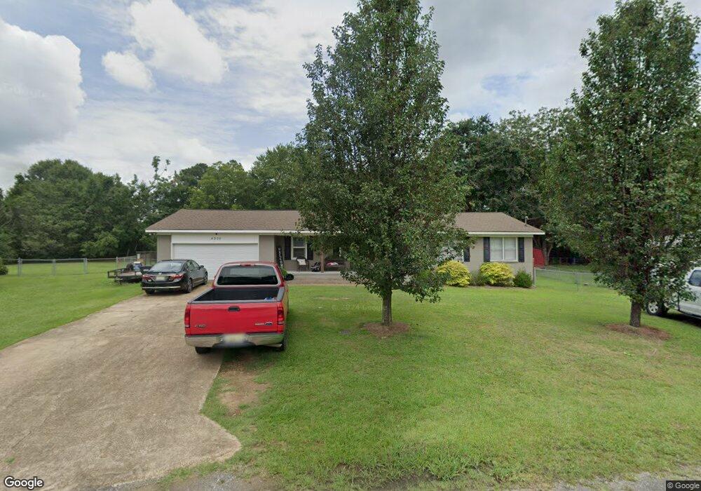
4206 S Point Cir N Gadsden, AL 35907
Estimated Value: $197,822 - $236,000
3
Beds
2
Baths
1,526
Sq Ft
$141/Sq Ft
Est. Value
About This Home
This home is located at 4206 S Point Cir N, Gadsden, AL 35907 and is currently estimated at $215,456, approximately $141 per square foot. 4206 S Point Cir N is a home located in Etowah County with nearby schools including Southside Elementary School, Southside High School, and Rainbow Middle School.
Ownership History
Date
Name
Owned For
Owner Type
Purchase Details
Closed on
May 11, 2017
Sold by
Marldey Angela Y and Nall Angela Y
Bought by
Morgan Sarah E
Current Estimated Value
Home Financials for this Owner
Home Financials are based on the most recent Mortgage that was taken out on this home.
Original Mortgage
$107,908
Outstanding Balance
$88,864
Interest Rate
3.75%
Mortgage Type
FHA
Estimated Equity
$126,592
Create a Home Valuation Report for This Property
The Home Valuation Report is an in-depth analysis detailing your home's value as well as a comparison with similar homes in the area
Home Values in the Area
Average Home Value in this Area
Purchase History
| Date | Buyer | Sale Price | Title Company |
|---|---|---|---|
| Morgan Sarah E | $109,900 | None Available |
Source: Public Records
Mortgage History
| Date | Status | Borrower | Loan Amount |
|---|---|---|---|
| Open | Morgan Sarah E | $107,908 |
Source: Public Records
Tax History Compared to Growth
Tax History
| Year | Tax Paid | Tax Assessment Tax Assessment Total Assessment is a certain percentage of the fair market value that is determined by local assessors to be the total taxable value of land and additions on the property. | Land | Improvement |
|---|---|---|---|---|
| 2024 | $593 | $15,660 | $2,080 | $13,580 |
| 2023 | $593 | $15,660 | $2,080 | $13,580 |
| 2022 | $486 | $13,030 | $2,080 | $10,950 |
| 2021 | $401 | $10,970 | $2,060 | $8,910 |
| 2020 | $401 | $10,980 | $0 | $0 |
| 2019 | $444 | $10,840 | $0 | $0 |
| 2017 | $820 | $20,000 | $0 | $0 |
| 2016 | $820 | $20,000 | $0 | $0 |
| 2015 | $820 | $20,000 | $0 | $0 |
| 2013 | -- | $19,360 | $0 | $0 |
Source: Public Records
Map
Nearby Homes
- 4198 Pilgrims Rest Rd
- 2964 Plymouth Rock Trail W
- 2890 Plymouth Rock Trail S
- 4209 Rollingwood Dr
- 1.77 Gatewood Trail
- 14.87 Fowlers Ferry Rd S
- 4470 Green Valley Rd
- 1 Berkley Hills Dr W
- 39 acres Fowlers Ferry Rd
- 2810 Mountain View Dr
- 3625 S Valley Rd
- 2785 Miller Dr
- 1920 Lasseter Rd
- 1810 Lasseter Rd
- 4241 Quail Cir
- 105 Riverview Ln
- 2943 Highway 77
- 1600 Lasseter Rd
- 1805 Sibert Dr
- 10.0 Crimson Lake Dr
- 4206 Southpointe Cir
- 4210 S Point Cir N
- 4192 S Point Cir N
- 4180 S Point Cir N
- 4180 S Point Cir S
- 4161 S Point Cir N
- 2794 Plymouth Rock Trail W
- 4199 S Point Cir S
- 2790 Plymouth Rock Trail W
- 4160 S Point Cir S
- 4160 S Point Cir N
- 2820 Plymouth Rock Trail W
- 4147 S Point Cir N
- 4181 S Point Cir S
- 4290 Plymouth Rock Trail E
- 4140 S Point Cir S
- 4161 S Point Cir S
- 2830 Plymouth Rock Trail W
- 4171 Pilgrims Rest Rd
- 4120 S Point Cir N