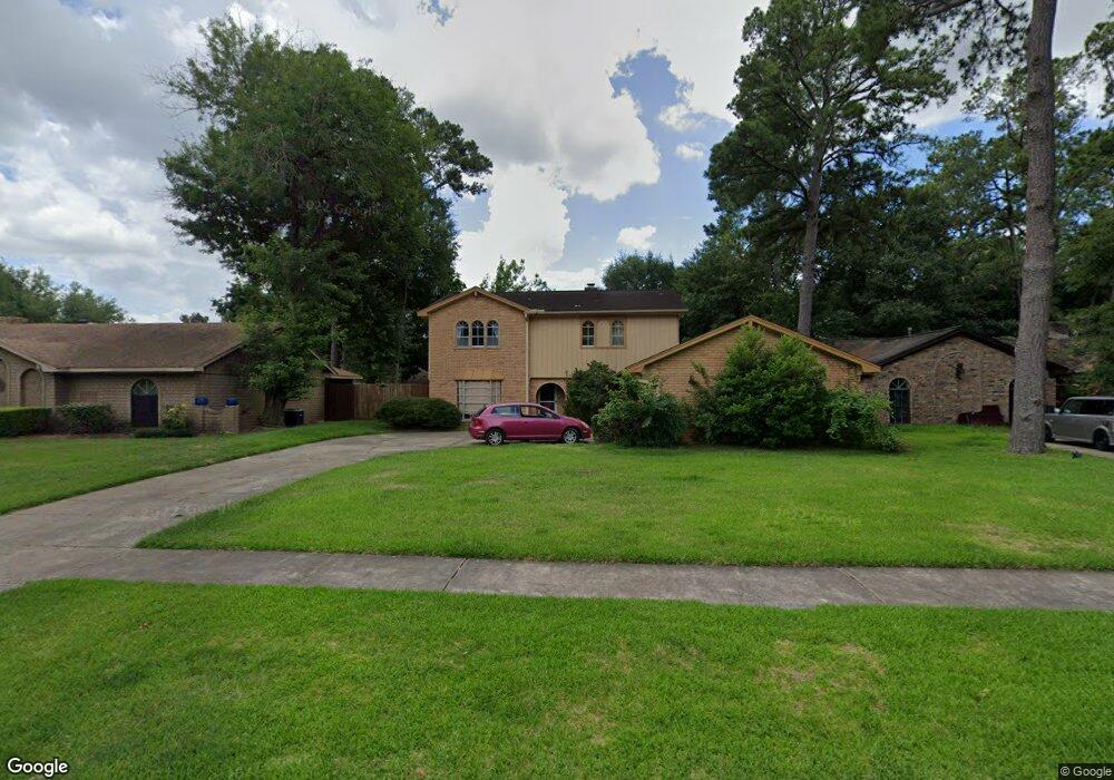
4207 Black Locust Dr Houston, TX 77088
Greater Inwood NeighborhoodEstimated Value: $265,000 - $291,000
4
Beds
3
Baths
2,439
Sq Ft
$115/Sq Ft
Est. Value
About This Home
This home is located at 4207 Black Locust Dr, Houston, TX 77088 and is currently estimated at $281,157, approximately $115 per square foot. 4207 Black Locust Dr is a home located in Harris County with nearby schools including Stovall School, Caraway Intermediate School, and Caraway Elementary School.
Ownership History
Date
Name
Owned For
Owner Type
Purchase Details
Closed on
Oct 20, 2009
Sold by
Santifer Charles Stuart and Gorham Ricky Ray
Bought by
Rainone John
Current Estimated Value
Home Financials for this Owner
Home Financials are based on the most recent Mortgage that was taken out on this home.
Original Mortgage
$127,645
Outstanding Balance
$83,267
Interest Rate
5.14%
Mortgage Type
FHA
Estimated Equity
$197,890
Purchase Details
Closed on
Feb 13, 1997
Sold by
Sims James
Bought by
Jones Linda F
Purchase Details
Closed on
Nov 11, 1994
Sold by
Hammond Kenneth D and Hammond Mickey A
Bought by
Santifer Charles Stuart and Gorham Ricky Day
Home Financials for this Owner
Home Financials are based on the most recent Mortgage that was taken out on this home.
Original Mortgage
$85,400
Interest Rate
5.75%
Create a Home Valuation Report for This Property
The Home Valuation Report is an in-depth analysis detailing your home's value as well as a comparison with similar homes in the area
Home Values in the Area
Average Home Value in this Area
Purchase History
| Date | Buyer | Sale Price | Title Company |
|---|---|---|---|
| Rainone John | -- | Stewart Title | |
| Jones Linda F | -- | -- | |
| Santifer Charles Stuart | -- | -- |
Source: Public Records
Mortgage History
| Date | Status | Borrower | Loan Amount |
|---|---|---|---|
| Open | Rainone John | $127,645 | |
| Previous Owner | Santifer Charles Stuart | $85,400 |
Source: Public Records
Tax History Compared to Growth
Tax History
| Year | Tax Paid | Tax Assessment Tax Assessment Total Assessment is a certain percentage of the fair market value that is determined by local assessors to be the total taxable value of land and additions on the property. | Land | Improvement |
|---|---|---|---|---|
| 2025 | $191 | $241,735 | $54,000 | $187,735 |
| 2024 | $191 | $249,559 | $54,000 | $195,559 |
| 2023 | $191 | $277,238 | $54,000 | $223,238 |
| 2022 | $5,454 | $255,824 | $45,000 | $210,824 |
| 2021 | $5,192 | $215,811 | $45,000 | $170,811 |
| 2020 | $4,960 | $215,811 | $45,000 | $170,811 |
| 2019 | $4,727 | $180,659 | $23,850 | $156,809 |
| 2018 | $1,871 | $155,306 | $23,850 | $131,456 |
| 2017 | $4,078 | $155,306 | $23,850 | $131,456 |
| 2016 | $3,708 | $139,760 | $23,850 | $115,910 |
| 2015 | $2,857 | $139,760 | $23,850 | $115,910 |
| 2014 | $2,857 | $126,914 | $23,850 | $103,064 |
Source: Public Records
Map
Nearby Homes
- 4015 Black Locust Dr
- 4306 Saratoga Dr
- 4206 Saratoga Dr
- 7331 Athlone Dr
- 3919 Badger Forest Dr
- 4444 Victory Dr Unit 1311
- 4444 Victory Dr Unit 1108
- 7611 Athlone Dr
- 0 Maple Hill Dr
- 5514 Long Creek Ln
- 3711 Black Locust Dr
- 5606 Water Leaf Ln
- 5710 Council Grove Ln
- 7526 Antoine Dr
- 7705 Inwood Grove Ln
- 7707 Inwood Grove Ln
- 5639 Council Grove Ln
- 7816 Inwood Grove Ln
- DOVE Plan at Alaia Crossing
- CEDAR Plan at Alaia Crossing
- 4211 Black Locust Dr
- 4203 Black Locust Dr
- 4206 Littleberry Rd
- 4210 Littleberry Rd
- 4202 Littleberry Rd
- 4215 Black Locust Dr
- 4210 Black Locust Dr
- 4214 Littleberry Rd
- 4206 Black Locust Dr
- 4214 Black Locust Dr
- 4219 Black Locust Dr
- 4202 Black Locust Dr
- 4107 Littleberry Rd
- 4218 Littleberry Rd
- 4111 Littleberry Rd
- 4218 Black Locust Dr
- 4103 Littleberry Rd
- 4115 Littleberry Rd
- 4207 Littleberry Rd
- 4303 Black Locust Dr