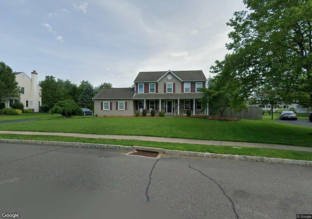
4208 Marie Cir Doylestown, PA 18902
Plumstead NeighborhoodEstimated Value: $713,088 - $770,000
4
Beds
3
Baths
2,228
Sq Ft
$332/Sq Ft
Est. Value
About This Home
This home is located at 4208 Marie Cir, Doylestown, PA 18902 and is currently estimated at $739,522, approximately $331 per square foot. 4208 Marie Cir is a home located in Bucks County with nearby schools including Groveland Elementary School, Tohickon Middle School, and Central Bucks High School-West.
Ownership History
Date
Name
Owned For
Owner Type
Purchase Details
Closed on
May 14, 2010
Sold by
Lang V Charles H and Lang Lori A
Bought by
Quinn Steven R and Quinn Brenda
Current Estimated Value
Home Financials for this Owner
Home Financials are based on the most recent Mortgage that was taken out on this home.
Original Mortgage
$344,000
Outstanding Balance
$213,855
Interest Rate
3.62%
Mortgage Type
New Conventional
Estimated Equity
$525,667
Purchase Details
Closed on
Jan 31, 1996
Sold by
Landis Greene Lp
Bought by
Lang V Charles H and Lang Lori A
Home Financials for this Owner
Home Financials are based on the most recent Mortgage that was taken out on this home.
Original Mortgage
$135,000
Interest Rate
7.57%
Create a Home Valuation Report for This Property
The Home Valuation Report is an in-depth analysis detailing your home's value as well as a comparison with similar homes in the area
Home Values in the Area
Average Home Value in this Area
Purchase History
| Date | Buyer | Sale Price | Title Company |
|---|---|---|---|
| Quinn Steven R | $430,000 | None Available | |
| Lang V Charles H | $196,796 | -- |
Source: Public Records
Mortgage History
| Date | Status | Borrower | Loan Amount |
|---|---|---|---|
| Open | Quinn Steven R | $344,000 | |
| Previous Owner | Lang V Charles H | $135,000 |
Source: Public Records
Tax History Compared to Growth
Tax History
| Year | Tax Paid | Tax Assessment Tax Assessment Total Assessment is a certain percentage of the fair market value that is determined by local assessors to be the total taxable value of land and additions on the property. | Land | Improvement |
|---|---|---|---|---|
| 2025 | $6,846 | $39,400 | $6,160 | $33,240 |
| 2024 | $6,846 | $39,400 | $6,160 | $33,240 |
| 2023 | $6,554 | $39,400 | $6,160 | $33,240 |
| 2022 | $6,554 | $39,400 | $6,160 | $33,240 |
| 2021 | $6,481 | $39,400 | $6,160 | $33,240 |
| 2020 | $6,481 | $39,400 | $6,160 | $33,240 |
| 2019 | $6,442 | $39,400 | $6,160 | $33,240 |
| 2018 | $6,442 | $39,400 | $6,160 | $33,240 |
| 2017 | $6,353 | $39,400 | $6,160 | $33,240 |
| 2016 | $6,353 | $39,400 | $6,160 | $33,240 |
| 2015 | -- | $39,400 | $6,160 | $33,240 |
| 2014 | -- | $39,400 | $6,160 | $33,240 |
Source: Public Records
Map
Nearby Homes
- 4000 Miriam Dr
- 3789 Stump Rd
- 1222 Hockley Dr
- 1214 Hockley Dr
- 204 Pennland Farm Dr
- 4811 Lincoln Aly
- 81 Williams Dr
- 319 Pennington Way
- Lot 10 Schadle Rd
- 316 Schadle Rd
- Lot 6 Henry Ct
- 5068 Kratz Carriage Rd
- 137 S Main St
- 4936 Curly Hill Rd
- 17 Ruhl Dr
- 116 Bishop Way
- 238 Allem Ln Unit 238
- 135 Bishop Way
- 4464 Kleinot Dr
- 4246 Kleinot Dr
- 4216 Marie Cir
- 4191 Gregory Dr
- 4200 Marie Cir
- 4199 Gregory Dr
- 4183 Gregory Dr
- 4201 Marie Cir
- 4224 Marie Cir
- 4209 Marie Cir
- 4207 Gregory Dr
- 4175 Gregory Dr
- 4217 Marie Cir
- 4190 Gregory Dr
- 4182 Gregory Dr
- 5722 Landis Greene Dr
- 4215 Gregory Dr
- 4232 Marie Cir
- 4176 Gregory Dr
- 5709 Landis Greene Dr
- 4225 Marie Cir
- 5732 Landis Greene Dr