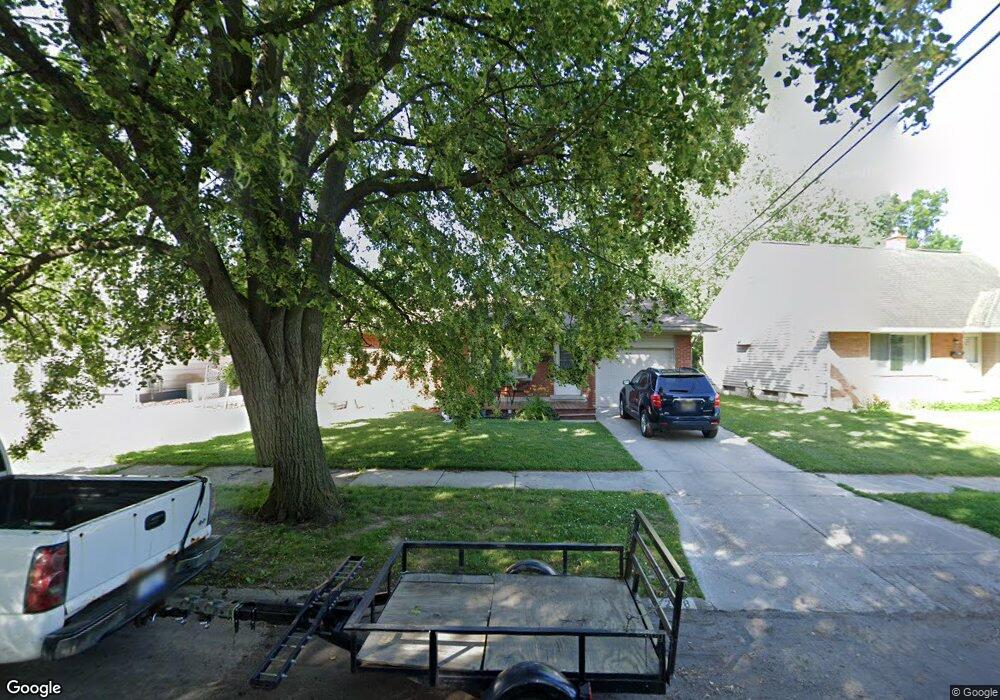
4208 Shawnee Ave Flint, MI 48507
Circle Drive NeighborhoodEstimated Value: $79,000 - $113,000
3
Beds
2
Baths
929
Sq Ft
$100/Sq Ft
Est. Value
About This Home
This home is located at 4208 Shawnee Ave, Flint, MI 48507 and is currently estimated at $92,797, approximately $99 per square foot. 4208 Shawnee Ave is a home located in Genesee County with nearby schools including Freeman Elementary School, Flint Southwestern Classical Academy, and Burton Glen Charter Academy.
Ownership History
Date
Name
Owned For
Owner Type
Purchase Details
Closed on
Nov 5, 2008
Sold by
Johnson Michael and Johnson Sharon
Bought by
The Bank Of New York Mellon
Current Estimated Value
Purchase Details
Closed on
Jun 26, 2006
Sold by
White Maryellen and White Sylvester
Bought by
Johnson Michael and Johnson Sharon
Home Financials for this Owner
Home Financials are based on the most recent Mortgage that was taken out on this home.
Original Mortgage
$70,000
Interest Rate
11.99%
Mortgage Type
Purchase Money Mortgage
Create a Home Valuation Report for This Property
The Home Valuation Report is an in-depth analysis detailing your home's value as well as a comparison with similar homes in the area
Home Values in the Area
Average Home Value in this Area
Purchase History
| Date | Buyer | Sale Price | Title Company |
|---|---|---|---|
| The Bank Of New York Mellon | $65,080 | None Available | |
| Johnson Michael | $70,000 | Nations Title Agency |
Source: Public Records
Mortgage History
| Date | Status | Borrower | Loan Amount |
|---|---|---|---|
| Previous Owner | Johnson Michael | $70,000 |
Source: Public Records
Tax History Compared to Growth
Tax History
| Year | Tax Paid | Tax Assessment Tax Assessment Total Assessment is a certain percentage of the fair market value that is determined by local assessors to be the total taxable value of land and additions on the property. | Land | Improvement |
|---|---|---|---|---|
| 2025 | $1,196 | $40,900 | $0 | $0 |
| 2024 | $1,107 | $35,400 | $0 | $0 |
| 2023 | $1,081 | $29,500 | $0 | $0 |
| 2022 | $0 | $22,600 | $0 | $0 |
| 2021 | $1,096 | $21,200 | $0 | $0 |
| 2020 | $1,007 | $20,700 | $0 | $0 |
| 2019 | $984 | $14,800 | $0 | $0 |
| 2018 | $976 | $12,000 | $0 | $0 |
| 2017 | $951 | $0 | $0 | $0 |
| 2016 | $944 | $0 | $0 | $0 |
| 2015 | -- | $0 | $0 | $0 |
| 2014 | -- | $0 | $0 | $0 |
| 2012 | -- | $17,900 | $0 | $0 |
Source: Public Records
Map
Nearby Homes
- 4310 Cheyenne Ave
- 4424 Cheyenne Ave
- 810 Macdonald Ave
- 630 Buckingham Ave
- 621 Burroughs Ave
- 3614 Comanche Ave
- 3505 Comanche Ave
- 3343 Cheyenne Ave
- 454 E Atherton Rd
- 4127 Custer Ave
- 4205 Red Arrow Rd
- 3115 Circle Dr
- 326 Burroughs Ave
- 2910 Shawnee Ave
- 0000 E Bristol Rd
- 3512 Barcey Ct
- 4010 Milton Dr
- 2618 Pinetree Dr
- 3129 Christner St
- 3277 Sayre Ct
- 922 Mckinley Ave
- 1011 Lochhead Ave
- 1005 Lochhead Ave
- 918 Mckinley Ave
- 1001 Lochhead Ave
- 914 Mckinley Ave
- 4201 Shawnee Ave
- 913 Lochhead Ave
- 1101 Lochhead Ave
- 4207 Shawnee Ave
- 0 Mckinley Ave
- 4302 Shawnee Ave
- 910 Mckinley Ave
- 909 Lochhead Ave
- 1014 Lochhead Ave
- 1010 Lochhead Ave
- 4308 Shawnee Ave
- 1006 Lochhead Ave
- 906 Mckinley Ave
- 1107 Lochhead Ave