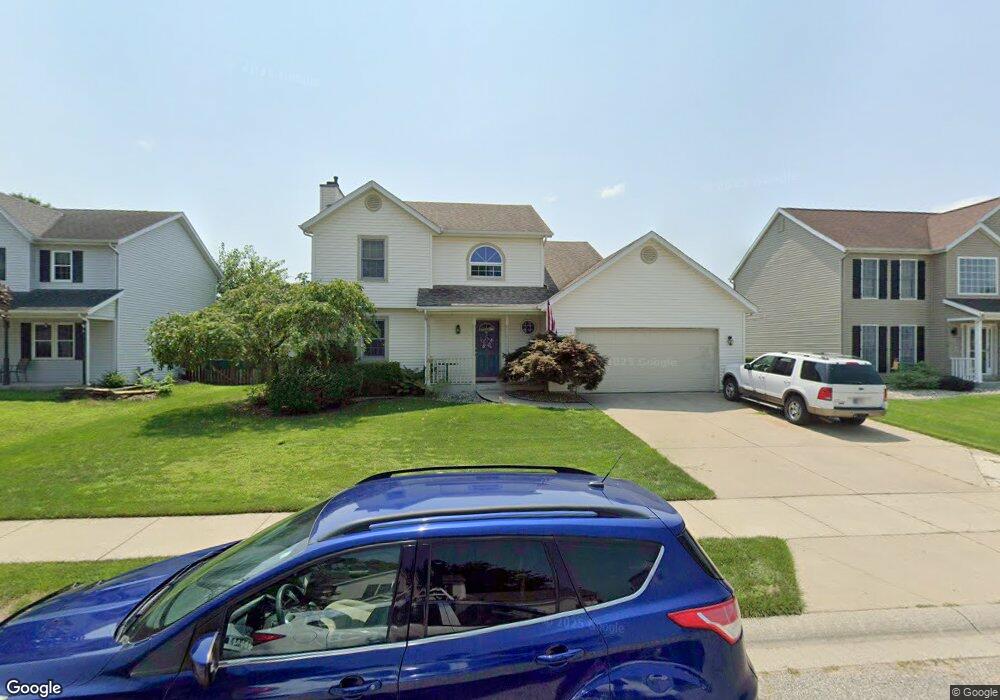
4209 Sail Dr Mishawaka, IN 46544
Estimated Value: $318,000 - $385,000
3
Beds
3
Baths
1,657
Sq Ft
$207/Sq Ft
Est. Value
About This Home
This home is located at 4209 Sail Dr, Mishawaka, IN 46544 and is currently estimated at $343,149, approximately $207 per square foot. 4209 Sail Dr is a home located in St. Joseph County with nearby schools including Fred J. Hums Elementary School, John J. Young Middle School, and Mishawaka High School.
Ownership History
Date
Name
Owned For
Owner Type
Purchase Details
Closed on
Apr 11, 2006
Sold by
Wood Jonathon M
Bought by
Wilkey Kevin E and Wilkey Valerie L
Current Estimated Value
Home Financials for this Owner
Home Financials are based on the most recent Mortgage that was taken out on this home.
Original Mortgage
$135,006
Outstanding Balance
$77,852
Interest Rate
6.42%
Mortgage Type
New Conventional
Estimated Equity
$265,297
Create a Home Valuation Report for This Property
The Home Valuation Report is an in-depth analysis detailing your home's value as well as a comparison with similar homes in the area
Home Values in the Area
Average Home Value in this Area
Purchase History
| Date | Buyer | Sale Price | Title Company |
|---|---|---|---|
| Wilkey Kevin E | -- | None Available |
Source: Public Records
Mortgage History
| Date | Status | Borrower | Loan Amount |
|---|---|---|---|
| Open | Wilkey Kevin E | $135,006 |
Source: Public Records
Tax History Compared to Growth
Tax History
| Year | Tax Paid | Tax Assessment Tax Assessment Total Assessment is a certain percentage of the fair market value that is determined by local assessors to be the total taxable value of land and additions on the property. | Land | Improvement |
|---|---|---|---|---|
| 2024 | $2,795 | $262,700 | $43,300 | $219,400 |
| 2023 | $2,819 | $238,300 | $43,300 | $195,000 |
| 2022 | $2,834 | $239,300 | $43,300 | $196,000 |
| 2021 | $2,409 | $203,600 | $25,800 | $177,800 |
| 2020 | $2,185 | $186,100 | $23,600 | $162,500 |
| 2019 | $2,049 | $174,400 | $22,100 | $152,300 |
| 2018 | $2,496 | $171,400 | $21,700 | $149,700 |
| 2017 | $2,247 | $147,900 | $18,500 | $129,400 |
| 2016 | $2,573 | $171,700 | $18,500 | $153,200 |
| 2014 | $2,211 | $169,700 | $18,500 | $151,200 |
Source: Public Records
Map
Nearby Homes
- 4020 Stonegate Dr
- 3964 Stonegate Dr
- VL Blackberry Rd
- 1602 Stoneham
- Lot 619A Stoneham Unit 619
- Lot 683A Stoneham Unit 683
- Lot 677A Rosemont Place Unit 677A
- Lot 607A Rosemont Place Unit 607A
- Lot 608A Rosemont Place Unit 608A
- 1725 Stoneham
- 3811 Dudley Dr
- 3421 Westborough Dr
- 1101 Wellsley Ct
- 11861 6th St
- 4207 Lincolnway E
- 1568 Blanchard Dr
- 135 Ray St
- 1556 Conant Ct
- 12340 Lincoln Way E
- 123 Oakside Ave