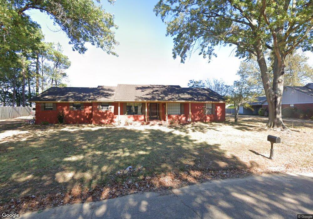
421 Calvert Rd Forrest City, AR 72335
Estimated Value: $123,072 - $191,000
--
Bed
2
Baths
2,039
Sq Ft
$80/Sq Ft
Est. Value
About This Home
This home is located at 421 Calvert Rd, Forrest City, AR 72335 and is currently estimated at $164,018, approximately $80 per square foot. 421 Calvert Rd is a home located in St. Francis County with nearby schools including Central Elementary School, Stewart Elementary School, and Forrest City Junior High School.
Ownership History
Date
Name
Owned For
Owner Type
Purchase Details
Closed on
Jan 6, 2017
Sold by
Routon Marie G
Bought by
Patel Harsh D and Patel Chirag D
Current Estimated Value
Home Financials for this Owner
Home Financials are based on the most recent Mortgage that was taken out on this home.
Original Mortgage
$118,750
Outstanding Balance
$97,608
Interest Rate
4.03%
Mortgage Type
New Conventional
Estimated Equity
$66,410
Purchase Details
Closed on
Jan 1, 1988
Bought by
Routon
Purchase Details
Closed on
Sep 1, 1986
Bought by
Bank
Create a Home Valuation Report for This Property
The Home Valuation Report is an in-depth analysis detailing your home's value as well as a comparison with similar homes in the area
Home Values in the Area
Average Home Value in this Area
Purchase History
| Date | Buyer | Sale Price | Title Company |
|---|---|---|---|
| Patel Harsh D | $125,000 | None Available | |
| Routon | $81,000 | -- | |
| Planters Bank | -- | -- | |
| Bank | -- | -- |
Source: Public Records
Mortgage History
| Date | Status | Borrower | Loan Amount |
|---|---|---|---|
| Open | Patel Harsh D | $118,750 |
Source: Public Records
Tax History Compared to Growth
Tax History
| Year | Tax Paid | Tax Assessment Tax Assessment Total Assessment is a certain percentage of the fair market value that is determined by local assessors to be the total taxable value of land and additions on the property. | Land | Improvement |
|---|---|---|---|---|
| 2024 | $1,101 | $23,790 | $3,000 | $20,790 |
| 2023 | $1,104 | $23,790 | $3,000 | $20,790 |
| 2022 | $705 | $23,790 | $3,000 | $20,790 |
| 2021 | $678 | $22,690 | $3,000 | $19,690 |
| 2020 | $678 | $22,690 | $3,000 | $19,690 |
| 2019 | $701 | $22,690 | $3,000 | $19,690 |
| 2018 | $726 | $22,690 | $3,000 | $19,690 |
| 2017 | $1,051 | $22,690 | $3,000 | $19,690 |
| 2016 | $1,149 | $24,810 | $3,000 | $21,810 |
| 2015 | $1,149 | $24,810 | $3,000 | $21,810 |
| 2014 | $1,149 | $24,810 | $3,000 | $21,810 |
Source: Public Records
Map
Nearby Homes
- 361 Yorktown Dr
- 220 Lexington Dr
- 308 Trenton Rd
- 1255 Chestnut St
- 917 Calvert Cove
- 423 Laughrun Dr
- 319 Mississippi St
- 1216 N Izard St
- 424 Beech Grove Dr
- 1108 N Izard St
- 717 Laughrun Dr
- 1047 N Rosser St
- 1047 N Rosser St Unit 122 E Arkansas Avenu
- 1030 N Izard St
- 1110 N Division St
- 1031 Cherry St
- 1006 Hickey St
- 947 Cherry St
- 654 N Forrest St
- 617 N Forrest St
- 425 Calvert Rd
- 422 Calvert Rd
- 429 Calvert Rd
- 428 Calvert Rd
- 0 Calvert Rd
- 412 Calvert Rd
- 435 Calvert Rd
- 411 Calvert Rd
- 432 Calvert Rd
- 307 Concord Dr
- 315 Concord Dr
- 468 Calvert Rd
- 319 Concord Dr
- 497 Calvert Rd
- 329 Calvert Rd
- 323 Concord Dr
- 494 Calvert Rd
- 2212 N Washington St
- 316 Concord Dr
- 315 Calvert Rd