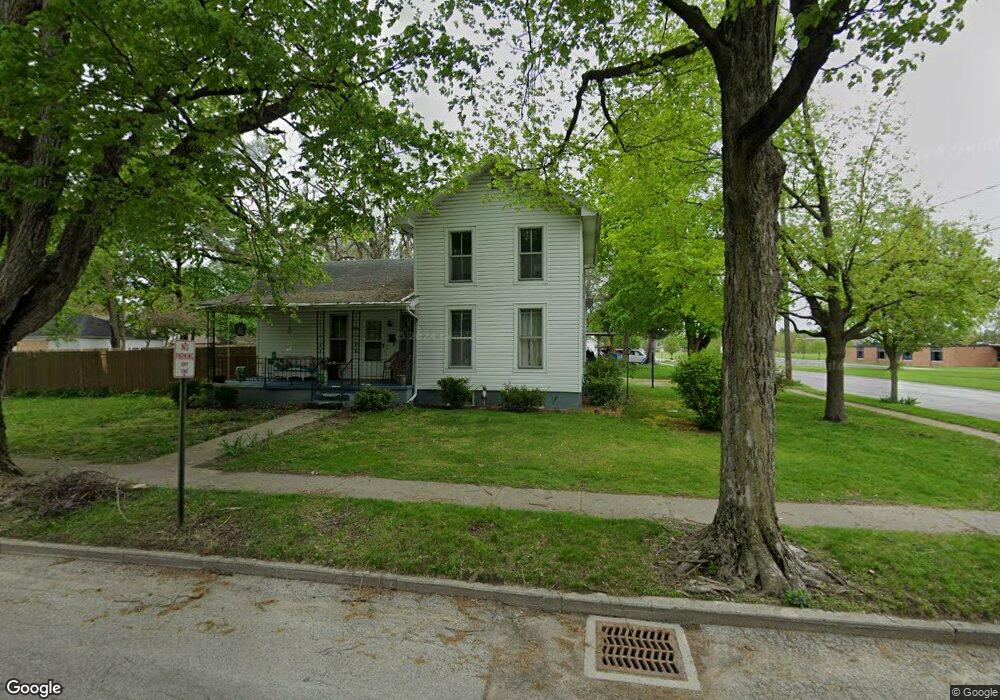
421 E Locust St Morenci, MI 49256
Estimated Value: $122,000 - $127,971
2
Beds
1
Bath
1,498
Sq Ft
$83/Sq Ft
Est. Value
About This Home
This home is located at 421 E Locust St, Morenci, MI 49256 and is currently estimated at $124,243, approximately $82 per square foot. 421 E Locust St is a home located in Lenawee County with nearby schools including Morenci Elementary School and Morenci Middle/High School.
Ownership History
Date
Name
Owned For
Owner Type
Purchase Details
Closed on
Sep 11, 2010
Sold by
Baumgartner David P and Baugartner Penney J
Bought by
Harley Holly
Current Estimated Value
Home Financials for this Owner
Home Financials are based on the most recent Mortgage that was taken out on this home.
Original Mortgage
$30,588
Outstanding Balance
$21,256
Interest Rate
5.5%
Mortgage Type
FHA
Estimated Equity
$102,987
Purchase Details
Closed on
Apr 2, 2010
Sold by
Brubaker Scott and Brubaker Lea
Bought by
Baumgartner David P and Baumgartner Penney J
Purchase Details
Closed on
Sep 25, 2007
Sold by
Mccaskey Charles
Bought by
Baumgartner David P and Baumgartner Penny J
Home Financials for this Owner
Home Financials are based on the most recent Mortgage that was taken out on this home.
Original Mortgage
$59,500
Interest Rate
6.49%
Mortgage Type
New Conventional
Create a Home Valuation Report for This Property
The Home Valuation Report is an in-depth analysis detailing your home's value as well as a comparison with similar homes in the area
Home Values in the Area
Average Home Value in this Area
Purchase History
| Date | Buyer | Sale Price | Title Company |
|---|---|---|---|
| Harley Holly | $31,000 | Prestige Title Insurance Age | |
| Baumgartner David P | -- | Presting Title Insruance Age | |
| Baumgartner David P | $70,000 | None Available |
Source: Public Records
Mortgage History
| Date | Status | Borrower | Loan Amount |
|---|---|---|---|
| Open | Harley Holly | $30,588 | |
| Previous Owner | Baumgartner David P | $59,500 |
Source: Public Records
Tax History
| Year | Tax Paid | Tax Assessment Tax Assessment Total Assessment is a certain percentage of the fair market value that is determined by local assessors to be the total taxable value of land and additions on the property. | Land | Improvement |
|---|---|---|---|---|
| 2025 | $4,339 | $51,600 | $0 | $0 |
| 2024 | $27 | $46,800 | $0 | $0 |
| 2022 | $3,679 | $38,900 | $0 | $0 |
| 2020 | $1,833 | $34,600 | $0 | $0 |
| 2019 | $85,154 | $33,100 | $0 | $0 |
| 2018 | $85,154 | $29,694 | $0 | $0 |
| 2017 | $844 | $29,540 | $0 | $0 |
| 2016 | $0 | $29,259 | $0 | $0 |
| 2014 | -- | $27,774 | $0 | $0 |
Source: Public Records
Map
Nearby Homes
- 511 E Main St
- 115 N East St
- 234 E Union St
- 202 E Locust St
- 120 S Washington St
- 328 E Main St
- 440 Whitney Ave
- 507 Page St
- 314 Whitney Ave
- 518 N East St
- 402 Pearl St
- 136 E Chestnut St
- 00 Coomer St Unit 9728 Coomer St
- 210 W Locust St
- 124 W Walnut Rd
- 136 Orchard St
- 504 North St
- Block Skyline Dr
- 945 N Summit St
- 139 Gorham St
Your Personal Tour Guide
Ask me questions while you tour the home.