Estimated Value: $275,000 - $436,000
2
Beds
1
Bath
844
Sq Ft
$391/Sq Ft
Est. Value
About This Home
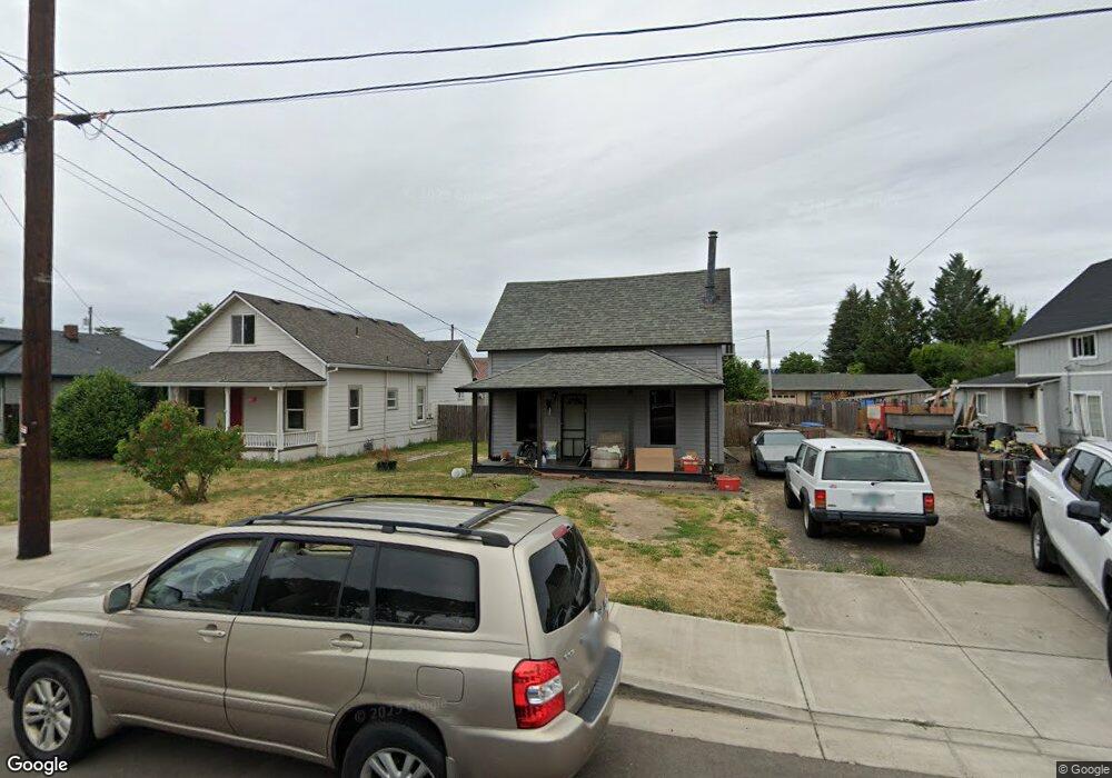
This home is located at 421 Park St, Banks, OR 97106 and is currently estimated at $330,225, approximately $391 per square foot. 421 Park St is a home located in Washington County with nearby schools including Banks Elementary School, Banks Middle School, and Banks High School.
Ownership History
Date
Name
Owned For
Owner Type
Purchase Details
Closed on
Aug 24, 2007
Sold by
Phillips Eric George
Bought by
Phillips Scott Patrick
Current Estimated Value
Purchase Details
Closed on
Oct 6, 2005
Sold by
Phillips Elizabeth A and Phillips Eric G
Bought by
Phillips Eric G
Home Financials for this Owner
Home Financials are based on the most recent Mortgage that was taken out on this home.
Original Mortgage
$116,500
Interest Rate
7.5%
Mortgage Type
New Conventional
Purchase Details
Closed on
Dec 6, 2004
Sold by
Goeden Gean A
Bought by
Phillips Eric G and Phillips Elizabeth A
Home Financials for this Owner
Home Financials are based on the most recent Mortgage that was taken out on this home.
Original Mortgage
$84,000
Interest Rate
7.5%
Mortgage Type
Unknown
Create a Home Valuation Report for This Property
The Home Valuation Report is an in-depth analysis detailing your home's value as well as a comparison with similar homes in the area
Home Values in the Area
Average Home Value in this Area
Purchase History
| Date | Buyer | Sale Price | Title Company |
|---|---|---|---|
| Phillips Scott Patrick | -- | None Available | |
| Phillips Eric G | -- | Lawyers Title Ins | |
| Phillips Eric G | $105,000 | Transnation Title Agency Or |
Source: Public Records
Mortgage History
| Date | Status | Borrower | Loan Amount |
|---|---|---|---|
| Previous Owner | Phillips Eric G | $116,500 | |
| Previous Owner | Phillips Eric G | $84,000 | |
| Closed | Phillips Eric G | $21,000 |
Source: Public Records
Tax History Compared to Growth
Tax History
| Year | Tax Paid | Tax Assessment Tax Assessment Total Assessment is a certain percentage of the fair market value that is determined by local assessors to be the total taxable value of land and additions on the property. | Land | Improvement |
|---|---|---|---|---|
| 2025 | $1,828 | $99,510 | -- | -- |
| 2024 | $1,662 | $96,620 | -- | -- |
| 2023 | $1,662 | $93,810 | $0 | $0 |
| 2022 | $1,618 | $93,810 | $0 | $0 |
| 2021 | $1,561 | $88,430 | $0 | $0 |
| 2020 | $1,515 | $85,860 | $0 | $0 |
| 2019 | $1,454 | $83,360 | $0 | $0 |
| 2018 | $1,415 | $80,940 | $0 | $0 |
| 2017 | $1,355 | $78,590 | $0 | $0 |
| 2016 | $1,334 | $76,310 | $0 | $0 |
| 2015 | $1,282 | $74,090 | $0 | $0 |
| 2014 | $1,264 | $71,940 | $0 | $0 |
Source: Public Records
Map
Nearby Homes
- 12874 NW Maplecrest Way
- 42371 NW Banks Rd
- 12838 NW Maplecrest Way
- 0 NW Sellers Rd
- 12734 NW Hammond Place
- 42015 NW Buckshire St
- 42098 NW Broadshire Ln
- 43300 NW Cedar Canyon Rd
- 41710 NW Oak Way
- 41753 NW Buckshire St
- 41637 NW Buckshire St
- 0 NW Lodge Rd
- 48025 NW Strohmayer Rd
- 0 NW Green Mountain Rd Unit 1 23320324
- 0 NW Green Mountain Rd Unit 24253646
- 46345 NW Strohmayer Rd
- 18282 NW Hilltop Place
- 11911 NW Seavey Rd
- 45868 NW Hillside Rd
- 21076 NW Green Mountain Rd