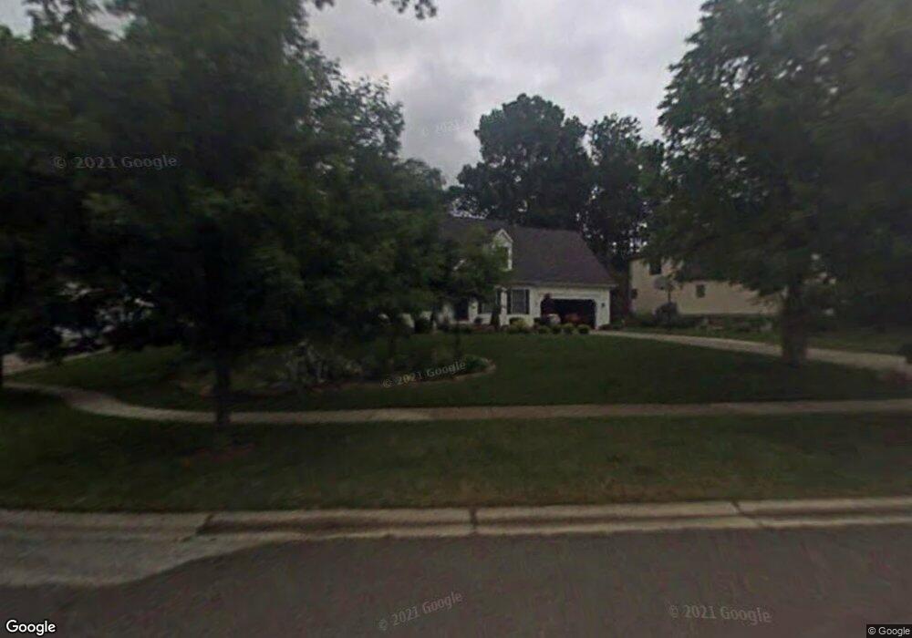
421 Peter Path Tallmadge, OH 44278
Estimated Value: $330,000 - $381,000
3
Beds
3
Baths
1,971
Sq Ft
$180/Sq Ft
Est. Value
About This Home
This home is located at 421 Peter Path, Tallmadge, OH 44278 and is currently estimated at $353,814, approximately $179 per square foot. 421 Peter Path is a home located in Summit County with nearby schools including Tallmadge Middle School, Tallmadge High School, and Cornerstone Community School.
Ownership History
Date
Name
Owned For
Owner Type
Purchase Details
Closed on
May 9, 2005
Sold by
Blaser Dennis F and Blaser Nancy J
Bought by
Blaser Dennis F and Blaser Nancy J
Current Estimated Value
Purchase Details
Closed on
Apr 13, 1998
Sold by
Maclean James C
Bought by
Blaser Dennis F and Blaser Nancy J
Home Financials for this Owner
Home Financials are based on the most recent Mortgage that was taken out on this home.
Original Mortgage
$135,000
Outstanding Balance
$25,829
Interest Rate
7.19%
Mortgage Type
New Conventional
Estimated Equity
$327,985
Create a Home Valuation Report for This Property
The Home Valuation Report is an in-depth analysis detailing your home's value as well as a comparison with similar homes in the area
Home Values in the Area
Average Home Value in this Area
Purchase History
| Date | Buyer | Sale Price | Title Company |
|---|---|---|---|
| Blaser Dennis F | -- | -- | |
| Blaser Dennis F | $170,000 | -- |
Source: Public Records
Mortgage History
| Date | Status | Borrower | Loan Amount |
|---|---|---|---|
| Open | Blaser Dennis F | $135,000 |
Source: Public Records
Tax History
| Year | Tax Paid | Tax Assessment Tax Assessment Total Assessment is a certain percentage of the fair market value that is determined by local assessors to be the total taxable value of land and additions on the property. | Land | Improvement |
|---|---|---|---|---|
| 2024 | $5,011 | $108,402 | $23,513 | $84,889 |
| 2023 | $5,011 | $108,402 | $23,513 | $84,889 |
| 2022 | $4,397 | $79,811 | $17,290 | $62,521 |
| 2021 | $4,416 | $79,811 | $17,290 | $62,521 |
| 2020 | $4,382 | $79,810 | $17,290 | $62,520 |
| 2019 | $4,489 | $73,850 | $19,140 | $54,710 |
| 2018 | $3,961 | $73,850 | $19,140 | $54,710 |
| 2017 | $3,708 | $73,850 | $19,140 | $54,710 |
| 2016 | $3,996 | $69,100 | $19,140 | $49,960 |
| 2015 | $3,708 | $69,100 | $19,140 | $49,960 |
| 2014 | $3,684 | $69,100 | $19,140 | $49,960 |
| 2013 | $3,538 | $67,720 | $19,140 | $48,580 |
Source: Public Records
Map
Nearby Homes
- 496 Helena Dr
- 122 S Munroe Rd
- 691 Southeast Ave
- 895 East Ave
- 0 East Ave
- 0 Newton Unit 5174619
- 1157 Newton St
- 483 Eastwood Ave
- V/L Tallmadge Rd
- 185 Reserve Dr
- 1014 Newton St
- 112 Tallmadge Rd
- 124 Tallmadge Rd
- 128 Byatt Rd
- 449 Southeast Ave
- 146 Reserve Dr
- 294 Milton Dr
- 353 Southeast Ave
- 59 Tudor Ln
- 32 Picadilly Ct