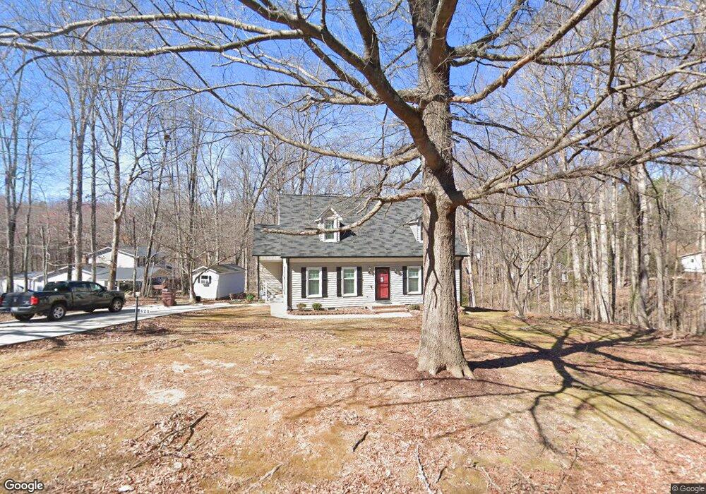
421 Reade Dr Roxboro, NC 27573
Estimated Value: $260,550 - $307,000
3
Beds
2
Baths
1,636
Sq Ft
$175/Sq Ft
Est. Value
About This Home
This home is located at 421 Reade Dr, Roxboro, NC 27573 and is currently estimated at $285,638, approximately $174 per square foot. 421 Reade Dr is a home located in Person County with nearby schools including Person High School, Roxboro Community School, and Roxboro Christian Academy.
Ownership History
Date
Name
Owned For
Owner Type
Purchase Details
Closed on
Nov 3, 2017
Sold by
Bryson Robert Lloyd and Bryson Lisa W
Bought by
Jacobs Dwayne
Current Estimated Value
Home Financials for this Owner
Home Financials are based on the most recent Mortgage that was taken out on this home.
Original Mortgage
$148,500
Outstanding Balance
$126,605
Interest Rate
4.62%
Mortgage Type
Adjustable Rate Mortgage/ARM
Estimated Equity
$159,033
Purchase Details
Closed on
Jun 17, 2010
Sold by
Powley James Cary and Powley Melanie Hembree
Bought by
Bryson Robert Lloyd
Home Financials for this Owner
Home Financials are based on the most recent Mortgage that was taken out on this home.
Original Mortgage
$142,086
Interest Rate
4.97%
Mortgage Type
FHA
Create a Home Valuation Report for This Property
The Home Valuation Report is an in-depth analysis detailing your home's value as well as a comparison with similar homes in the area
Purchase History
| Date | Buyer | Sale Price | Title Company |
|---|---|---|---|
| Jacobs Dwayne | $149,500 | None Available | |
| Bryson Robert Lloyd | $144,000 | -- |
Source: Public Records
Mortgage History
| Date | Status | Borrower | Loan Amount |
|---|---|---|---|
| Open | Jacobs Dwayne | $148,500 | |
| Previous Owner | Bryson Robert Lloyd | $142,086 |
Source: Public Records
Tax History Compared to Growth
Tax History
| Year | Tax Paid | Tax Assessment Tax Assessment Total Assessment is a certain percentage of the fair market value that is determined by local assessors to be the total taxable value of land and additions on the property. | Land | Improvement |
|---|---|---|---|---|
| 2025 | $1,675 | $249,129 | $0 | $0 |
| 2024 | $1,356 | $174,771 | $0 | $0 |
| 2023 | $1,356 | $174,771 | $0 | $0 |
| 2022 | $1,352 | $174,771 | $0 | $0 |
| 2021 | $1,312 | $174,771 | $0 | $0 |
| 2020 | $1,066 | $141,846 | $0 | $0 |
| 2019 | $1,080 | $141,846 | $0 | $0 |
| 2018 | $1,013 | $141,846 | $0 | $0 |
| 2017 | $999 | $141,846 | $0 | $0 |
| 2016 | $999 | $141,846 | $0 | $0 |
| 2015 | $999 | $141,846 | $0 | $0 |
| 2014 | $999 | $141,846 | $0 | $0 |
Source: Public Records
Map
Nearby Homes
- 240 Crestwood Dr
- 2 Semora Rd
- 421 W Gordon St
- 167.10 Leasburg Rd
- 515 Reams Ave
- 305 Lochridge Dr
- 310 Wesleyan Heights Rd
- 417 Green St
- 229 Wesleyan Heights Rd
- 508 Jones St
- 608 Hillhaven Terrace
- 135 Hill St
- 60 Banbury Ct
- 513 Broad St
- 50 Southern Village Dr
- Lot 3 Hurdle Mills Rd
- 0 Garrett St Unit 10077581
- 150 Summit St
- 500 Jones Lester Rd
- 3 Allensville Rd