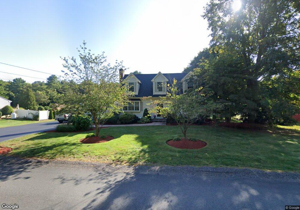
421 Taunton St Wrentham, MA 02093
Estimated Value: $726,000 - $955,000
3
Beds
3
Baths
2,572
Sq Ft
$323/Sq Ft
Est. Value
About This Home
This home is located at 421 Taunton St, Wrentham, MA 02093 and is currently estimated at $829,746, approximately $322 per square foot. 421 Taunton St is a home located in Norfolk County with nearby schools including Delaney Elementary School, Charles E Roderick, and Cadence Academy Preschool - North Attleborough.
Ownership History
Date
Name
Owned For
Owner Type
Purchase Details
Closed on
Jul 31, 1998
Sold by
Nelson Kathy L and Nelson Harold J
Bought by
Cooke William A and Cooke Leslie E
Current Estimated Value
Home Financials for this Owner
Home Financials are based on the most recent Mortgage that was taken out on this home.
Original Mortgage
$112,000
Interest Rate
6.92%
Mortgage Type
Purchase Money Mortgage
Purchase Details
Closed on
Jan 20, 1994
Sold by
Ricci Extr Alfred A
Bought by
Nelson Kathy L and Nelson Harold J
Home Financials for this Owner
Home Financials are based on the most recent Mortgage that was taken out on this home.
Original Mortgage
$123,600
Interest Rate
7.08%
Mortgage Type
Purchase Money Mortgage
Create a Home Valuation Report for This Property
The Home Valuation Report is an in-depth analysis detailing your home's value as well as a comparison with similar homes in the area
Home Values in the Area
Average Home Value in this Area
Purchase History
| Date | Buyer | Sale Price | Title Company |
|---|---|---|---|
| Cooke William A | $160,000 | -- | |
| Nelson Kathy L | $123,300 | -- |
Source: Public Records
Mortgage History
| Date | Status | Borrower | Loan Amount |
|---|---|---|---|
| Open | Nelson Kathy L | $225,000 | |
| Closed | Nelson Kathy L | $112,000 | |
| Previous Owner | Nelson Kathy L | $123,600 |
Source: Public Records
Tax History Compared to Growth
Tax History
| Year | Tax Paid | Tax Assessment Tax Assessment Total Assessment is a certain percentage of the fair market value that is determined by local assessors to be the total taxable value of land and additions on the property. | Land | Improvement |
|---|---|---|---|---|
| 2025 | $8,806 | $759,800 | $273,800 | $486,000 |
| 2024 | $8,486 | $707,200 | $273,800 | $433,400 |
| 2023 | $8,741 | $692,600 | $248,900 | $443,700 |
| 2022 | $8,086 | $591,500 | $224,000 | $367,500 |
| 2021 | $7,730 | $549,400 | $200,200 | $349,200 |
| 2020 | $7,984 | $560,300 | $182,700 | $377,600 |
| 2019 | $7,407 | $524,600 | $166,100 | $358,500 |
| 2018 | $7,167 | $503,300 | $166,300 | $337,000 |
| 2017 | $7,024 | $492,900 | $163,100 | $329,800 |
| 2016 | $6,882 | $481,900 | $158,400 | $323,500 |
| 2015 | $6,901 | $460,700 | $152,200 | $308,500 |
| 2014 | $6,792 | $443,600 | $146,400 | $297,200 |
Source: Public Records
Map
Nearby Homes
- 319 Taunton St
- 311 South St
- 12 Earle Stewart Ln
- Lot 3 - 14 Earle Stewart Ln
- 10 Tilting Rock Rd
- 791 South St Unit 5
- 15 Nature View Dr
- 10 Nature View Dr
- 131 Creek St Unit 9
- 110 Hawes St
- 100 Pokanoket Path
- 570 Eastside Rd
- 20 Pokanoket Path
- 20 Rowell Rd
- 483 Thurston St
- 1 Lorraine Metcalf Dr
- 60 Oxbow Dr
- 270 Dedham St
- 570 Franklin St
- 1204 South St
- 411 Taunton St
- 431 Taunton St
- 401 Taunton St
- 450 Taunton St
- 443 Taunton St
- 437 Taunton St
- 391 Taunton St
- 381 Taunton St
- 452 Taunton St
- 444 Taunton St
- 373 Taunton St
- 456 Taunton St
- 455 Taunton St
- 365 Taunton St
- 235 Taunton St
- 465 Taunton St
- 355 Taunton St
- 355 Taunton St Unit 1
- 334 Taunton St
- 334 Taunton St Unit 2