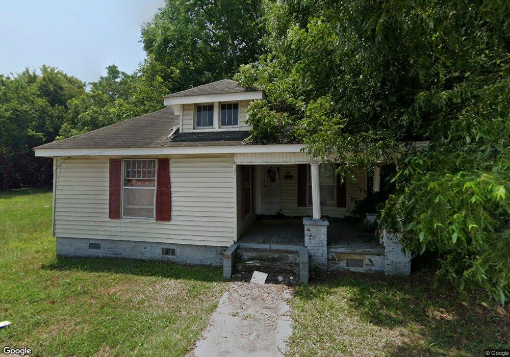
421 W Cemetary St Salisbury, NC 28144
Estimated Value: $114,000 - $147,000
2
Beds
2
Baths
1,224
Sq Ft
$101/Sq Ft
Est. Value
About This Home
This home is located at 421 W Cemetary St, Salisbury, NC 28144 and is currently estimated at $123,501, approximately $100 per square foot. 421 W Cemetary St is a home located in Rowan County with nearby schools including Carroll T Overton Elementary School, Knox Middle School, and North Rowan Middle School.
Ownership History
Date
Name
Owned For
Owner Type
Purchase Details
Closed on
Aug 12, 2025
Sold by
421 W Cemetery St Land Trust and Mabrey Shirley
Bought by
Lindsay Travis
Current Estimated Value
Purchase Details
Closed on
Mar 29, 2024
Sold by
Simpson Tyrone
Bought by
421 W Cemetery St Land Trust and Mabrey
Purchase Details
Closed on
Aug 30, 2013
Sold by
4Jamj Company Llc
Bought by
Vantage South Bank
Create a Home Valuation Report for This Property
The Home Valuation Report is an in-depth analysis detailing your home's value as well as a comparison with similar homes in the area
Home Values in the Area
Average Home Value in this Area
Purchase History
| Date | Buyer | Sale Price | Title Company |
|---|---|---|---|
| Lindsay Travis | $100,000 | None Listed On Document | |
| 421 W Cemetery St Land Trust | $1,000 | None Listed On Document | |
| 421 W Cemetery St Land Trust | $1,000 | None Listed On Document | |
| 421 W Cemetery St Land Trust | $1,000 | None Listed On Document | |
| 421 W Cemetery St Land Trust | $1,000 | None Listed On Document | |
| 421 W Cemetery St Land Trust | $1,000 | None Listed On Document | |
| 421 W Cemetery St Land Trust | $1,000 | None Listed On Document | |
| 421 W Cemetery St Land Trust | $1,000 | None Listed On Document | |
| 421 W Cemetery St Land Trust | $1,000 | None Listed On Document | |
| 421 W Cemetery St Land Trust | $1,000 | None Listed On Document | |
| 421 W Cemetery St Land Trust | $1,000 | None Listed On Document | |
| Mabrey Shirley | $1,000 | None Listed On Document | |
| Vantage South Bank | $23,000 | None Available |
Source: Public Records
Tax History Compared to Growth
Tax History
| Year | Tax Paid | Tax Assessment Tax Assessment Total Assessment is a certain percentage of the fair market value that is determined by local assessors to be the total taxable value of land and additions on the property. | Land | Improvement |
|---|---|---|---|---|
| 2025 | $1,082 | $90,435 | $14,700 | $75,735 |
| 2024 | $1,082 | $90,435 | $14,700 | $75,735 |
| 2023 | $1,082 | $90,435 | $14,700 | $75,735 |
| 2022 | $845 | $61,361 | $11,025 | $50,336 |
| 2021 | $845 | $61,361 | $11,025 | $50,336 |
| 2020 | $845 | $61,361 | $11,025 | $50,336 |
| 2019 | $845 | $61,361 | $11,025 | $50,336 |
| 2018 | $739 | $54,414 | $11,025 | $43,389 |
| 2017 | $735 | $54,414 | $11,025 | $43,389 |
| 2016 | $715 | $54,414 | $11,025 | $43,389 |
| 2015 | $720 | $54,414 | $11,025 | $43,389 |
| 2014 | $737 | $56,356 | $11,025 | $45,331 |
Source: Public Records
Map
Nearby Homes
- 423 N Caldwell St Unit 2
- 518 N Fulton St
- 300 N Fulton St Unit 24
- 300 N Fulton St Unit 11
- 301 N Fulton St
- 621 N Craige St
- 515 W Council St
- 716 N Fulton St
- 726 N Caldwell St
- 1205 Kildare Dr Unit 5
- 1215 Kildare Dr Unit 6
- 1040 Beckham Rd
- 1210 Kildare Dr Unit 80
- 1160 Kildare Dr Unit 76
- 1175 Kildare Dr Unit 3
- 208 W Lafayette St
- 720 Holmes St
- 730 W Innes St
- 123 N Main St
- 806 N Craige St
- 421 W Cemetary St
- 429 N Ellis St
- 429 N Ellis St Unit 1
- 417 W Cemetary St
- 418 W Cemetary St
- 0 Mocksville Ave
- 0 Mocksville Ave Unit NULL R46221
- 418 W Cemetary St
- 414 W Cemetary St
- 428 N Ellis St
- 410 W Cemetary St
- 502 W Cemetary St
- 418 W Kerr St
- 430 N Fulton St
- 416 W Kerr St
- 00 N Fulton St
- 420 N Ellis St
- 510 N Fulton St
- 508 W Cemetary St
- 408 W Kerr St