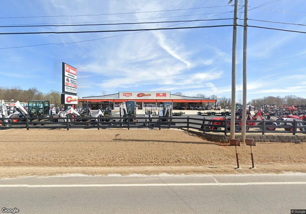
4210 Chisholm Rd Florence, AL 35630
Underwood-Petersville NeighborhoodEstimated Value: $554,000 - $6,645,889
Studio
--
Bath
1,008
Sq Ft
$3,571/Sq Ft
Est. Value
About This Home
This home is located at 4210 Chisholm Rd, Florence, AL 35630 and is currently estimated at $3,599,945, approximately $3,571 per square foot. 4210 Chisholm Rd is a home located in Lauderdale County with nearby schools including Underwood Elementary School, Brooks Elementary School, and St. Joseph Regional Catholic School.
Ownership History
Date
Name
Owned For
Owner Type
Purchase Details
Closed on
Mar 12, 2021
Sold by
Oakley Land Co Llc
Bought by
Oaks On Chisholm Llc
Current Estimated Value
Home Financials for this Owner
Home Financials are based on the most recent Mortgage that was taken out on this home.
Original Mortgage
$4,080,000
Outstanding Balance
$3,642,693
Interest Rate
2.73%
Mortgage Type
Commercial
Estimated Equity
-$42,748
Create a Home Valuation Report for This Property
The Home Valuation Report is an in-depth analysis detailing your home's value as well as a comparison with similar homes in the area
Home Values in the Area
Average Home Value in this Area
Purchase History
| Date | Buyer | Sale Price | Title Company |
|---|---|---|---|
| Oaks On Chisholm Llc | -- | None Available |
Source: Public Records
Mortgage History
| Date | Status | Borrower | Loan Amount |
|---|---|---|---|
| Open | Oaks On Chisholm Llc | $4,080,000 |
Source: Public Records
Tax History
| Year | Tax Paid | Tax Assessment Tax Assessment Total Assessment is a certain percentage of the fair market value that is determined by local assessors to be the total taxable value of land and additions on the property. | Land | Improvement |
|---|---|---|---|---|
| 2025 | $32,130 | $888,000 | $0 | $0 |
| 2024 | $32,130 | $888,000 | $0 | $0 |
| 2023 | $32,130 | $22,600 | $22,600 | $0 |
| 2022 | $463 | $13,240 | $0 | $0 |
| 2021 | $404 | $11,540 | $0 | $0 |
| 2020 | $613 | $16,080 | $0 | $0 |
| 2019 | $604 | $15,820 | $0 | $0 |
| 2018 | $613 | $16,080 | $0 | $0 |
| 2017 | $6,830 | $14,880 | $0 | $0 |
| 2016 | $571 | $14,880 | $0 | $0 |
| 2015 | $571 | $14,880 | $0 | $0 |
| 2014 | $574 | $14,960 | $0 | $0 |
Source: Public Records
Map
Nearby Homes
- 153 Blaze Dr
- 134 Sugar Maple Dr
- 114 Silver Leaf Ln
- 101 Casey Ln
- 157 Silver Leaf Ln
- 105 Walnut Grove Cir
- 322 Dunolly Ln
- 145 E Oak Hill Dr
- 117 Pin Oak Dr
- 201 New Providence Ct
- 112 Newport Dr
- 205 Cordelia Way
- 000 Chisholm Rd
- 0 County Road 30
- 307 County Road 30
- 131 Taylor Rd
- 569 Hazelwood Dr
- 570 Hazelwood Dr
- 3713 Cloverdale Rd
- 217 Flurnoy Ave
- 4239 Chisholm Rd
- 4375 Highway 17
- 3811 Chisholm Rd
- 4150 Chisholm Rd
- 4264 Chisholm Rd Unit 209
- 4264 Chisholm Rd
- 4209 Chisholm Rd
- 3201 Roberson Rd
- 4131 Chisholm Rd
- 4305 Chisholm Rd
- 4319 Chisholm Rd
- 4050 Chisholm Rd
- 4309 Chisholm Rd
- 3150 Roberson Rd
- 3101 Kendall Dr
- 4341 Chisholm Rd
- 42411 Bryson Blvd
- 4040 Chisholm Rd
- 3215 Roberson Rd
- 4030 Chisholm Rd
Your Personal Tour Guide
Ask me questions while you tour the home.
