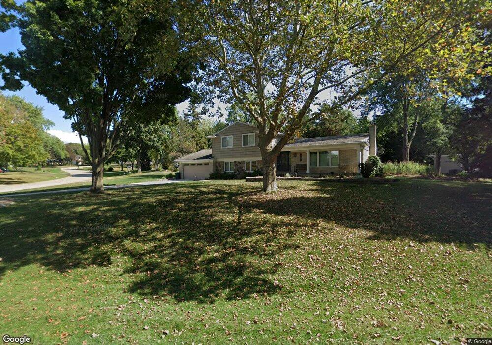
4211 Claire Dr West Bloomfield, MI 48323
Estimated Value: $381,462 - $481,000
4
Beds
2
Baths
2,366
Sq Ft
$180/Sq Ft
Est. Value
About This Home
This home is located at 4211 Claire Dr, West Bloomfield, MI 48323 and is currently estimated at $426,866, approximately $180 per square foot. 4211 Claire Dr is a home located in Oakland County with nearby schools including West Hills Middle School, Bloomfield Hills High School, and The Susan And Rabbi Harold Loss Ecc.
Ownership History
Date
Name
Owned For
Owner Type
Purchase Details
Closed on
Jun 19, 1995
Sold by
Sorge Robert V
Bought by
Allerton Frank C and Allerton Patricia A
Current Estimated Value
Home Financials for this Owner
Home Financials are based on the most recent Mortgage that was taken out on this home.
Original Mortgage
$153,000
Interest Rate
7.9%
Mortgage Type
New Conventional
Create a Home Valuation Report for This Property
The Home Valuation Report is an in-depth analysis detailing your home's value as well as a comparison with similar homes in the area
Home Values in the Area
Average Home Value in this Area
Purchase History
| Date | Buyer | Sale Price | Title Company |
|---|---|---|---|
| Allerton Frank C | $170,000 | -- |
Source: Public Records
Mortgage History
| Date | Status | Borrower | Loan Amount |
|---|---|---|---|
| Closed | Allerton Frank C | $153,000 |
Source: Public Records
Tax History Compared to Growth
Tax History
| Year | Tax Paid | Tax Assessment Tax Assessment Total Assessment is a certain percentage of the fair market value that is determined by local assessors to be the total taxable value of land and additions on the property. | Land | Improvement |
|---|---|---|---|---|
| 2024 | $2,070 | $177,550 | $0 | $0 |
| 2022 | $2,003 | $149,500 | $43,100 | $106,400 |
| 2021 | $3,478 | $145,050 | $0 | $0 |
| 2020 | $1,725 | $142,530 | $43,100 | $99,430 |
| 2018 | $3,270 | $128,800 | $29,650 | $99,150 |
| 2015 | -- | $98,020 | $0 | $0 |
| 2014 | -- | $89,660 | $0 | $0 |
| 2011 | -- | $79,910 | $0 | $0 |
Source: Public Records
Map
Nearby Homes
- 4435 Westover Dr
- 4427 Westover Dr
- 3835 Lone Pine Rd
- 3925 Lone Pine Rd Unit 300
- 4053 Harbor Vista Dr
- 3845 Lone Pine Rd Unit 101
- 4568 Rolling Ridge Rd
- 3440 Lone Pine Rd
- 4408 Knightsbridge Ln
- 3367 Lone Pine Rd
- 3930 Maple Hill W
- 4371 Foxpointe Dr Unit 4
- 4291 Foxpointe Dr
- 4343 Foxpointe Dr Unit 39
- 3142 Bloomfield Shore Dr
- 4205 Hardwoods Dr
- 4941 Fairway Ridge Cir
- 2943 Moon Lake Dr Unit 52
- 3075 Bloomfield Park Dr
- 4163 Old Dominion Dr
- 3771 Tyrconnel Trail
- 4223 Claire Ct
- 4229 Claire Ct
- 4212 Claire Dr
- 4235 Claire Ct
- 3753 Tyrconnel Trail
- 4220 Claire Dr
- 4200 Claire Dr
- 3845 Tyrconnel Trail
- 3760 Tyrconnel Trail
- 3717 Tyrconnel Ct
- LOT C Comfort
- 4259 Claire Ct
- 4260 Claire Dr
- 3842 Tyrconnel Trail
- 4241 Claire Ct
- 3658 Tyrconnel Trail
- 3867 Tyrconnel Trail
- 3729 Hutchins Hill Dr
- 4253 Claire Ct