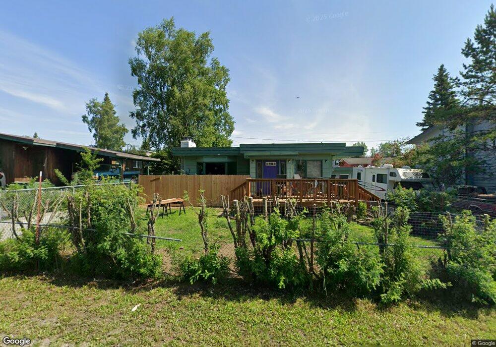
4211 Iowa Dr Anchorage, AK 99517
Spenard NeighborhoodEstimated Value: $276,000 - $364,000
3
Beds
2
Baths
1,048
Sq Ft
$319/Sq Ft
Est. Value
About This Home
This home is located at 4211 Iowa Dr, Anchorage, AK 99517 and is currently estimated at $333,845, approximately $318 per square foot. 4211 Iowa Dr is a home located in Anchorage Municipality with nearby schools including Northwood Elementary School, Romig Middle School, and West High School.
Ownership History
Date
Name
Owned For
Owner Type
Purchase Details
Closed on
Jun 1, 2009
Sold by
Brady Kathleen Ellen
Bought by
Satterwaite David Eric
Current Estimated Value
Purchase Details
Closed on
Sep 11, 2002
Sold by
Brady Timothy Carl
Bought by
Brady Kathleen Ellen
Create a Home Valuation Report for This Property
The Home Valuation Report is an in-depth analysis detailing your home's value as well as a comparison with similar homes in the area
Home Values in the Area
Average Home Value in this Area
Purchase History
| Date | Buyer | Sale Price | Title Company |
|---|---|---|---|
| Satterwaite David Eric | -- | None Available | |
| Brady Kathleen Ellen | -- | -- |
Source: Public Records
Tax History Compared to Growth
Tax History
| Year | Tax Paid | Tax Assessment Tax Assessment Total Assessment is a certain percentage of the fair market value that is determined by local assessors to be the total taxable value of land and additions on the property. | Land | Improvement |
|---|---|---|---|---|
| 2025 | $5,099 | $330,500 | $85,300 | $245,200 |
| 2024 | $5,099 | $315,800 | $85,300 | $230,500 |
| 2023 | $5,010 | $294,200 | $85,300 | $208,900 |
| 2022 | $4,904 | $291,200 | $85,300 | $205,900 |
| 2021 | $4,745 | $263,300 | $85,300 | $178,000 |
| 2020 | $4,418 | $259,900 | $85,300 | $174,600 |
| 2019 | $4,267 | $260,800 | $85,300 | $175,500 |
| 2018 | $4,136 | $252,200 | $79,900 | $172,300 |
| 2017 | $4,047 | $258,400 | $79,900 | $178,500 |
| 2016 | $3,653 | $257,500 | $75,200 | $182,300 |
| 2015 | $3,653 | $259,100 | $75,200 | $183,900 |
| 2014 | $3,653 | $241,200 | $75,200 | $166,000 |
Source: Public Records
Map
Nearby Homes
- NHN Northwood Dr
- 5000 Northwood Dr
- 4000 Iowa Dr
- 4302 Forrest Rd
- 3913 Barbara Dr
- 2202 Lincoln Ave
- 2201 W 47th Ave
- 2105 Mckinley Ave
- 2040 Wenmatt Cir
- 2808 Iris Dr
- 2101 W 47th Ave
- 2820 Wiley Post Ave
- 1808 Cleveland Ave
- 1808 W 47th Ave
- 2702 Mcrae Rd
- 1806 Cleveland Ave
- 2925 W 36th Ave
- 2511 Abbey Ln
- 3900 Crosson Dr
- 3605 Oregon Dr Unit 7
- 000 Northwood Dr
- 4213 Iowa Dr
- 4210 Northwood Dr
- 4206 Northwood Dr
- 4300 Northwood Dr
- 4203 Iowa Dr
- 4301 Iowa Dr
- 4301 Iowa Dr Unit A
- 4301 Iowa Dr Unit B
- 2501 W 43rd Ct
- 4330 Northwood Dr
- Tr 3 Northwood Dr
- 4305 Iowa Dr
- 4200 Iowa Dr
- 4201 Iowa Dr
- 4204 Northwood Dr
- 4300 Iowa Dr
- 4340 Northwood Dr
- 2316 Roosevelt Dr
- 4200 Northwood Dr