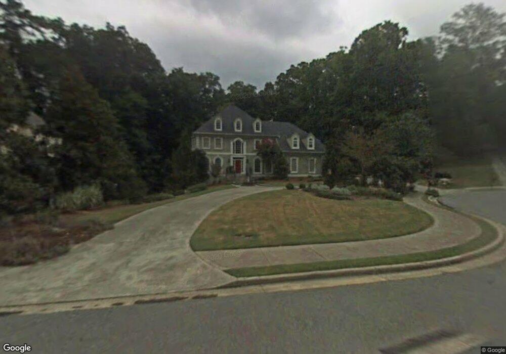
4211 River Bottom Dr Unit IX Norcross, GA 30092
Estimated Value: $1,073,000 - $1,356,000
6
Beds
5
Baths
4,163
Sq Ft
$295/Sq Ft
Est. Value
About This Home
This home is located at 4211 River Bottom Dr Unit IX, Norcross, GA 30092 and is currently estimated at $1,227,410, approximately $294 per square foot. 4211 River Bottom Dr Unit IX is a home located in Gwinnett County with nearby schools including Simpson Elementary School, Pinckneyville Middle School, and Norcross High School.
Ownership History
Date
Name
Owned For
Owner Type
Purchase Details
Closed on
Jul 25, 2019
Sold by
Stopher Flora
Bought by
Susskind Karin and Susskind Geoff
Current Estimated Value
Home Financials for this Owner
Home Financials are based on the most recent Mortgage that was taken out on this home.
Original Mortgage
$480,000
Outstanding Balance
$418,828
Interest Rate
3.73%
Mortgage Type
New Conventional
Estimated Equity
$808,582
Purchase Details
Closed on
Aug 18, 2011
Sold by
Dark Jessica D
Bought by
Stopher Flora
Purchase Details
Closed on
Dec 19, 1996
Sold by
Larson Richard Bernadette
Bought by
Dark John Jessica
Create a Home Valuation Report for This Property
The Home Valuation Report is an in-depth analysis detailing your home's value as well as a comparison with similar homes in the area
Home Values in the Area
Average Home Value in this Area
Purchase History
| Date | Buyer | Sale Price | Title Company |
|---|---|---|---|
| Susskind Karin | $800,000 | -- | |
| Stopher Flora | $576,500 | -- | |
| Dark John Jessica | $435,000 | -- |
Source: Public Records
Mortgage History
| Date | Status | Borrower | Loan Amount |
|---|---|---|---|
| Open | Susskind Karin | $480,000 | |
| Closed | Dark John Jessica | $0 |
Source: Public Records
Tax History Compared to Growth
Tax History
| Year | Tax Paid | Tax Assessment Tax Assessment Total Assessment is a certain percentage of the fair market value that is determined by local assessors to be the total taxable value of land and additions on the property. | Land | Improvement |
|---|---|---|---|---|
| 2025 | $13,441 | $466,920 | $61,960 | $404,960 |
| 2024 | $13,134 | $441,080 | $71,200 | $369,880 |
| 2023 | $13,134 | $359,160 | $64,000 | $295,160 |
| 2022 | $10,573 | $315,520 | $52,000 | $263,520 |
| 2021 | $9,729 | $266,000 | $44,000 | $222,000 |
| 2020 | $9,789 | $266,000 | $44,000 | $222,000 |
| 2019 | $7,008 | $278,320 | $44,000 | $234,320 |
| 2018 | $7,031 | $190,040 | $36,000 | $154,040 |
| 2016 | $6,258 | $190,040 | $36,000 | $154,040 |
| 2015 | $6,335 | $169,560 | $36,000 | $133,560 |
| 2014 | $5,335 | $144,126 | $30,600 | $113,526 |
Source: Public Records
Map
Nearby Homes
- 6304 Broomsedge Trail
- 4291 River Bottom Dr
- 4405 River Trail Dr
- 4410 River Trail Dr Unit 383
- 4410 River Trail Dr
- 6040 Neely Farm Dr Unit 3
- 5970 Rachel Ridge Unit 2
- 6381 E Deerhollow Way
- 4575 Dairy Way
- 6538 Deerings Ln
- 0 Hawk Run Unit 7571401
- 0 Hawk Run
- 6550 Deerings Ln
- 5961 Ranger Ct
- 3922 Glen Meadow Dr
- 3910 Spalding Bluff Dr
- 3710 Wedgewood Chase Unit 22
- 4053 Spalding Hollow NW
- 5885 Match Point
- 7315 Chattahoochee Bluff Dr
- 4221 River Bottom Dr Unit 12
- 4221 River Bottom Dr Unit IX
- 6290 Indian River Dr
- 6300 Indian River Dr Unit 6
- 4201 River Bottom Dr
- 6310 Indian River Dr Unit IX
- 4191 River Bottom Dr
- 6280 Indian River Dr Unit 6
- 4220 River Bottom Dr
- 4200 River Bottom Dr Unit IX
- 4230 River Bottom Dr
- 6260 Indian River Dr
- 4190 River Bottom Dr
- 6250 Indian River Dr
- 4249 Old Bridge Ln
- 6291 Indian River Dr
- 6311 Indian River Dr
- 4259 Old Bridge Ln
- 4240 River Bottom Dr
- 4239 Old Bridge Ln