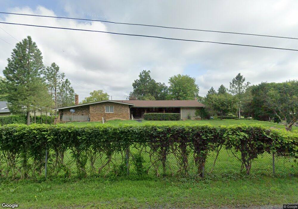
4211 W Simpson Dr Dunlap, IL 61525
Estimated Value: $269,000 - $338,611
4
Beds
3
Baths
2,728
Sq Ft
$108/Sq Ft
Est. Value
About This Home
This home is located at 4211 W Simpson Dr, Dunlap, IL 61525 and is currently estimated at $293,870, approximately $107 per square foot. 4211 W Simpson Dr is a home located in Peoria County with nearby schools including Dunlap Grade School, Dunlap Valley Middle School, and Dunlap High School.
Ownership History
Date
Name
Owned For
Owner Type
Purchase Details
Closed on
Feb 13, 2017
Sold by
Baker Bessie J
Bought by
Baker George H and Baker Cindy R
Current Estimated Value
Home Financials for this Owner
Home Financials are based on the most recent Mortgage that was taken out on this home.
Original Mortgage
$124,000
Interest Rate
4.5%
Mortgage Type
New Conventional
Create a Home Valuation Report for This Property
The Home Valuation Report is an in-depth analysis detailing your home's value as well as a comparison with similar homes in the area
Purchase History
| Date | Buyer | Sale Price | Title Company |
|---|---|---|---|
| Baker George H | $155,000 | Attorney Only |
Source: Public Records
Mortgage History
| Date | Status | Borrower | Loan Amount |
|---|---|---|---|
| Previous Owner | Baker George H | $124,000 | |
| Closed | Baker George H | $124,000 |
Source: Public Records
Tax History
| Year | Tax Paid | Tax Assessment Tax Assessment Total Assessment is a certain percentage of the fair market value that is determined by local assessors to be the total taxable value of land and additions on the property. | Land | Improvement |
|---|---|---|---|---|
| 2024 | $3,839 | $61,560 | $9,620 | $51,940 |
| 2023 | $3,616 | $58,075 | $9,075 | $49,000 |
| 2022 | $3,332 | $53,563 | $8,393 | $45,170 |
| 2021 | $3,188 | $51,004 | $7,984 | $43,020 |
| 2020 | $3,115 | $49,506 | $7,736 | $41,770 |
| 2019 | $3,128 | $50,500 | $7,880 | $42,620 |
| 2018 | $3,158 | $51,435 | $8,015 | $43,420 |
| 2017 | $3,342 | $53,562 | $8,332 | $45,230 |
| 2016 | $2,869 | $53,550 | $8,320 | $45,230 |
| 2015 | $5,297 | $51,479 | $7,989 | $43,490 |
| 2014 | $5,192 | $87,229 | $8,099 | $79,130 |
| 2013 | -- | $85,517 | $7,937 | $77,580 |
Source: Public Records
Map
Nearby Homes
- 13462 N Lakewood Dr
- 13014 N Crater Ln
- Lot 136 French Dr
- LOT 209 Copperpoint Dr
- LOT 208 Copperpoint Dr
- 628 Copperpoint Dr
- LOT 204 W Salem School Ct
- Lot 7 W Augusta Dr
- 2247 W Augusta Dr
- 2218 W Augusta Dr
- 11428 N Boulder Creek Ct
- 11227 N Stone Creek Dr
- 5821 W Dickison Cemetery Rd
- 11224 N Sycamore Creek Dr
- 11124 N Tuscany Ridge Ct
- 2817 W Lake Trail Ct
- 2331 W Molly Ln
- 000 W Singing Woods Rd
- 11517 N Brooklyn Place
- 3508 W Trail Wood Ct
- 4123 W Simpson Dr
- 4208 W Simpson Dr
- 4130 W Simpson Dr
- 4223 W Simpson Dr
- 13644 N Lucerne Dr
- 4112 W Simpson Dr
- 13717 N Lucerne Dr
- 4305 W Simpson Dr
- 13707 N Lucerne Dr
- 4111 W Simpson Dr
- 13606 N Lucerne Dr
- 4106 W Simpson Dr
- 13701 N Lucerne Dr
- 4101 W Simpson Dr
- 4315 W Simpson Dr
- 4004 W Simpson Dr
- 4022 W Legion Hall Rd
- 13645 N Lucerne Dr
- 13625 N Lucerne Dr
- 13618 N Lucerne Dr
Your Personal Tour Guide
Ask me questions while you tour the home.