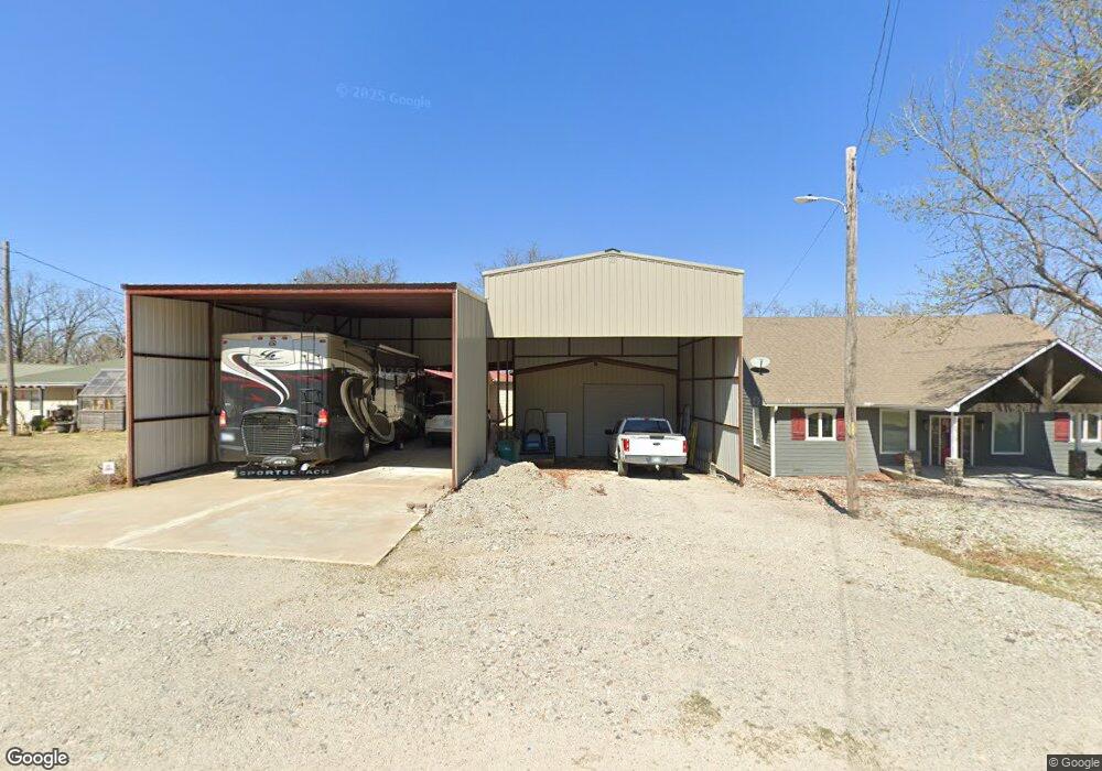
421179 E 1165 Rd Eufaula, OK 74432
Estimated Value: $281,332 - $340,000
2
Beds
1
Bath
1,560
Sq Ft
$205/Sq Ft
Est. Value
About This Home
This home is located at 421179 E 1165 Rd, Eufaula, OK 74432 and is currently estimated at $319,083, approximately $204 per square foot. 421179 E 1165 Rd is a home with nearby schools including Eufaula Elementary School, Eufaula Middle School, and Eufaula High School.
Ownership History
Date
Name
Owned For
Owner Type
Purchase Details
Closed on
Mar 1, 2006
Sold by
Gipson David
Bought by
Hensley Mervin L and Hensley Debra L
Current Estimated Value
Home Financials for this Owner
Home Financials are based on the most recent Mortgage that was taken out on this home.
Original Mortgage
$9,000
Interest Rate
6.05%
Mortgage Type
New Conventional
Purchase Details
Closed on
Jan 6, 2003
Sold by
Jones
Bought by
Gipson
Purchase Details
Closed on
Sep 17, 1999
Sold by
King
Bought by
Jones
Create a Home Valuation Report for This Property
The Home Valuation Report is an in-depth analysis detailing your home's value as well as a comparison with similar homes in the area
Purchase History
| Date | Buyer | Sale Price | Title Company |
|---|---|---|---|
| Hensley Mervin L | $95,000 | None Available | |
| Gipson | $75,000 | -- | |
| Jones | $52,000 | -- |
Source: Public Records
Mortgage History
| Date | Status | Borrower | Loan Amount |
|---|---|---|---|
| Closed | Hensley Mervin L | $9,000 |
Source: Public Records
Tax History
| Year | Tax Paid | Tax Assessment Tax Assessment Total Assessment is a certain percentage of the fair market value that is determined by local assessors to be the total taxable value of land and additions on the property. | Land | Improvement |
|---|---|---|---|---|
| 2025 | $1,635 | $19,681 | $3,862 | $15,819 |
| 2024 | $1,582 | $19,681 | $4,213 | $15,468 |
| 2023 | $1,582 | $18,552 | $3,300 | $15,252 |
| 2022 | $1,411 | $18,011 | $3,300 | $14,711 |
| 2021 | $1,384 | $18,011 | $4,479 | $13,532 |
| 2020 | $1,341 | $17,486 | $4,171 | $13,315 |
| 2019 | $1,311 | $16,977 | $3,872 | $13,105 |
| 2018 | $1,249 | $16,483 | $4,590 | $11,893 |
| 2017 | $1,294 | $15,536 | $3,300 | $12,236 |
| 2016 | $1,112 | $13,288 | $3,300 | $9,988 |
| 2015 | $1,045 | $12,655 | $3,300 | $9,355 |
| 2014 | $989 | $12,053 | $3,300 | $8,753 |
Source: Public Records
Map
Nearby Homes
- 114996 S 4212 Rd
- 116565 S 4213 Rd
- 118900 S 4213 Rd
- 001 Siers Rd
- 1 E 1167 Rd
- 421317 E 1168 Rd
- 002 E 1168 Rd
- 001 E 1168 Rd
- 421355 E 1168 Rd
- 4107 South St
- 116349 S 4209 Rd
- 116307 S 4209 Rd
- 420707 E 1166 Rd
- 421216 E 1161 Cir
- 421843 E 1163 Rd
- 421866 E 1163 Rd
- 117197 S 4205 Rd
- 117525 S 4209 Rd
- 420406 E 1171 Rd
- 421874 E 1155 Rd
- 421199 E 1165 Rd
- 9921 S Hillcrest Dr
- 421156 E 1165 Rd
- 2310 Rr 4
- 421224 E 1165 Rd Unit Rt 4 Box 2290
- 421167 E 1166 Rd
- 421171 E 1166 Rd
- 421310 E 1164 Rd
- 116534 S 4213
- 421182 E 1166 Rd
- 2035 Rr 4
- 421106 E 1165 Rd
- 421316 E 1164 Rd
- 4307 Arrowhead Rd NW
- 421400 Dickey Rd
- 5 Dickey Rd
- 116564 S 4213 Rd
- 2020 Rr 4
- 421071 E 1165 Rd
- 421175 E 1167 Rd
Your Personal Tour Guide
Ask me questions while you tour the home.