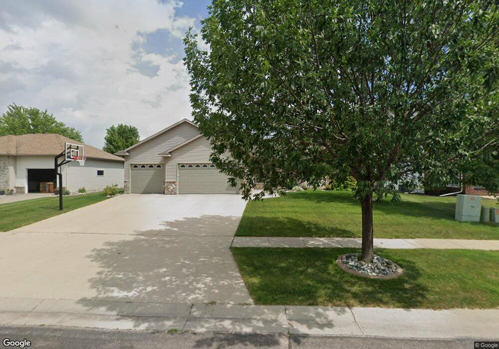
4212 55th St S Fargo, ND 58104
Osgood NeighborhoodEstimated Value: $455,000 - $494,810
4
Beds
3
Baths
3,178
Sq Ft
$150/Sq Ft
Est. Value
About This Home
This home is located at 4212 55th St S, Fargo, ND 58104 and is currently estimated at $475,453, approximately $149 per square foot. 4212 55th St S is a home located in Cass County with nearby schools including Osgood Elementary School, Liberty Middle School, and West Fargo Sheyenne High School.
Ownership History
Date
Name
Owned For
Owner Type
Purchase Details
Closed on
Nov 9, 2018
Sold by
Huhn Paul A and Huhn Maria J
Bought by
Jensen Michael J P and Jensen Lisa A
Current Estimated Value
Home Financials for this Owner
Home Financials are based on the most recent Mortgage that was taken out on this home.
Original Mortgage
$278,000
Outstanding Balance
$243,945
Interest Rate
4.7%
Mortgage Type
New Conventional
Estimated Equity
$231,508
Purchase Details
Closed on
Jun 6, 2005
Sold by
Plecity Kowalski Construction
Bought by
Huhn Paul A and Huhn Marla J
Create a Home Valuation Report for This Property
The Home Valuation Report is an in-depth analysis detailing your home's value as well as a comparison with similar homes in the area
Home Values in the Area
Average Home Value in this Area
Purchase History
| Date | Buyer | Sale Price | Title Company |
|---|---|---|---|
| Jensen Michael J P | $347,500 | Fm Title | |
| Huhn Paul A | -- | -- |
Source: Public Records
Mortgage History
| Date | Status | Borrower | Loan Amount |
|---|---|---|---|
| Open | Jensen Michael J P | $278,000 |
Source: Public Records
Tax History Compared to Growth
Tax History
| Year | Tax Paid | Tax Assessment Tax Assessment Total Assessment is a certain percentage of the fair market value that is determined by local assessors to be the total taxable value of land and additions on the property. | Land | Improvement |
|---|---|---|---|---|
| 2024 | $5,755 | $215,500 | $37,150 | $178,350 |
| 2023 | $5,660 | $192,350 | $38,800 | $153,550 |
| 2022 | $5,533 | $179,750 | $38,800 | $140,950 |
| 2021 | $5,339 | $171,200 | $38,800 | $132,400 |
| 2020 | $5,222 | $171,200 | $38,800 | $132,400 |
| 2019 | $5,193 | $171,200 | $24,250 | $146,950 |
| 2018 | $5,075 | $171,200 | $24,250 | $146,950 |
| 2017 | $4,431 | $148,450 | $24,250 | $124,200 |
| 2016 | $3,987 | $138,750 | $24,250 | $114,500 |
| 2015 | $4,154 | $138,750 | $16,500 | $122,250 |
| 2014 | $4,559 | $150,350 | $16,500 | $133,850 |
| 2013 | $4,376 | $143,200 | $16,500 | $126,700 |
Source: Public Records
Map
Nearby Homes
- 4127 52nd St S
- 4272 51st St S
- 4281 Estate Dr S
- 9350 & 9124 57th St S
- 4110 52nd St S
- 5466 Justice Dr S
- 4758 Townsite Place S
- 4723 Clock Tower Ln S
- 4775 Townsite Place S
- 5861 Wildflower Dr S
- 3676 Crimson Loop S
- 4450 48th St S
- 4856 48th Ave S
- 4891 Foxtail Ln S
- 6023 Wildflower Dr S
- 4868 Bluebell Loop S
- 3712 49th St S
- 6090 Wildflower Dr S
- 6152 Wildflower Dr
- 522 Westview Ln E
- 4196 55th St S
- 4230 55th St S
- 4176 55th St S
- 4248 55th St S
- 4237 54th St S
- 5503 Sunflower Ln S
- 4219 54th St S
- 5599 Farmstead Ct S
- 4253 54th St S
- 4203 54th St S
- 4160 55th St S
- 4264 55th St S
- 4271 54th St S
- 5597 Farmstead Ct S
- 5507 Sunflower Ln S
- 4185 54th St S
- 5502 Sunflower Ln S
- 4287 54th St S
- 4144 55th St S
- 4282 55th St S