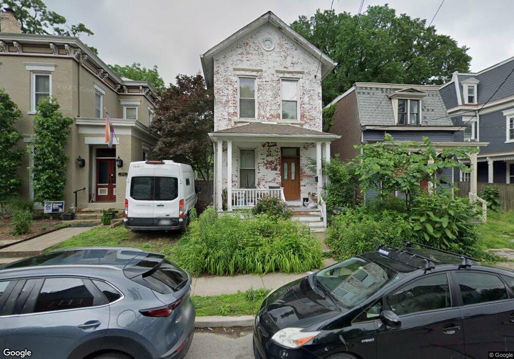
4212 Brookside Ave Cincinnati, OH 45223
Northside NeighborhoodEstimated Value: $235,958 - $365,000
3
Beds
2
Baths
1,588
Sq Ft
$174/Sq Ft
Est. Value
About This Home
This home is located at 4212 Brookside Ave, Cincinnati, OH 45223 and is currently estimated at $276,740, approximately $174 per square foot. 4212 Brookside Ave is a home located in Hamilton County with nearby schools including Chase Elementary School, Robert A. Taft Information Technology High School, and Western Hills High School.
Ownership History
Date
Name
Owned For
Owner Type
Purchase Details
Closed on
Jul 23, 1997
Sold by
Hubbard David S and Falstrom Diana K
Bought by
Burke Terrence J and Rumizen Lara M
Current Estimated Value
Home Financials for this Owner
Home Financials are based on the most recent Mortgage that was taken out on this home.
Original Mortgage
$60,000
Outstanding Balance
$7,321
Interest Rate
7.81%
Estimated Equity
$269,419
Purchase Details
Closed on
Oct 16, 1996
Sold by
Falstrom Diana K
Bought by
Hubbard David S and Diana K Falstrom Trust
Create a Home Valuation Report for This Property
The Home Valuation Report is an in-depth analysis detailing your home's value as well as a comparison with similar homes in the area
Home Values in the Area
Average Home Value in this Area
Purchase History
| Date | Buyer | Sale Price | Title Company |
|---|---|---|---|
| Burke Terrence J | $63,200 | -- | |
| Hubbard David S | -- | -- |
Source: Public Records
Mortgage History
| Date | Status | Borrower | Loan Amount |
|---|---|---|---|
| Open | Burke Terrence J | $60,000 |
Source: Public Records
Tax History
| Year | Tax Paid | Tax Assessment Tax Assessment Total Assessment is a certain percentage of the fair market value that is determined by local assessors to be the total taxable value of land and additions on the property. | Land | Improvement |
|---|---|---|---|---|
| 2025 | $3,050 | $49,505 | $11,148 | $38,357 |
| 2023 | $3,024 | $49,505 | $11,148 | $38,357 |
| 2022 | $1,592 | $23,321 | $5,765 | $17,556 |
| 2021 | $1,531 | $23,321 | $5,765 | $17,556 |
| 2020 | $1,576 | $23,321 | $5,765 | $17,556 |
| 2019 | $1,447 | $19,597 | $4,844 | $14,753 |
| 2018 | $1,449 | $19,597 | $4,844 | $14,753 |
| 2017 | $1,377 | $19,597 | $4,844 | $14,753 |
| 2016 | $1,324 | $18,561 | $4,725 | $13,836 |
| 2015 | $1,194 | $18,561 | $4,725 | $13,836 |
| 2014 | $1,202 | $18,561 | $4,725 | $13,836 |
| 2013 | $1,153 | $17,511 | $4,459 | $13,052 |
Source: Public Records
Map
Nearby Homes
- 4208 Brookside Ave
- 4153 Langland St
- 4235 Brookside Ave
- 4236 Brookside Ave
- 4250 Langland St
- 4210 Turrill St
- 4215 Turrill St
- 1541 Donaldson Place
- 4326 Hamilton Ave
- 4214 Chambers St
- 1324 Apjones St
- 4129 Chambers St
- 1318 Knowlton St
- 4125 Chambers St
- 4135 Lakeman St
- 4392 Hamilton Ave
- 1612 Cooper St
- 1743 Hanfield St
- 4034 Colerain Ave
- 1764 Chase Ave
- 4210 Brookside Ave
- 4214 Brookside Ave
- 4216 Brookside Ave
- 4213 Langland St
- 4220 Brookside Ave
- 1554 Chase Ave
- 4221 Langland St
- 4223 Langland St
- 4209 Brookside Ave
- 4209 Langland St
- 4222 Brookside Ave
- 1558 Hobart Ave
- 4225 Langland St
- 4224 Brookside Ave
- 4227 Langland St
- 4217 Brookside Ave
- 1549 Hobart Ave
- 4229 Langland St
- 4226 Brookside Ave
- 4221 Brookside Ave
Your Personal Tour Guide
Ask me questions while you tour the home.