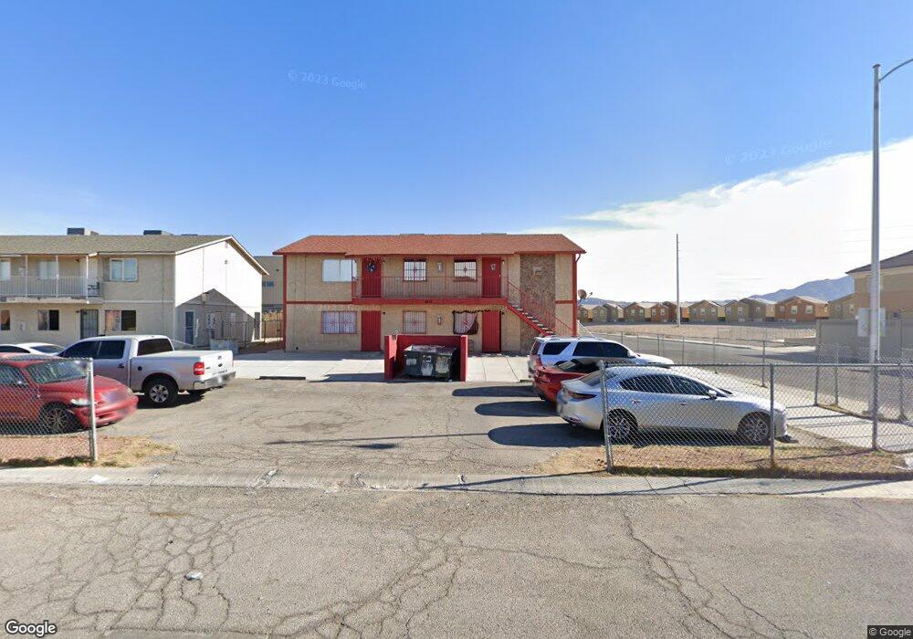
4212 Vornsand Dr Las Vegas, NV 89115
Estimated Value: $661,000 - $720,000
8
Beds
4
Baths
3,468
Sq Ft
$198/Sq Ft
Est. Value
About This Home
This home is located at 4212 Vornsand Dr, Las Vegas, NV 89115 and is currently estimated at $688,333, approximately $198 per square foot. 4212 Vornsand Dr is a home located in Clark County with nearby schools including Zel & Mary Lowman Elementary School, J.E. Manch Elementary School, and Carroll M. Johnston STEM Academy of Environmental Studies.
Ownership History
Date
Name
Owned For
Owner Type
Purchase Details
Closed on
Aug 24, 2010
Sold by
Fannie Mae
Bought by
2105 Jesse Scott 26 Llc
Current Estimated Value
Purchase Details
Closed on
Apr 29, 2010
Sold by
Gaytan Francisco R
Bought by
Federal National Mortgage Association
Purchase Details
Closed on
Oct 13, 2004
Sold by
Gaytan Francisco R and Gaytan Francisco
Bought by
Gaytan Francisco R
Home Financials for this Owner
Home Financials are based on the most recent Mortgage that was taken out on this home.
Original Mortgage
$154,280
Interest Rate
5.72%
Mortgage Type
FHA
Create a Home Valuation Report for This Property
The Home Valuation Report is an in-depth analysis detailing your home's value as well as a comparison with similar homes in the area
Home Values in the Area
Average Home Value in this Area
Purchase History
| Date | Buyer | Sale Price | Title Company |
|---|---|---|---|
| 2105 Jesse Scott 26 Llc | $109,900 | Old Republic Title Company | |
| Federal National Mortgage Association | $315,273 | Accommodation | |
| Gaytan Francisco R | -- | Lawyers Title Of Nevada |
Source: Public Records
Mortgage History
| Date | Status | Borrower | Loan Amount |
|---|---|---|---|
| Previous Owner | Gaytan Francisco R | $154,280 |
Source: Public Records
Tax History Compared to Growth
Tax History
| Year | Tax Paid | Tax Assessment Tax Assessment Total Assessment is a certain percentage of the fair market value that is determined by local assessors to be the total taxable value of land and additions on the property. | Land | Improvement |
|---|---|---|---|---|
| 2025 | $1,449 | $94,601 | $46,200 | $48,401 |
| 2024 | $1,360 | $94,601 | $46,200 | $48,401 |
| 2023 | $1,360 | $93,745 | $47,950 | $45,795 |
| 2022 | $1,243 | $79,864 | $35,700 | $44,164 |
| 2021 | $1,151 | $71,226 | $28,700 | $42,526 |
| 2020 | $1,066 | $69,449 | $26,250 | $43,199 |
| 2019 | $999 | $66,096 | $22,750 | $43,346 |
| 2018 | $954 | $59,108 | $16,800 | $42,308 |
| 2017 | $1,579 | $53,845 | $11,025 | $42,820 |
| 2016 | $894 | $38,756 | $8,400 | $30,356 |
| 2015 | $891 | $38,063 | $8,400 | $29,663 |
| 2014 | $863 | $28,554 | $8,400 | $20,154 |
Source: Public Records
Map
Nearby Homes
- 4759 Pinon Pointe Rd
- 4195 Story Rock St
- 4305 Puebla St
- 4219 Norstad St Unit 1
- 4915 Chidlaw Ave Unit 3
- 4241 Vivenda St Unit 3
- Paxton Plan at Falcon Ridge
- Nadia Plan at Falcon Ridge
- Alina Plan at Falcon Ridge
- 4774 Valleyside Ave
- 4250 Vivenda St Unit 2
- 4266 Winter Cloud Ct
- 4300 N Lamont St Unit 209
- 4300 N Lamont St Unit 232
- 4071 Morning Peace St
- 4730 E Craig Rd Unit 1020
- 4730 E Craig Rd Unit 2096
- 4730 E Craig Rd Unit 2180
- 4730 E Craig Rd Unit 2115
- 4730 E Craig Rd Unit 2163
- 4224 Vornsand Dr Unit 3
- 4224 Vornsand Dr Unit 1
- 4783 Corsaire Ave
- 4790 Pinon Pointe Rd
- 4784 Pinon Pointe Rd
- 4796 Pinon Pointe Rd
- 4778 Pinon Pointe Rd
- 4236 Vornsand Dr
- 4772 Pinon Pointe Rd
- 4772 Pinon Pointe Rd Unit n
- 4782 Corsaire Ave
- 4766 Pinon Pointe Rd
- 4769 Corsaire Ave
- 4785 Arroyo Seco Dr
- 4785 Arroyo Seco Dr Unit n/a
- 4791 Pinon Pointe Rd
- 4797 Pinon Pointe Rd
- 4754 Pinon Pointe Rd
- 4771 Pinon Pointe Rd
- 4781 Arroyo Seco Dr