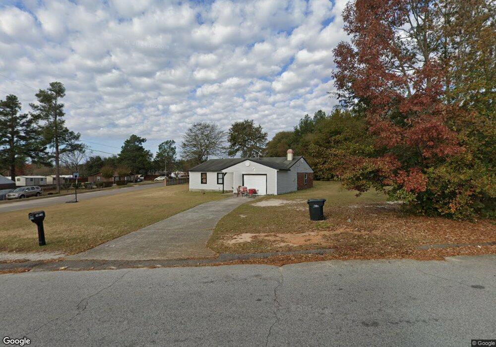
4213 James Dr Hephzibah, GA 30815
Richmond Factory NeighborhoodEstimated Value: $162,649 - $184,000
3
Beds
2
Baths
1,287
Sq Ft
$136/Sq Ft
Est. Value
About This Home
This home is located at 4213 James Dr, Hephzibah, GA 30815 and is currently estimated at $174,662, approximately $135 per square foot. 4213 James Dr is a home located in Richmond County with nearby schools including R.B. Hunt Elementary School, Willis Foreman Elementary School, and Hephzibah Middle School.
Ownership History
Date
Name
Owned For
Owner Type
Purchase Details
Closed on
Feb 25, 2021
Sold by
Ogarro Lawrence
Bought by
L & M Properties And Rentals
Current Estimated Value
Purchase Details
Closed on
Feb 28, 2020
Sold by
Bjs Llc
Bought by
Ogarro Lawrence and Ogarro Malvernia R
Home Financials for this Owner
Home Financials are based on the most recent Mortgage that was taken out on this home.
Original Mortgage
$27,000
Interest Rate
3.5%
Mortgage Type
New Conventional
Purchase Details
Closed on
Jan 28, 1998
Sold by
Transamerica Financial Services Inc
Bought by
West William E
Home Financials for this Owner
Home Financials are based on the most recent Mortgage that was taken out on this home.
Original Mortgage
$33,300
Interest Rate
7.07%
Purchase Details
Closed on
Oct 27, 1995
Sold by
Meyre Robert F
Bought by
Meyre Steven
Create a Home Valuation Report for This Property
The Home Valuation Report is an in-depth analysis detailing your home's value as well as a comparison with similar homes in the area
Home Values in the Area
Average Home Value in this Area
Purchase History
| Date | Buyer | Sale Price | Title Company |
|---|---|---|---|
| L & M Properties And Rentals | -- | -- | |
| Ogarro Lawrence | $35,000 | -- | |
| West William E | $37,000 | -- | |
| Meyre Steven | -- | -- |
Source: Public Records
Mortgage History
| Date | Status | Borrower | Loan Amount |
|---|---|---|---|
| Previous Owner | Ogarro Lawrence | $27,000 | |
| Previous Owner | West William E | $33,300 |
Source: Public Records
Tax History Compared to Growth
Tax History
| Year | Tax Paid | Tax Assessment Tax Assessment Total Assessment is a certain percentage of the fair market value that is determined by local assessors to be the total taxable value of land and additions on the property. | Land | Improvement |
|---|---|---|---|---|
| 2025 | $2,181 | $63,676 | $5,600 | $58,076 |
| 2024 | $2,181 | $58,032 | $5,600 | $52,432 |
| 2023 | $1,956 | $51,444 | $5,600 | $45,844 |
| 2022 | $1,131 | $26,258 | $5,600 | $20,658 |
| 2021 | $826 | $28,608 | $5,600 | $23,008 |
| 2020 | $1,258 | $28,608 | $5,600 | $23,008 |
| 2019 | $1,321 | $28,608 | $5,600 | $23,008 |
Source: Public Records
Map
Nearby Homes
- 2382 Patrick Ave
- 2339 Basswood Dr
- 2382 Travis Pines Dr
- 4212 Cap Chat St
- 2325 Moncrieff St
- 4309 Windsor Spring Rd
- 212 Willowton Ln
- 210 Willowton Ln
- 208 Willowton Ln
- 206 Willowton Ln
- 2383 Richwood Dr
- 2603 Ardwick Dr
- 2806 Wyndham Dr
- 2369 Plantation Rd
- 1018 Rosendale Dr
- 1016 Rosendale Dr
- 3371 Stockport Dr
- 3359 Stockport Dr
- 3351 Stockport Dr
- 3363 Stockport Dr
- 2403 Buffington Dr
- 4217 James Dr
- 2404 Buffington Dr
- 4268 James Dr
- 4270 James Dr
- 4266 James Dr
- 2405 Buffington Dr
- 2406 Buffington Dr
- 4264 James Dr
- 2404 Bristol Place Ct
- 2403 Bristol Place Ct
- 2407 Buffington Dr
- 2406 Bristol Place Ct
- 2408 Buffington Dr
- 4272 James Dr
- 2408 Buffington Dr
- 2382 Boykin Rd
- 2405 Bristol Place Ct
- 2380 Boykin Rd
- 2408 Bristol Place Ct