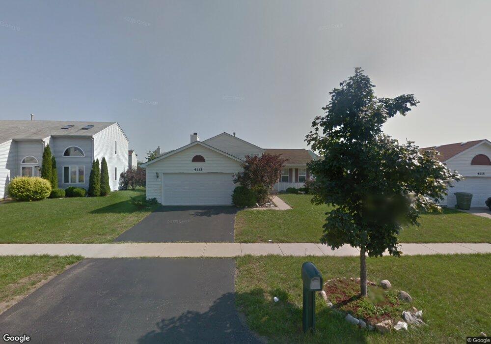
4213 Quail St Zion, IL 60099
West Zion NeighborhoodEstimated Value: $278,000 - $324,000
3
Beds
2
Baths
1,104
Sq Ft
$270/Sq Ft
Est. Value
About This Home
This home is located at 4213 Quail St, Zion, IL 60099 and is currently estimated at $297,627, approximately $269 per square foot. 4213 Quail St is a home located in Lake County with nearby schools including Newport Elementary School, Beach Park Middle School, and Zion-Benton Township High School.
Ownership History
Date
Name
Owned For
Owner Type
Purchase Details
Closed on
Sep 5, 2024
Sold by
Bautista Manuel M and Ocampo-Bautista Nancy
Bought by
Bautista Family Living Trust and Bautista
Current Estimated Value
Purchase Details
Closed on
Jun 28, 2000
Sold by
Bank Of Waukegan
Bought by
Bautista Manuel M and Ocampo Bautista Nancy L
Home Financials for this Owner
Home Financials are based on the most recent Mortgage that was taken out on this home.
Original Mortgage
$149,600
Interest Rate
8.55%
Create a Home Valuation Report for This Property
The Home Valuation Report is an in-depth analysis detailing your home's value as well as a comparison with similar homes in the area
Home Values in the Area
Average Home Value in this Area
Purchase History
| Date | Buyer | Sale Price | Title Company |
|---|---|---|---|
| Bautista Family Living Trust | -- | None Listed On Document | |
| Bautista Manuel M | $157,500 | -- |
Source: Public Records
Mortgage History
| Date | Status | Borrower | Loan Amount |
|---|---|---|---|
| Previous Owner | Bautista Manuel M | $149,600 |
Source: Public Records
Tax History Compared to Growth
Tax History
| Year | Tax Paid | Tax Assessment Tax Assessment Total Assessment is a certain percentage of the fair market value that is determined by local assessors to be the total taxable value of land and additions on the property. | Land | Improvement |
|---|---|---|---|---|
| 2024 | $7,474 | $83,559 | $9,808 | $73,751 |
| 2023 | $7,787 | $74,500 | $8,745 | $65,755 |
| 2022 | $7,787 | $65,679 | $7,196 | $58,483 |
| 2021 | $7,667 | $61,612 | $6,750 | $54,862 |
| 2020 | $7,387 | $57,950 | $6,349 | $51,601 |
| 2019 | $7,177 | $53,982 | $5,914 | $48,068 |
| 2018 | $6,516 | $48,753 | $5,420 | $43,333 |
| 2017 | $6,383 | $45,226 | $5,028 | $40,198 |
| 2016 | $5,899 | $41,055 | $4,564 | $36,491 |
| 2015 | $5,641 | $37,251 | $4,141 | $33,110 |
| 2014 | $4,530 | $31,656 | $4,068 | $27,588 |
| 2012 | $4,094 | $33,712 | $4,332 | $29,380 |
Source: Public Records
Map
Nearby Homes
- 1302 Lorelei Dr
- 1304 Lorelei Dr
- 908 Countrywood Dr
- 1417 Westside Trail
- 4014 Ridge Rd
- 3717 Willow Crest Dr
- 0 9th St
- 3707 Willow Crest Dr
- 4539 Illinois 173
- 4533 Illinois 173
- 1304 Pelican Ct
- 41320 N Green Bay Rd
- 1916 Sunshine Ct
- 1531 Southport Ct
- 2010 Sunset Ct
- 1521 Southport Ct
- 1405 Lewis Ave
- 42334 N Heritage Lot 7 Trail
- 43389 N Oakcrest Ln
- 42908 N Lewis Ave
- 4211 Quail St
- 4215 Quail St
- 4217 Quail St
- 1230 Pheasant Run
- 4209 Quail St
- 1232 Pheasant Run
- 1228 Pheasant Run
- 1234 Pheasant Run
- 4219 Quail St
- 1236 Pheasant Run
- 4212 Quail St
- 1226 Pheasant Run
- 4210 Quail St
- 4207 Quail St
- 4214 Quail St
- 4208 Quail St
- 1238 Pheasant Run
- 4216 Quail St
- 1224 Pheasant Run
- 1209 Cardinal Dr