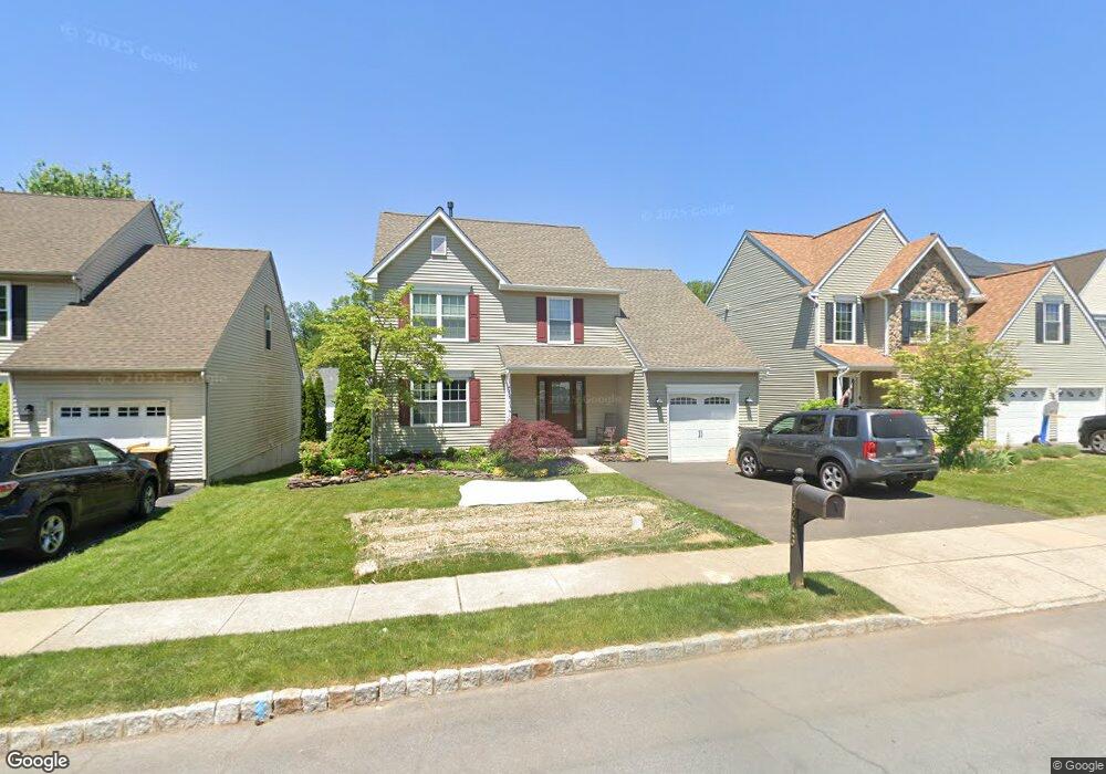
4213 Sir Andrew Cir Doylestown, PA 18902
Estimated Value: $611,752 - $646,000
3
Beds
3
Baths
1,742
Sq Ft
$363/Sq Ft
Est. Value
About This Home
This home is located at 4213 Sir Andrew Cir, Doylestown, PA 18902 and is currently estimated at $633,188, approximately $363 per square foot. 4213 Sir Andrew Cir is a home located in Bucks County with nearby schools including Cold Spring Elementary School, Holicong Middle School, and Central Bucks High School - East.
Ownership History
Date
Name
Owned For
Owner Type
Purchase Details
Closed on
Dec 9, 2024
Sold by
Kille David A and Kille Kristen M
Bought by
David And Kristen Kille Joint Revocable Livin and Kille
Current Estimated Value
Purchase Details
Closed on
Jun 30, 2004
Sold by
Romero Gregory A and Romero Susan D
Bought by
Kille David A and Kille Kristen M
Home Financials for this Owner
Home Financials are based on the most recent Mortgage that was taken out on this home.
Original Mortgage
$276,000
Interest Rate
6.25%
Mortgage Type
Purchase Money Mortgage
Purchase Details
Closed on
Aug 5, 1997
Sold by
Westrum Buckingham Square Ltd Prtnrshp
Bought by
Romero Gregory A and Romero Susan D
Home Financials for this Owner
Home Financials are based on the most recent Mortgage that was taken out on this home.
Original Mortgage
$154,150
Interest Rate
7.56%
Create a Home Valuation Report for This Property
The Home Valuation Report is an in-depth analysis detailing your home's value as well as a comparison with similar homes in the area
Home Values in the Area
Average Home Value in this Area
Purchase History
| Date | Buyer | Sale Price | Title Company |
|---|---|---|---|
| David And Kristen Kille Joint Revocable Livin | -- | None Listed On Document | |
| Kille David A | $345,000 | -- | |
| Romero Gregory A | $171,285 | -- |
Source: Public Records
Mortgage History
| Date | Status | Borrower | Loan Amount |
|---|---|---|---|
| Previous Owner | Kille David A | $276,000 | |
| Previous Owner | Romero Gregory A | $154,150 |
Source: Public Records
Tax History Compared to Growth
Tax History
| Year | Tax Paid | Tax Assessment Tax Assessment Total Assessment is a certain percentage of the fair market value that is determined by local assessors to be the total taxable value of land and additions on the property. | Land | Improvement |
|---|---|---|---|---|
| 2025 | $5,594 | $34,360 | $5,760 | $28,600 |
| 2024 | $5,594 | $34,360 | $5,760 | $28,600 |
| 2023 | $5,404 | $34,360 | $5,760 | $28,600 |
| 2022 | $5,340 | $34,360 | $5,760 | $28,600 |
| 2021 | $5,276 | $34,360 | $5,760 | $28,600 |
| 2020 | $5,276 | $34,360 | $5,760 | $28,600 |
| 2019 | $5,242 | $34,360 | $5,760 | $28,600 |
| 2018 | $5,242 | $34,360 | $5,760 | $28,600 |
| 2017 | $5,199 | $34,360 | $5,760 | $28,600 |
| 2016 | $5,250 | $34,360 | $5,760 | $28,600 |
| 2015 | -- | $34,360 | $5,760 | $28,600 |
| 2014 | -- | $34,360 | $5,760 | $28,600 |
Source: Public Records
Map
Nearby Homes
- 4201 Sir Andrew Cir
- 4190 Milords Ln
- 4542 Deep Creek Way
- 4605 Twinbrook Cir
- 3865 Burnt House Hill Rd
- 4925 Redfield Rd
- 4936 Davis Dr
- 4250 Aly Dr
- 4221 Enders Way
- 3689 Hancock Ln
- 3975 Amberton Ct
- 4964 Point Pleasant Pike
- 5063 Sagewood Ct
- 3555 Northview Ln
- 4306 Kleinot Dr
- 4298 Kleinot Dr
- 4330 Kleinot Dr
- 4246 Kleinot Dr
- 4080 Holly Way
- 4464 Kleinot Dr
- 4211 Sir Andrew Cir
- 4215 Sir Andrew Cir
- 4209 Sir Andrew Cir
- 4217 Sir Andrew Cir
- 4234 Miladies Ln
- 4236 Miladies Ln
- 4232 Miladies Ln
- 4207 Sir Andrew Cir
- 4238 Miladies Ln
- 4230 Miladies Ln
- 4212 Sir Andrew Cir
- 4214 Sir Andrew Cir
- 4210 Sir Andrew Cir
- 4219 Sir Andrew Cir
- 4240 Miladies Ln
- 4216 Sir Andrew Cir
- 4208 Sir Andrew Cir
- 4228 Miladies Ln
- 4205 Sir Andrew Cir
- 4206 Sir Andrew Cir