Estimated Value: $462,000 - $517,000
4
Beds
4
Baths
2,296
Sq Ft
$209/Sq Ft
Est. Value
About This Home
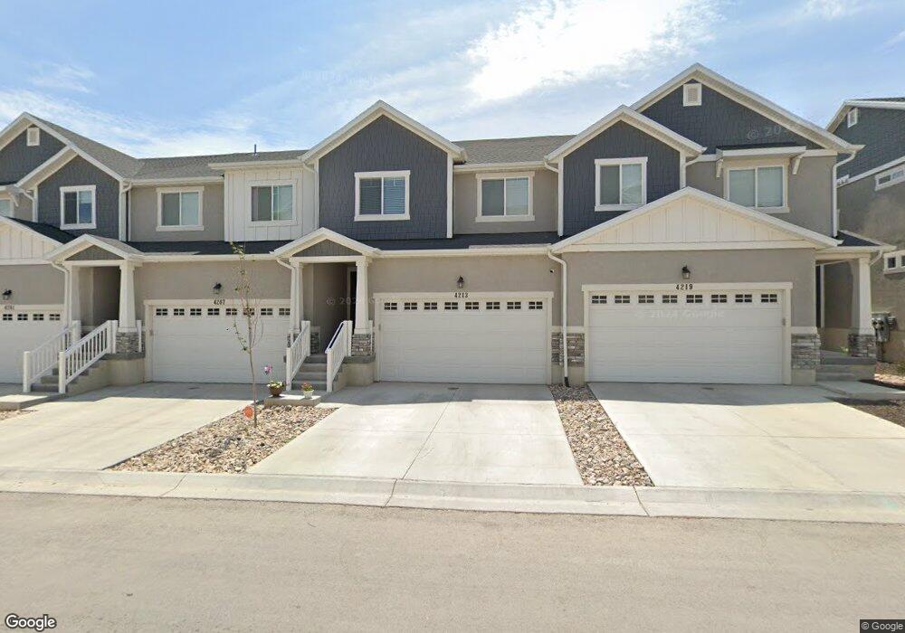
This home is located at 4213 W 1850 N Unit 1515, Lehi, UT 84043 and is currently estimated at $479,160, approximately $208 per square foot. 4213 W 1850 N Unit 1515 is a home located in Utah County with nearby schools including North Point Elementary School, Willowcreek Middle School, and Lehi High School.
Ownership History
Date
Name
Owned For
Owner Type
Purchase Details
Closed on
Nov 18, 2021
Sold by
Kevin Hopkinson
Bought by
Mortenson Brittany N
Current Estimated Value
Home Financials for this Owner
Home Financials are based on the most recent Mortgage that was taken out on this home.
Original Mortgage
$384,000
Outstanding Balance
$352,356
Interest Rate
3.09%
Mortgage Type
New Conventional
Estimated Equity
$126,804
Purchase Details
Closed on
Aug 6, 2019
Sold by
Edge Homes Utah Llc
Bought by
Hopkinson Kevin and Hopkinson Savannah
Home Financials for this Owner
Home Financials are based on the most recent Mortgage that was taken out on this home.
Original Mortgage
$278,275
Interest Rate
3.7%
Mortgage Type
New Conventional
Create a Home Valuation Report for This Property
The Home Valuation Report is an in-depth analysis detailing your home's value as well as a comparison with similar homes in the area
Home Values in the Area
Average Home Value in this Area
Purchase History
| Date | Buyer | Sale Price | Title Company |
|---|---|---|---|
| Mortenson Brittany N | -- | Skyline Title | |
| Hopkinson Kevin | -- | Provo Land Title Co |
Source: Public Records
Mortgage History
| Date | Status | Borrower | Loan Amount |
|---|---|---|---|
| Open | Mortenson Brittany N | $384,000 | |
| Previous Owner | Hopkinson Kevin | $278,275 |
Source: Public Records
Tax History Compared to Growth
Tax History
| Year | Tax Paid | Tax Assessment Tax Assessment Total Assessment is a certain percentage of the fair market value that is determined by local assessors to be the total taxable value of land and additions on the property. | Land | Improvement |
|---|---|---|---|---|
| 2025 | $2,039 | $246,070 | $65,800 | $381,600 |
| 2024 | $2,039 | $238,975 | $0 | $0 |
| 2023 | $1,854 | $235,950 | $0 | $0 |
| 2022 | $2,071 | $255,475 | $0 | $0 |
| 2021 | $1,646 | $307,100 | $46,100 | $261,000 |
| 2020 | $1,643 | $303,000 | $46,000 | $257,000 |
| 2019 | $664 | $70,000 | $70,000 | $0 |
Source: Public Records
Map
Nearby Homes
- 4252 W 1850 N Unit J203
- 4173 W 1850 N
- 1991 W 1960 N
- 2019 W 1960 N
- 4155 W 1960 N
- 1941 N 4100 W
- 4193 W 2010 N
- 2047 N 4260 W
- 4057 W 1760 N
- 1700 N Boston St
- 1552 N Boston St Unit 5B
- 2057 N 4100 W
- 4028 W 1730 N
- 3984 W 1850 N Unit D102
- 4037 W 1730 N
- 4089 W 1700 N Unit 618
- 3985 W 1960 N
- 1606 N 4230 W
- 2538 N Redwood Rd
- 4397 W Bromwell Ct
- 4207 W 1850 N Unit 1516
- 4219 W 1850 N Unit 1514
- 4201 W 1850 N
- 4231 W 1850 N Unit 1513
- 4237 W 1850 N Unit 1512
- 4210 W 1850 N Unit I304
- 4210 W 1850 N Unit I303
- 4210 W 1850 N Unit I201
- 4210 W 1850 N Unit I203
- 4210 W 1850 N Unit 101
- 4210 W 1850 N Unit 301
- 4210 W 1850 N Unit I302
- 4210 W 1850 N Unit I202
- 4249 W 1850 N
- 4173 W 1850 N Unit 806
- 4243 W 1850 N
- 4252 W 1850 N
- 4252 W 1850 N Unit J201
- 4252 W 1850 N Unit J101
- 4252 W 1850 N Unit J202