Estimated Value: $147,000 - $185,904
--
Bed
1
Bath
1,008
Sq Ft
$170/Sq Ft
Est. Value
About This Home
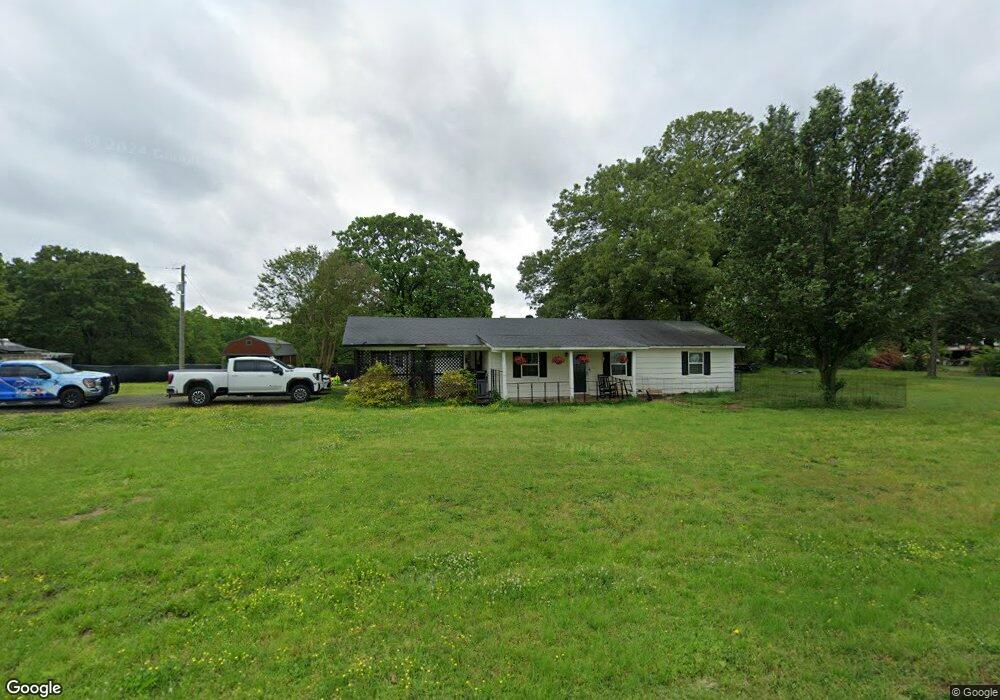
This home is located at 4213 W Justice Rd, Cabot, AR 72023 and is currently estimated at $171,726, approximately $170 per square foot. 4213 W Justice Rd is a home located in Pulaski County with nearby schools including Bayou Meto Elementary School, Jacksonville Middle School, and Jacksonville High School.
Ownership History
Date
Name
Owned For
Owner Type
Purchase Details
Closed on
Jul 30, 2012
Sold by
Bailey Terry and Bailey Pamela Sue
Bought by
Fairchild Jeremy
Current Estimated Value
Home Financials for this Owner
Home Financials are based on the most recent Mortgage that was taken out on this home.
Original Mortgage
$95,918
Outstanding Balance
$66,242
Interest Rate
3.68%
Mortgage Type
New Conventional
Estimated Equity
$105,484
Purchase Details
Closed on
Dec 15, 2010
Sold by
Welcher Lance and Welcher Michael D
Bought by
Bailey Terry and Bailey Pamela Sue
Purchase Details
Closed on
Apr 5, 2010
Sold by
Welcher Michael D
Bought by
Welcher Lance and Welcher Audra
Create a Home Valuation Report for This Property
The Home Valuation Report is an in-depth analysis detailing your home's value as well as a comparison with similar homes in the area
Home Values in the Area
Average Home Value in this Area
Purchase History
| Date | Buyer | Sale Price | Title Company |
|---|---|---|---|
| Fairchild Jeremy | $94,000 | Lenders Title Company | |
| Bailey Terry | $75,000 | Lenders Title Company | |
| Welcher Lance | -- | Lenders Title Company | |
| Welcher Lance | -- | None Available |
Source: Public Records
Mortgage History
| Date | Status | Borrower | Loan Amount |
|---|---|---|---|
| Open | Fairchild Jeremy | $95,918 |
Source: Public Records
Tax History Compared to Growth
Tax History
| Year | Tax Paid | Tax Assessment Tax Assessment Total Assessment is a certain percentage of the fair market value that is determined by local assessors to be the total taxable value of land and additions on the property. | Land | Improvement |
|---|---|---|---|---|
| 2025 | $1,328 | $22,736 | $3,900 | $18,836 |
| 2024 | $1,140 | $22,736 | $3,900 | $18,836 |
| 2023 | $1,140 | $22,736 | $3,900 | $18,836 |
| 2022 | $1,296 | $22,736 | $3,900 | $18,836 |
| 2021 | $1,236 | $20,400 | $5,230 | $15,170 |
| 2020 | $861 | $20,400 | $5,230 | $15,170 |
| 2019 | $861 | $20,400 | $5,230 | $15,170 |
| 2018 | $886 | $20,400 | $5,230 | $15,170 |
| 2017 | $858 | $20,400 | $5,230 | $15,170 |
| 2016 | $803 | $18,970 | $5,460 | $13,510 |
| 2015 | $964 | $18,970 | $5,460 | $13,510 |
| 2014 | $964 | $18,970 | $5,460 | $13,510 |
Source: Public Records
Map
Nearby Homes
- 70 Buena Vista Dr
- lot 7 Mantooth Dr
- 1 Arnies Ln
- 16 Four Mile Hill Rd
- 16 Four Mile Hill
- 17 Four Mile Hill Rd
- 11 Four Mile Hill Rd
- 54 Bud Ford Way
- 20 Barbara Point Rd
- 25 Seven Point Lake Rd
- 0 Hwy 89 W Unit 25026922
- 34 Eden Valley Ranch Rd
- 29907 Highway 107
- 231 Ballard Rd
- 6102 Noble Rd
- 30 Denali Dr
- 27 Denali Dr
- 6821 Haynie Rd
- 42 Ballard Rd
- 00 Otto Rd
- 4204 W Justice Rd
- 4327 W Justice Rd
- 4119 W Justice Rd
- 4105 W Justice Rd
- 4400 W Justice Rd
- 4106 W Justice Rd
- 34721 Highway 107
- 34914 Highway 107
- 4018 W Justice Rd
- 34619 Highway 107
- 4420 W Justice Rd
- 34811 Highway 107
- 34601 Highway 107
- 4523 W Justice Rd
- 4000 W Justice Rd
- 4314 W Justice Rd
- 34720 Highway 107
- 4610 W Justice Rd
- 4615 W Justice Rd
- 4500 W Justice Rd