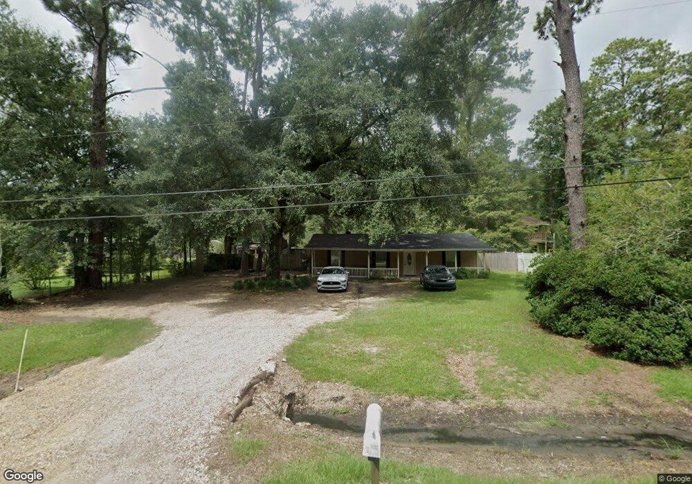
42137 S Range Rd Ponchatoula, LA 70454
Estimated Value: $172,000 - $204,000
3
Beds
2
Baths
1,246
Sq Ft
$147/Sq Ft
Est. Value
About This Home
This home is located at 42137 S Range Rd, Ponchatoula, LA 70454 and is currently estimated at $182,579, approximately $146 per square foot. 42137 S Range Rd is a home located in Tangipahoa Parish with nearby schools including Perrin Early Learning Center, D.C. Reeves Elementary School, and Tucker Memorial Elementary School.
Ownership History
Date
Name
Owned For
Owner Type
Purchase Details
Closed on
Apr 19, 2021
Sold by
Breese Anastaxia
Bought by
Nichols Mary J
Current Estimated Value
Home Financials for this Owner
Home Financials are based on the most recent Mortgage that was taken out on this home.
Original Mortgage
$108,000
Outstanding Balance
$97,511
Interest Rate
3%
Mortgage Type
Purchase Money Mortgage
Estimated Equity
$85,068
Purchase Details
Closed on
Feb 29, 2008
Sold by
Young Leroy Timothy
Bought by
Breese Anastacia
Home Financials for this Owner
Home Financials are based on the most recent Mortgage that was taken out on this home.
Original Mortgage
$119,000
Interest Rate
5.47%
Mortgage Type
Future Advance Clause Open End Mortgage
Purchase Details
Closed on
Apr 20, 2007
Sold by
Sherman Kenneth John
Bought by
Young Leroy Timothy
Purchase Details
Closed on
Apr 17, 2007
Sold by
Sherman Christopher Jeremy and Sherman Jonathan Tyler
Bought by
Young Leroy Timothy
Create a Home Valuation Report for This Property
The Home Valuation Report is an in-depth analysis detailing your home's value as well as a comparison with similar homes in the area
Home Values in the Area
Average Home Value in this Area
Purchase History
| Date | Buyer | Sale Price | Title Company |
|---|---|---|---|
| Nichols Mary J | $135,000 | None Available | |
| Breese Anastacia | -- | None Available | |
| Young Leroy Timothy | $18,285 | None Available | |
| Young Leroy Timothy | $11,000 | None Available |
Source: Public Records
Mortgage History
| Date | Status | Borrower | Loan Amount |
|---|---|---|---|
| Open | Nichols Mary J | $108,000 | |
| Previous Owner | Breese Anastacia | $119,000 |
Source: Public Records
Tax History Compared to Growth
Tax History
| Year | Tax Paid | Tax Assessment Tax Assessment Total Assessment is a certain percentage of the fair market value that is determined by local assessors to be the total taxable value of land and additions on the property. | Land | Improvement |
|---|---|---|---|---|
| 2024 | $1,205 | $11,343 | $2,160 | $9,183 |
| 2023 | $1,214 | $11,277 | $2,000 | $9,277 |
| 2022 | $1,197 | $11,277 | $2,000 | $9,277 |
| 2021 | $406 | $11,277 | $2,000 | $9,277 |
| 2020 | $1,126 | $10,620 | $2,000 | $8,620 |
| 2019 | $1,134 | $10,620 | $2,000 | $8,620 |
| 2018 | $1,159 | $10,620 | $2,000 | $8,620 |
| 2017 | $1,127 | $10,620 | $2,000 | $8,620 |
| 2016 | $1,137 | $10,620 | $2,000 | $8,620 |
| 2015 | $375 | $10,995 | $2,000 | $8,995 |
| 2014 | $354 | $10,995 | $2,000 | $8,995 |
Source: Public Records
Map
Nearby Homes
- 42145 Garden Dr
- 847 White Pine Dr
- 843 White Pine Dr
- 933 Lob Lolly Ct
- 42185 Penrose St
- 454 Scotch Pine Dr
- 42174 Penrose St
- 16405 Amour Dr
- 117 Jack Pine Ln
- TBD 4 E Charbonnet Rd
- TBD 3 E Charbonnet Rd
- 17327 Timberlane Dr
- 16013 Halbert Rd
- 42170 Veterans Ave
- 17379 Oak Hollow Dr
- 41605 Veterans Ave
- 0 S Veterans Ave Unit 891921
- 0 S Veterans Ave Unit 2135212
- 0 S Veterans Ave Unit 2368775
- 0 S Veterans Ave Unit 2135211
- 42147 S Range Rd
- 42094 Meadow Ln
- 42092 Meadow Ln
- 16324 Black Dr
- 16338 Black Dr
- 42082 Meadow Ln
- 42215 Garden Dr
- 16316 Black Dr
- 42205 Garden Dr
- 42225 Garden Dr
- 42101 Meadow Ln
- 42081 Meadow Ln
- 42091 Meadow Ln
- 16323 Black Dr
- 0 Garden Dr Unit 2378088
- 0 Garden Dr Unit 929538
- 42224 Garden Dr
- 42197 Garden Dr
- 42216 Garden Dr
- 42181 S Range Rd
