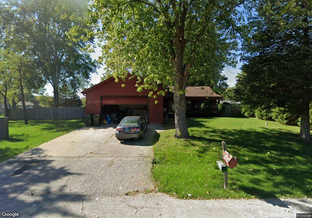
42144 N Fossland Ave Zion, IL 60099
Shore Acres NeighborhoodEstimated Value: $262,000 - $334,000
3
Beds
2
Baths
1,296
Sq Ft
$232/Sq Ft
Est. Value
About This Home
This home is located at 42144 N Fossland Ave, Zion, IL 60099 and is currently estimated at $300,536, approximately $231 per square foot. 42144 N Fossland Ave is a home located in Lake County with nearby schools including Kenneth Murphy School, Beach Park Middle School, and Zion-Benton Township High School.
Ownership History
Date
Name
Owned For
Owner Type
Purchase Details
Closed on
Apr 10, 2019
Sold by
Schneider Gregory J
Bought by
Schneider Gregory J and Gregory Schneider Living Trust
Current Estimated Value
Purchase Details
Closed on
Nov 16, 1998
Sold by
Shumate Thomas M and Shumate Joanne
Bought by
Schneider Gregory J
Home Financials for this Owner
Home Financials are based on the most recent Mortgage that was taken out on this home.
Original Mortgage
$119,200
Outstanding Balance
$27,005
Interest Rate
7.02%
Estimated Equity
$273,531
Create a Home Valuation Report for This Property
The Home Valuation Report is an in-depth analysis detailing your home's value as well as a comparison with similar homes in the area
Home Values in the Area
Average Home Value in this Area
Purchase History
| Date | Buyer | Sale Price | Title Company |
|---|---|---|---|
| Schneider Gregory J | -- | None Available | |
| Schneider Gregory J | $149,000 | Chicago Title Insurance Co |
Source: Public Records
Mortgage History
| Date | Status | Borrower | Loan Amount |
|---|---|---|---|
| Open | Schneider Gregory J | $119,200 |
Source: Public Records
Tax History Compared to Growth
Tax History
| Year | Tax Paid | Tax Assessment Tax Assessment Total Assessment is a certain percentage of the fair market value that is determined by local assessors to be the total taxable value of land and additions on the property. | Land | Improvement |
|---|---|---|---|---|
| 2024 | $6,776 | $86,344 | $9,942 | $76,402 |
| 2023 | $6,678 | $77,127 | $9,597 | $67,530 |
| 2022 | $6,678 | $73,042 | $9,375 | $63,667 |
| 2021 | $5,838 | $61,278 | $9,137 | $52,141 |
| 2020 | $5,700 | $58,477 | $8,719 | $49,758 |
| 2019 | $5,684 | $55,481 | $8,272 | $47,209 |
| 2018 | $6,462 | $59,872 | $10,042 | $49,830 |
| 2017 | $6,355 | $56,324 | $9,447 | $46,877 |
| 2016 | $6,178 | $53,622 | $8,994 | $44,628 |
| 2015 | $5,974 | $49,176 | $8,248 | $40,928 |
| 2014 | $5,586 | $49,104 | $6,867 | $42,237 |
| 2012 | $5,640 | $51,028 | $7,136 | $43,892 |
Source: Public Records
Map
Nearby Homes
- 1405 Lewis Ave
- 1531 Southport Ct
- 1304 Pelican Ct
- 1521 Southport Ct
- 3616 Creekside Ct
- 3707 Willow Crest Dr
- 3717 Willow Crest Dr
- 42908 N Lewis Ave
- 1703 Hermon Ave
- 0 9th St
- 4014 Ridge Rd
- 1417 Westside Trail
- 3106 13th St
- 1817 Joppa Ave
- 1814 Jethro Ave
- 1701 Galilee Ave
- 1807 Horeb Ave
- 1302 Lorelei Dr
- 1718 Gilboa Ave
- 43100 N Lewis Ave
- 42162 N Fossland Ave
- 42145 N Fago Ave
- 42163 N Fago Ave
- 42145 N Fossland Ave
- 42163 N Fossland Ave
- 3113 12th St
- 42177 N Fago Ave
- 42177 N Fossland Ave
- 43275 N Fago Ave
- 42144 N Fago Ave
- 42162 N Fago Ave
- 42215 N Fago Ave
- 42176 N Fago Ave
- 11589 W 11th St
- 42145 N Hanks Ave
- 42163 N Hanks Ave
- 11623 W 11th St
- 3101 12th St
- 11547 W 11th St
- 42177 N Hanks Ave