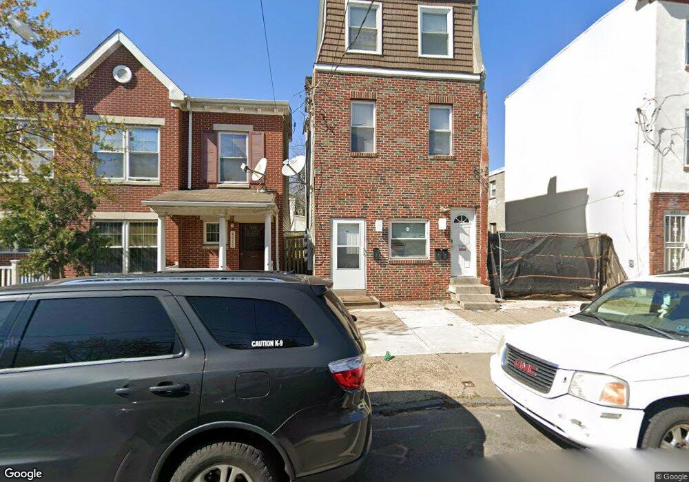
4215 Haverford Ave Philadelphia, PA 19104
Haverford North NeighborhoodEstimated Value: $440,000 - $443,000
4
Beds
3
Baths
2,660
Sq Ft
$166/Sq Ft
Est. Value
About This Home
This home is located at 4215 Haverford Ave, Philadelphia, PA 19104 and is currently estimated at $441,500, approximately $165 per square foot. 4215 Haverford Ave is a home located in Philadelphia County with nearby schools including Alain Locke School, West Philadelphia High School, and KIPP Philadelphia Octavius Catto CS.
Ownership History
Date
Name
Owned For
Owner Type
Purchase Details
Closed on
Mar 4, 2011
Sold by
Mosheyev Roman
Bought by
Ernik Properties Llc
Current Estimated Value
Purchase Details
Closed on
May 17, 2010
Sold by
Manigault Tanya
Bought by
Mosheyev Roman
Purchase Details
Closed on
Jun 19, 2001
Sold by
Estate Of John J Manigault
Bought by
Manigault Tanya
Create a Home Valuation Report for This Property
The Home Valuation Report is an in-depth analysis detailing your home's value as well as a comparison with similar homes in the area
Home Values in the Area
Average Home Value in this Area
Purchase History
| Date | Buyer | Sale Price | Title Company |
|---|---|---|---|
| Ernik Properties Llc | $23,000 | None Available | |
| Mosheyev Roman | $27,600 | None Available | |
| Manigault Tanya | -- | -- |
Source: Public Records
Tax History Compared to Growth
Tax History
| Year | Tax Paid | Tax Assessment Tax Assessment Total Assessment is a certain percentage of the fair market value that is determined by local assessors to be the total taxable value of land and additions on the property. | Land | Improvement |
|---|---|---|---|---|
| 2026 | $5,409 | $415,600 | $83,100 | $332,500 |
| 2025 | $5,409 | $415,600 | $83,100 | $332,500 |
| 2024 | $5,409 | $415,600 | $83,100 | $332,500 |
| 2023 | $5,409 | $386,400 | $77,280 | $309,120 |
| 2022 | $5,409 | $386,400 | $77,280 | $309,120 |
| 2021 | $2,668 | $0 | $0 | $0 |
| 2020 | $2,668 | $0 | $0 | $0 |
| 2019 | $2,569 | $0 | $0 | $0 |
| 2018 | $1,620 | $0 | $0 | $0 |
| 2017 | $1,620 | $0 | $0 | $0 |
| 2016 | $1,620 | $0 | $0 | $0 |
| 2015 | $11,305 | $0 | $0 | $0 |
| 2014 | -- | $115,700 | $10,668 | $105,032 |
| 2012 | -- | $9,120 | $1,824 | $7,296 |
Source: Public Records
Map
Nearby Homes
- 4220 Wallace St
- 617 N Hutton St
- 629 N Hutton St
- 4231 Haverford Ave
- 638 Hutton St
- 627 Hutton St
- 619 Hutton St
- 636 Hutton St
- 4310 Wallace St
- 4303 Haverford Ave
- 518 N Holly St
- 318 20 Budd St
- 4130 42 Aspen St
- 4234 Aspen St
- 4207 Aspen St
- 4052 Lancaster Ave
- 508 N Budd St
- 661 Brooklyn St
- 644 Brooklyn St
- 770 Brooklyn St
- 4213 Haverford Ave
- 4217 Haverford Ave
- 4211 Haverford Ave Unit 2
- 4211 Haverford Ave
- 4219 Haverford Ave
- 4209 Haverford Ave
- 611 N Brooklyn St
- 4207 Haverford Ave
- 613 N Brooklyn St
- 4221 Haverford Ave
- 608 N 42nd St
- 4223 Haverford Ave
- 610 N 42nd St
- 608 N Brooklyn St
- 610 N Brooklyn St
- 612 N Brooklyn St
- 612 N 42nd St
- 4225 Haverford Ave
- 614 N Brooklyn St
- 4227 Haverford Ave