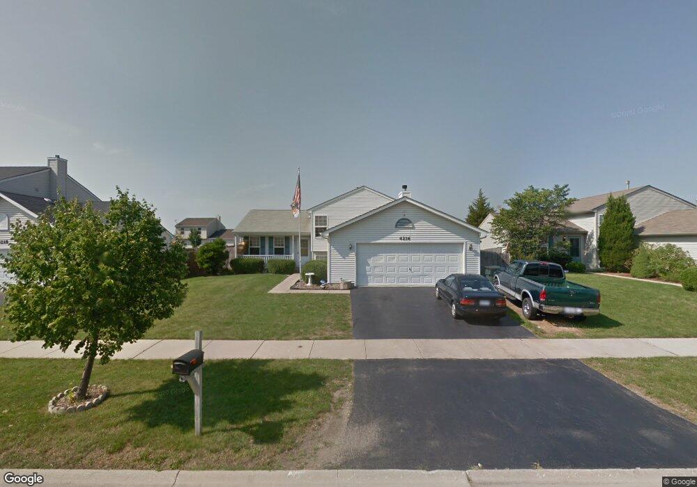
4216 Quail St Zion, IL 60099
West Zion NeighborhoodEstimated Value: $281,000 - $312,000
3
Beds
2
Baths
1,104
Sq Ft
$267/Sq Ft
Est. Value
About This Home
This home is located at 4216 Quail St, Zion, IL 60099 and is currently estimated at $294,479, approximately $266 per square foot. 4216 Quail St is a home located in Lake County with nearby schools including Newport Elementary School, Beach Park Middle School, and Zion-Benton Township High School.
Ownership History
Date
Name
Owned For
Owner Type
Purchase Details
Closed on
Jul 28, 1999
Sold by
Bank Of Waukegan
Bought by
Forshaw Ronald D and Forshaw Cynthia Cooper
Current Estimated Value
Home Financials for this Owner
Home Financials are based on the most recent Mortgage that was taken out on this home.
Original Mortgage
$150,307
Outstanding Balance
$43,598
Interest Rate
7.77%
Mortgage Type
FHA
Estimated Equity
$250,881
Purchase Details
Closed on
Apr 26, 1999
Sold by
Grand Premier Trust & Investment Inc Na
Bought by
Bank Of Waukegan and Trust #204129
Create a Home Valuation Report for This Property
The Home Valuation Report is an in-depth analysis detailing your home's value as well as a comparison with similar homes in the area
Home Values in the Area
Average Home Value in this Area
Purchase History
| Date | Buyer | Sale Price | Title Company |
|---|---|---|---|
| Forshaw Ronald D | $152,000 | -- | |
| Bank Of Waukegan | $71,000 | -- |
Source: Public Records
Mortgage History
| Date | Status | Borrower | Loan Amount |
|---|---|---|---|
| Open | Forshaw Ronald D | $150,307 |
Source: Public Records
Tax History Compared to Growth
Tax History
| Year | Tax Paid | Tax Assessment Tax Assessment Total Assessment is a certain percentage of the fair market value that is determined by local assessors to be the total taxable value of land and additions on the property. | Land | Improvement |
|---|---|---|---|---|
| 2024 | $8,231 | $83,474 | $9,909 | $73,565 |
| 2023 | $7,668 | $74,424 | $8,835 | $65,589 |
| 2022 | $7,668 | $64,773 | $7,270 | $57,503 |
| 2021 | $7,550 | $60,763 | $6,820 | $53,943 |
| 2020 | $6,989 | $57,151 | $6,415 | $50,736 |
| 2019 | $6,771 | $53,238 | $5,976 | $47,262 |
| 2018 | $6,501 | $48,656 | $5,420 | $43,236 |
| 2017 | $6,369 | $45,136 | $5,028 | $40,108 |
| 2016 | $5,885 | $40,973 | $4,564 | $36,409 |
| 2015 | $5,628 | $37,177 | $4,141 | $33,036 |
| 2014 | $5,322 | $36,200 | $4,112 | $32,088 |
| 2012 | $5,768 | $38,552 | $4,379 | $34,173 |
Source: Public Records
Map
Nearby Homes
- 908 Countrywood Dr
- 1302 Lorelei Dr
- 0 9th St
- 1417 Westside Trail
- 4014 Ridge Rd
- 3717 Willow Crest Dr
- 3707 Willow Crest Dr
- 4539 Illinois 173
- 1304 Pelican Ct
- 4533 Illinois 173
- 41320 N Green Bay Rd
- 1916 Sunshine Ct
- 1531 Southport Ct
- 2010 Sunset Ct
- 2031 Dawn Ln
- 1521 Southport Ct
- 43389 N Oakcrest Ln
- 1405 Lewis Ave
- 43411 Lynn Dale Dr
- 42908 N Lewis Ave