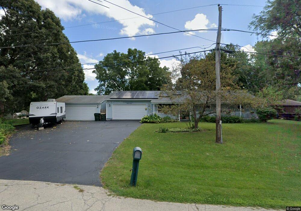
42163 N Fago Ave Zion, IL 60099
Shore Acres NeighborhoodEstimated Value: $272,000 - $331,000
3
Beds
3
Baths
1,144
Sq Ft
$255/Sq Ft
Est. Value
About This Home
This home is located at 42163 N Fago Ave, Zion, IL 60099 and is currently estimated at $292,250, approximately $255 per square foot. 42163 N Fago Ave is a home located in Lake County with nearby schools including Kenneth Murphy School, Beach Park Middle School, and Zion-Benton Township High School.
Ownership History
Date
Name
Owned For
Owner Type
Purchase Details
Closed on
May 22, 1995
Sold by
Crow Vecil and Crow Dorothy
Bought by
Traylor Michael K and Traylor Carol M
Current Estimated Value
Home Financials for this Owner
Home Financials are based on the most recent Mortgage that was taken out on this home.
Original Mortgage
$85,000
Interest Rate
8.42%
Create a Home Valuation Report for This Property
The Home Valuation Report is an in-depth analysis detailing your home's value as well as a comparison with similar homes in the area
Home Values in the Area
Average Home Value in this Area
Purchase History
| Date | Buyer | Sale Price | Title Company |
|---|---|---|---|
| Traylor Michael K | $121,000 | -- |
Source: Public Records
Mortgage History
| Date | Status | Borrower | Loan Amount |
|---|---|---|---|
| Closed | Traylor Michael K | $85,000 |
Source: Public Records
Tax History Compared to Growth
Tax History
| Year | Tax Paid | Tax Assessment Tax Assessment Total Assessment is a certain percentage of the fair market value that is determined by local assessors to be the total taxable value of land and additions on the property. | Land | Improvement |
|---|---|---|---|---|
| 2024 | $5,136 | $78,445 | $9,942 | $68,503 |
| 2023 | $5,171 | $68,400 | $9,597 | $58,803 |
| 2022 | $5,171 | $62,912 | $9,375 | $53,537 |
| 2021 | $4,621 | $58,359 | $9,137 | $49,222 |
| 2020 | $4,621 | $55,691 | $8,719 | $46,972 |
| 2019 | $4,815 | $52,837 | $8,272 | $44,565 |
| 2018 | $5,417 | $56,722 | $10,042 | $46,680 |
| 2017 | $5,349 | $53,360 | $9,447 | $43,913 |
| 2016 | $5,164 | $50,800 | $8,994 | $41,806 |
| 2015 | $4,924 | $46,588 | $8,248 | $38,340 |
| 2014 | $3,942 | $41,162 | $6,867 | $34,295 |
| 2012 | $4,622 | $42,775 | $7,136 | $35,639 |
Source: Public Records
Map
Nearby Homes
- 1304 Pelican Ct
- 1405 Lewis Ave
- 1531 Southport Ct
- 1521 Southport Ct
- 3616 Creekside Ct
- 3707 Willow Crest Dr
- 3717 Willow Crest Dr
- 42908 N Lewis Ave
- 0 9th St
- 4014 Ridge Rd
- 1417 Westside Trail
- 1703 Hermon Ave
- 1302 Lorelei Dr
- 3106 13th St
- 1817 Joppa Ave
- 1814 Jethro Ave
- 1701 Galilee Ave
- 1807 Horeb Ave
- 43100 N Lewis Ave
- 429 Megan Place
- 42145 N Fago Ave
- 42177 N Fago Ave
- 42162 N Fossland Ave
- 42144 N Fossland Ave
- 42162 N Fago Ave
- 42144 N Fago Ave
- 42176 N Fago Ave
- 42215 N Fago Ave
- 3113 12th St
- 42163 N Fossland Ave
- 42163 N Hanks Ave
- 11589 W 11th St
- 42145 N Fossland Ave
- 42145 N Hanks Ave
- 42177 N Fossland Ave
- 42177 N Hanks Ave
- 43275 N Fago Ave
- 11623 W 11th St
- 42215 N Hanks Ave
- 11647 W 11th St