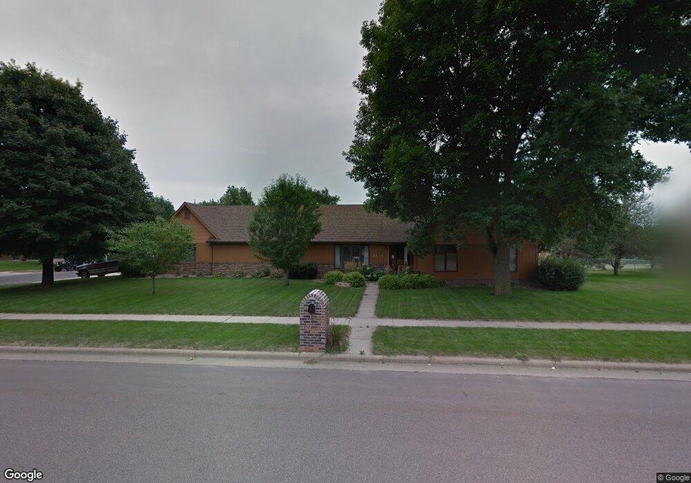
4217 E 33rd St Sioux Falls, SD 57103
Pepper Ridge NeighborhoodEstimated Value: $351,000 - $402,000
3
Beds
3
Baths
1,900
Sq Ft
$197/Sq Ft
Est. Value
About This Home
This home is located at 4217 E 33rd St, Sioux Falls, SD 57103 and is currently estimated at $374,672, approximately $197 per square foot. 4217 E 33rd St is a home located in Minnehaha County with nearby schools including Harvey Dunn Elementary School, Washington High School, and Train Up A Child Preschool/Kindergarten.
Ownership History
Date
Name
Owned For
Owner Type
Purchase Details
Closed on
May 29, 2020
Sold by
Paulson Penny L and Paulson Kevin J
Bought by
Schiebout Tim N and Schiebout Rochelle A
Current Estimated Value
Home Financials for this Owner
Home Financials are based on the most recent Mortgage that was taken out on this home.
Original Mortgage
$114,000
Outstanding Balance
$80,323
Interest Rate
3.3%
Mortgage Type
New Conventional
Estimated Equity
$294,349
Create a Home Valuation Report for This Property
The Home Valuation Report is an in-depth analysis detailing your home's value as well as a comparison with similar homes in the area
Home Values in the Area
Average Home Value in this Area
Purchase History
| Date | Buyer | Sale Price | Title Company |
|---|---|---|---|
| Schiebout Tim N | $250,000 | None Available |
Source: Public Records
Mortgage History
| Date | Status | Borrower | Loan Amount |
|---|---|---|---|
| Open | Schiebout Tim N | $114,000 |
Source: Public Records
Tax History
| Year | Tax Paid | Tax Assessment Tax Assessment Total Assessment is a certain percentage of the fair market value that is determined by local assessors to be the total taxable value of land and additions on the property. | Land | Improvement |
|---|---|---|---|---|
| 2024 | $4,587 | $322,900 | $59,800 | $263,100 |
| 2023 | $4,499 | $315,800 | $59,800 | $256,000 |
| 2022 | $4,315 | $285,500 | $59,800 | $225,700 |
| 2021 | $4,029 | $267,400 | $0 | $0 |
| 2020 | $4,029 | $255,900 | $0 | $0 |
| 2019 | $3,822 | $238,100 | $0 | $0 |
| 2018 | $3,394 | $228,614 | $0 | $0 |
| 2017 | $3,301 | $211,844 | $40,545 | $171,299 |
| 2016 | $3,301 | $206,162 | $40,545 | $165,617 |
| 2015 | $3,298 | $198,228 | $38,293 | $159,935 |
| 2014 | $3,154 | $198,228 | $38,293 | $159,935 |
Source: Public Records
Map
Nearby Homes
- 2805 S Whetstone Cir
- 2804 S Melanie Ln
- 2709 S Kaystone Dr Dr
- 2713 S Harvey Dunn Dr
- 2505 S Pepper Ridge Ave
- 4409 E 36th St
- 4219 E 37th St
- 4409 E 37th St
- 4315 E 38th St
- 3500 E Apple Blossom Cir
- 2309 S Stephen Ave
- 4613 E Fernwood Dr
- 3205 S Bluegrass Ct
- 4504 E Kearney Place
- 4700 E Alpine Cir
- 4505 E Kearney Place
- 3300 E Oak St
- 4620 E Hanna Cir
- 2832 E Granny Smith Place
- 3508 S Judy Ave
- 2805 S Melanie Ln
- 2809 S Melanie Ln
- 4213 E 33rd St
- 4204 E 33rd St
- 4200 E 33rd St
- 4301 E 33rd St
- 2813 S Melanie Ln
- 4104 E 33rd St
- 2808 S Melanie Ln
- 4200 E 36th St
- 4104 E 36th St
- 2704 S Melanie Ln
- 2804 S Whetstone Cir
- 4305 E 33rd St
- 2617 S Judy Ave
- 2800 S Whetstone Cir
- 2812 S Melanie Ln
- 2613 S Judy Ave
- 4214 E 33rd St
- 4100 E 36th St
Your Personal Tour Guide
Ask me questions while you tour the home.